Property Record
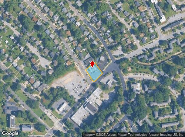
2310 Varnum St, Mount Rainier, MD 20712


NEARBY LISTINGS FOR SALE OR LEASE
Property Detail
2310 Varnum St
17-1906338
NORTH WOODRIDGE
Storebuilding
Prince George's
X
Maryland
24033C0128E
7
2024
0.36 AC
2025
College Park
804900
Washington, DC
2,664 SF
Washington-Arlington-Alexandria, DC-VA-MD-WV
DEMOGRAPHICS near 2310 Varnum St
1 mile
3 mile
5 mile
2024 Total Population
24,573
236,738
746,719
2029 Population
23,309
223,823
701,731
Pop Growth 2024-2029
(5.14%)
(5.46%)
(6.02%)
Average Age
40
37
37
2024 Total Households
9,345
88,822
311,178
HH Growth 2024-2029
(5.50%)
(6.07%)
(7.04%)
Median Household Inc
$69,758
$77,899
$90,555
Avg Household Size
2.50
2.50
2.30
2024 Avg HH Vehicles
1.00
1.00
1.00
Median Home Value
$514,452
$547,123
$572,862
Median Year Built
1949
1955
1959
Nearby Places
Map Layers
Map Styles
 Street
 Aerial
Transit
 Traffic
 Biking
Places
Listings with unknown addresses are not visible on the map
- Restaurants
- Banks
- Shops
- Fitness
- Groceries
PUBLIC TRANSPORTATION
COMMUTER RAIL
Riverdale (Camden Line - Maryland Area Regional Commuter Trains (The MARC))
Drive
Walk
Distance
Riverdale (Camden Line - Maryland Area Regional Commuter Trains (The MARC))
7 min
2.9 mi
Drive
Walk
Distance
10 min
4.0 mi
AIRPORT
Ronald Reagan Washington Ntl
Drive
Walk
Distance
Ronald Reagan Washington Ntl
20 min
10.0 mi
Baltimore/Washington International Thurgood Marshall
Drive
Walk
Distance
Baltimore/Washington International Thurgood Marshall
43 min
27.1 mi
Washington Dulles International
Drive
Walk
Distance
Washington Dulles International
53 min
32.8 mi
Freight Ports
Port of Baltimore
Drive
Walk
Distance
Port of Baltimore
50 min
34.7 mi
Nearby Properties
Address
Land Use
TOTAL SIZE
Lot Size
Zoning
Address
Land Use
TOTAL SIZE
Lot Size
Zoning
58,289 SF
418.97 AC
MU-4;PDR-1
Address
Land Use
TOTAL SIZE
Lot Size
Zoning
1,583,364 SF
276.66 AC
UNZONED
Address
Land Use
TOTAL SIZE
Lot Size
Zoning
1,642,951 SF
95.12 AC
RF-1
Address
Land Use
TOTAL SIZE
Lot Size
Zoning
95.32 AC
RA-1
Address
Land Use
TOTAL SIZE
Lot Size
Zoning
1,835,827 SF
34.66 AC
UNZONED
Address
Land Use
TOTAL SIZE
Lot Size
Zoning
791,730 SF
37.44 AC
RA-1
Address
Land Use
TOTAL SIZE
Lot Size
Zoning
1,095,275 SF
30.70 AC
MU-4;RA-2
Address
Land Use
TOTAL SIZE
Lot Size
Zoning
823,802 SF
7.30 AC
MU-2
Address
Land Use
TOTAL SIZE
Lot Size
Zoning
2,985,682 SF
4.33 AC
RSF65
Address
Land Use
TOTAL SIZE
Lot Size
Zoning
248,643 SF
8.66 AC
RA-1
Address
Land Use
TOTAL SIZE
Lot Size
Zoning
338,258 SF
1.94 AC
PDR-1;PDR-
Address
Land Use
TOTAL SIZE
Lot Size
Zoning
281,204 SF
PDR-1;PDR-
Address
Land Use
TOTAL SIZE
Lot Size
Zoning
1,201,133 SF
41.56 AC
RTOHC
Address
Land Use
TOTAL SIZE
Lot Size
Zoning
869,190 SF
4.97 AC
RA-1
Address
Land Use
TOTAL SIZE
Lot Size
Zoning
74,664 SF
1.83 AC
RTOLE
Address
Land Use
TOTAL SIZE
Lot Size
Zoning
41.12 AC
RA-1
Address
Land Use
TOTAL SIZE
Lot Size
Zoning
268,520 SF
PDR-1
Address
Land Use
TOTAL SIZE
Lot Size
Zoning
425,000 SF
1.04 AC
MU-9B
Address
Land Use
TOTAL SIZE
Lot Size
Zoning
327,745 SF
9.39 AC
RF-1
Address
Land Use
TOTAL SIZE
Lot Size
Zoning
944,105 SF
23.09 AC
CGO
Address
Land Use
TOTAL SIZE
Lot Size
Zoning
330,003 SF
1.74 AC
RTOLE
Address
Land Use
TOTAL SIZE
Lot Size
Zoning
326,985 SF
1.13 AC
MU-6B
Address
Land Use
TOTAL SIZE
Lot Size
Zoning
355,622 SF
1.04 AC
MU-9B
Address
Land Use
TOTAL SIZE
Lot Size
Zoning
169,500 SF
9.14 AC
RA-1
Address
Land Use
TOTAL SIZE
Lot Size
Zoning
492,835 SF
21.61 AC
RA-1
Address
Land Use
TOTAL SIZE
Lot Size
Zoning
4,924 SF
53.06 AC
R-3
Address
Land Use
TOTAL SIZE
Lot Size
Zoning
102,968 SF
18.08 AC
RF-1
Address
Land Use
TOTAL SIZE
Lot Size
Zoning
257,360 SF
0.65 AC
PDR-1
Address
Land Use
TOTAL SIZE
Lot Size
Zoning
248,768 SF
PDR-1
Address
Land Use
TOTAL SIZE
Lot Size
Zoning
1.02 AC
PDR-1
The World's #1 Commercial Real Estate Marketplace
Connect with us
© 2026 CoStar Group
The information above has been obtained from sources believed reliable. While we do not doubt its accuracy we have not verified it and make no guarantee, warranty or representation about it. It is your responsibility to independently confirm its accuracy and completeness. Any projections, opinions, assumptions, or estimates used are for example only and do not represent the current or future performance of the property. The value of this transaction to you depends on tax and other factors which should be evaluated by your tax, financial, and legal advisors. You and your advisors should conduct a careful, independent investigation of the property to determine to your satisfaction the suitability of the property for your needs.