Property Record
2310 W Kearney St, Springfield, MO 65803
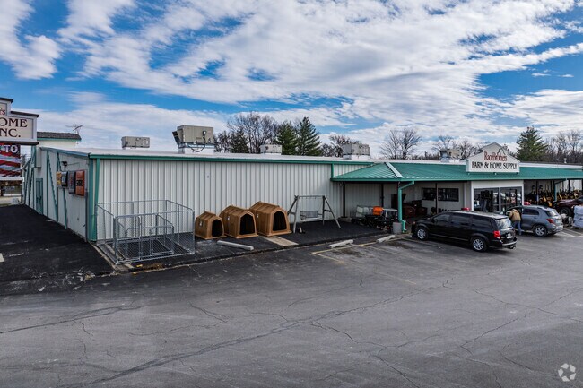

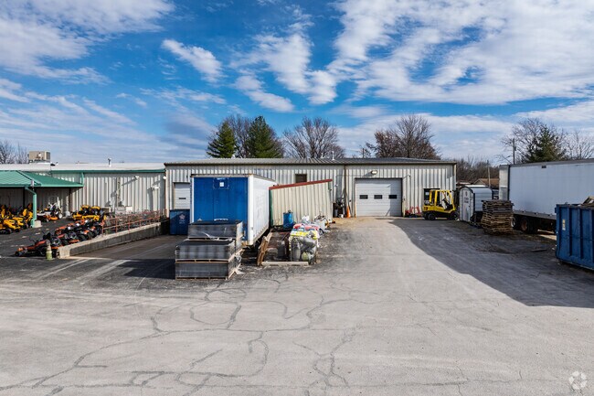
Property Detail
2310 W Kearney St
13-10-202-001
2.57A M/L BEG 358.8 FT W NE COR NE1/4 NW1/4 10/29/22 S 415 F T W 301.2 FT N415 FT E 301.2 FT TO BEG (EX STS) & (EX PT DEE DED FOR HWY)
Departmentstore
Greene
INC
Missouri
B and X Area of moderate flood hazard, usually the area between the limits of the 100-year and 500-year floods.
2.57 AC
2025
Northwest
2025
Springfield
003300
Springfield, MO
33,480 SF
NEARBY LISTINGS FOR SALE OR LEASE
DEMOGRAPHICS near 2310 W Kearney St
1 mile
3 mile
5 mile
2025 Total Population
6,041
54,875
121,433
2030 Population
6,281
56,696
125,086
Pop Growth 2025-2030
+ 3.97%
+ 3.32%
+ 3.01%
Average Age
37
38
37
2025 Total Households
2,547
22,690
51,761
HH Growth 2025-2030
+ 4.16%
+ 3.56%
+ 3.28%
Median Household Inc
$40,218
$43,732
$47,021
Avg Household Size
2.30
2.20
2.10
2025 Avg HH Vehicles
2.00
2.00
2.00
Median Home Value
$124,080
$133,947
$166,114
Median Year Built
1974
1970
1975
Nearby Places
Map Layers
Map Styles
 Street
 Aerial
Layers
 Traffic
 Biking
Places
Listings with unknown addresses are not visible on the map
- Restaurants
- Banks
- Shops
- Fitness
- Groceries
PUBLIC TRANSPORTATION
AIRPORT
Springfield-Branson Ntl
Drive
Walk
Distance
Springfield-Branson Ntl
14 min
5.1 mi
Freight Ports
Tulsa Port of Inola
Drive
Walk
Distance
Tulsa Port of Inola
189 min
169.9 mi
Nearby Properties
Address
Land Use
TOTAL SIZE
Lot Size
Zoning
Address
Land Use
TOTAL SIZE
Lot Size
Zoning
23.75 AC
Address
Land Use
TOTAL SIZE
Lot Size
Zoning
11 AC
INC
Address
Land Use
TOTAL SIZE
Lot Size
Zoning
234,926 SF
9.41 AC
INC
Address
Land Use
TOTAL SIZE
Lot Size
Zoning
186,125 SF
21.09 AC
INC
Address
Land Use
TOTAL SIZE
Lot Size
Zoning
2.92 AC
INC
Address
Land Use
TOTAL SIZE
Lot Size
Zoning
93,916 SF
7.91 AC
INC
Address
Land Use
TOTAL SIZE
Lot Size
Zoning
167,705 SF
1.43 AC
INC
Address
Land Use
TOTAL SIZE
Lot Size
Zoning
29.42 AC
INC
Address
Land Use
TOTAL SIZE
Lot Size
Zoning
136,629 SF
26.79 AC
INC
Address
Land Use
TOTAL SIZE
Lot Size
Zoning
10.76 AC
INC
Address
Land Use
TOTAL SIZE
Lot Size
Zoning
16.08 AC
Address
Land Use
TOTAL SIZE
Lot Size
Zoning
75.07 AC
INC
Address
Land Use
TOTAL SIZE
Lot Size
Zoning
20.54 AC
Address
Land Use
TOTAL SIZE
Lot Size
Zoning
Address
Land Use
TOTAL SIZE
Lot Size
Zoning
107,429 SF
0.78 AC
INC
Address
Land Use
TOTAL SIZE
Lot Size
Zoning
Address
Land Use
TOTAL SIZE
Lot Size
Zoning
Address
Land Use
TOTAL SIZE
Lot Size
Zoning
12.39 AC
Address
Land Use
TOTAL SIZE
Lot Size
Zoning
78,239 SF
10.01 AC
INC
Address
Land Use
TOTAL SIZE
Lot Size
Zoning
213,437 SF
1.58 AC
INC
Address
Land Use
TOTAL SIZE
Lot Size
Zoning
Address
Land Use
TOTAL SIZE
Lot Size
Zoning
77,160 SF
6.31 AC
INC
Address
Land Use
TOTAL SIZE
Lot Size
Zoning
55,568 SF
2.13 AC
INC
Address
Land Use
TOTAL SIZE
Lot Size
Zoning
55,309 SF
0.69 AC
INC
Address
Land Use
TOTAL SIZE
Lot Size
Zoning
105,920 SF
4.88 AC
INC
Address
Land Use
TOTAL SIZE
Lot Size
Zoning
75,000 SF
8.92 AC
INC
Address
Land Use
TOTAL SIZE
Lot Size
Zoning
52,772 SF
5.12 AC
INC
Address
Land Use
TOTAL SIZE
Lot Size
Zoning
504,804 SF
34.94 AC
INC
Address
Land Use
TOTAL SIZE
Lot Size
Zoning
51,320 SF
1.93 AC
INC.
Address
Land Use
TOTAL SIZE
Lot Size
Zoning
7.90 AC
INC
The World's #1 Commercial Real Estate Marketplace
Connect with us
© 2026 CoStar Group
The information above has been obtained from sources believed reliable. While we do not doubt its accuracy we have not verified it and make no guarantee, warranty or representation about it. It is your responsibility to independently confirm its accuracy and completeness. Any projections, opinions, assumptions, or estimates used are for example only and do not represent the current or future performance of the property. The value of this transaction to you depends on tax and other factors which should be evaluated by your tax, financial, and legal advisors. You and your advisors should conduct a careful, independent investigation of the property to determine to your satisfaction the suitability of the property for your needs.