Property Record
2322 Charles St, Rockford, IL 61104
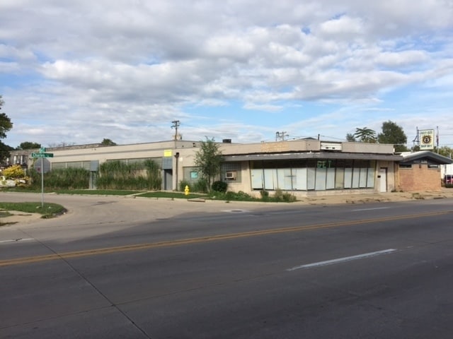
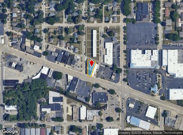
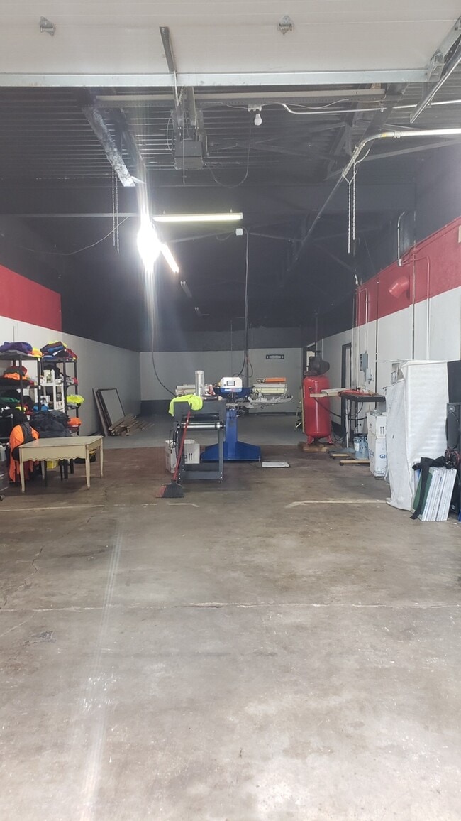
This Property Is For Sale
NEARBY LISTINGS FOR SALE OR LEASE
Property Detail
2322 Charles St
Rockford, IL
Evergreen Pk Sub
11-25-280-006
EVERGREEN PK SUB PT NE 1/4 SEC 25-44-1FILED FOR ANXN TO CITY RFD 5/17/16 LOT 013 BLOCK 008
Commercialnec
Winnebago
AE
Illinois
17201C0268E
013
2024
0.20 AC
2024
I-39 Corr/Winnebago Cnty
001400
Chicago
8,402 SF
DEMOGRAPHICS near 2322 Charles St
1 Mile
3 Mile
5 Mile
2024 Total Population
17,093
97,208
176,694
2029 Population
16,823
96,355
174,886
Pop Growth 2024-2029
(1.58%)
(0.88%)
(1.02%)
Average Age
37
38
40
2024 Total Households
6,823
39,006
72,073
HH Growth 2024-2029
(1.67%)
(0.93%)
(1.08%)
Median Household Inc
$48,767
$43,425
$47,392
Avg Household Size
2.40
2.40
2.30
2024 Avg HH Vehicles
2.00
2.00
2.00
Median Home Value
$71,793
$92,058
$117,593
Median Year Built
1949
1955
1963
Nearby Places
- Restaurants
- Banks
- Shops
- Fitness
- Groceries
PUBLIC TRANSPORTATION
AIRPORT
Chicago/Rockford International
DRIVE
WALK
Distance
Chicago/Rockford International
18 min
8.8 mi
Freight Ports
Port Milwaukee
DRIVE
WALK
Distance
Port Milwaukee
113 min
94.3 mi
Nearby Properties
Address
Land Use
TOTAL SIZE
Lot Size
Zoning
Address
Land Use
TOTAL SIZE
Lot Size
Zoning
920,723 SF
82.07 AC
Address
Land Use
TOTAL SIZE
Lot Size
Zoning
201,507 SF
C4
Address
Land Use
TOTAL SIZE
Lot Size
Zoning
13,308 SF
19.30 AC
I2
Address
Land Use
TOTAL SIZE
Lot Size
Zoning
217,520 SF
13.82 AC
C3
Address
Land Use
TOTAL SIZE
Lot Size
Zoning
119,560 SF
2.89 AC
R1
Address
Land Use
TOTAL SIZE
Lot Size
Zoning
115,095 SF
0.25 AC
C4
Address
Land Use
TOTAL SIZE
Lot Size
Zoning
117,360 SF
1.52 AC
R4
Address
Land Use
TOTAL SIZE
Lot Size
Zoning
147,900 SF
7.78 AC
Address
Land Use
TOTAL SIZE
Lot Size
Zoning
111,491 SF
0.32 AC
C4
Address
Land Use
TOTAL SIZE
Lot Size
Zoning
49,832 SF
5.62 AC
C2
Address
Land Use
TOTAL SIZE
Lot Size
Zoning
32,027 SF
117.18 AC
AG
Address
Land Use
TOTAL SIZE
Lot Size
Zoning
79,318 SF
1.55 AC
C4
Address
Land Use
TOTAL SIZE
Lot Size
Zoning
58,526 SF
134.42 AC
RE
Address
Land Use
TOTAL SIZE
Lot Size
Zoning
192,575 SF
46.19 AC
I1
Address
Land Use
TOTAL SIZE
Lot Size
Zoning
645,384 SF
25.22 AC
I1
Address
Land Use
TOTAL SIZE
Lot Size
Zoning
136,530 SF
4 AC
R4
Address
Land Use
TOTAL SIZE
Lot Size
Zoning
79,700 SF
7.15 AC
C2
Address
Land Use
TOTAL SIZE
Lot Size
Zoning
123,414 SF
8.86 AC
C3
Address
Land Use
TOTAL SIZE
Lot Size
Zoning
60,479 SF
117 AC
R1
Address
Land Use
TOTAL SIZE
Lot Size
Zoning
104,000 SF
14.15 AC
C3
Address
Land Use
TOTAL SIZE
Lot Size
Zoning
113,175 SF
5 AC
R3
Address
Land Use
TOTAL SIZE
Lot Size
Zoning
174,318 SF
17.97 AC
Address
Land Use
TOTAL SIZE
Lot Size
Zoning
133,394 SF
14.08 AC
C3
Address
Land Use
TOTAL SIZE
Lot Size
Zoning
2,975 SF
5.42 AC
I2
Address
Land Use
TOTAL SIZE
Lot Size
Zoning
31,898 SF
C2
Address
Land Use
TOTAL SIZE
Lot Size
Zoning
66,228 SF
5.08 AC
C1
Address
Land Use
TOTAL SIZE
Lot Size
Zoning
150,426 SF
9.25 AC
C3
Address
Land Use
TOTAL SIZE
Lot Size
Zoning
108,233 SF
0.34 AC
C4
Address
Land Use
TOTAL SIZE
Lot Size
Zoning
158,754 SF
0.91 AC
C4
Address
Land Use
TOTAL SIZE
Lot Size
Zoning
86,720 SF
3.91 AC
R4
The World's #1 Commercial Real Estate Marketplace
Connect with us
© 2025 CoStar Group
The information above has been obtained from sources believed reliable. While we do not doubt its accuracy we have not verified it and make no guarantee, warranty or representation about it. It is your responsibility to independently confirm its accuracy and completeness. Any projections, opinions, assumptions, or estimates used are for example only and do not represent the current or future performance of the property. The value of this transaction to you depends on tax and other factors which should be evaluated by your tax, financial, and legal advisors. You and your advisors should conduct a careful, independent investigation of the property to determine to your satisfaction the suitability of the property for your needs.