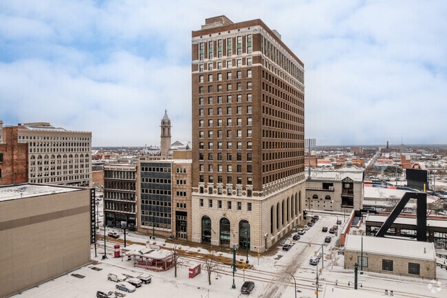
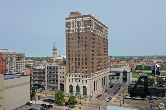
Property Record
233 Main St, Buffalo, NY 14203


Property Detail
233 Main St
140200 111.70-1-7.1
ERIE
Commercialofficeresidentialmixeduse
New York
N-1D
7.100
B and X Area of moderate flood hazard, usually the area between the limits of the 100-year and 500-year floods.
0.77 AC
2025
Buffalo CBD
2025
Buffalo/Niagara Falls
016500
Buffalo-Cheektowaga, NY
229,593 SF
NEARBY LISTINGS FOR SALE OR LEASE
DEMOGRAPHICS near 233 Main St
1 mile
3 mile
5 mile
2025 Total Population
12,252
94,397
236,409
2030 Population
12,634
93,537
231,274
Pop Growth 2025-2030
+ 3.12%
(0.91%)
(2.17%)
Average Age
40
38
38
2025 Total Households
6,276
43,660
102,956
HH Growth 2025-2030
+ 3.00%
(0.64%)
(2.07%)
Median Household Inc
$33,641
$44,277
$48,073
Avg Household Size
1.80
2.00
2.20
2025 Avg HH Vehicles
1.00
1.00
1.00
Median Home Value
$327,465
$215,675
$175,032
Median Year Built
1956
1947
1946
Nearby Places
Map Layers
Map Styles
 Street
 Aerial
Layers
 Traffic
 Biking
Places
Listings with unknown addresses are not visible on the map
- Restaurants
- Banks
- Shops
- Fitness
- Groceries
PUBLIC TRANSPORTATION
TRANSIT/SUBWAY
Seneca (Buffalo Metro Rail - Niagara Frontier Transportation Authority Light Rail (Buffalo Metro Rail))
Drive
Walk
Distance
Seneca (Buffalo Metro Rail - Niagara Frontier Transportation Authority Light Rail (Buffalo Metro Rail))
0 min
0 min
0.0 mi
Erie Canal Harbor (Buffalo Metro Rail - Niagara Frontier Transportation Authority Light Rail (Buffalo Metro Rail))
Drive
Walk
Distance
Erie Canal Harbor (Buffalo Metro Rail - Niagara Frontier Transportation Authority Light Rail (Buffalo Metro Rail))
0 min
4 min
0.2 mi
Church (Buffalo Metro Rail - Niagara Frontier Transportation Authority Light Rail (Buffalo Metro Rail))
Drive
Walk
Distance
Church (Buffalo Metro Rail - Niagara Frontier Transportation Authority Light Rail (Buffalo Metro Rail))
1 min
4 min
0.2 mi
Lafayette Square (Buffalo Metro Rail - Niagara Frontier Transportation Authority Light Rail (Buffalo Metro Rail))
Drive
Walk
Distance
Lafayette Square (Buffalo Metro Rail - Niagara Frontier Transportation Authority Light Rail (Buffalo Metro Rail))
1 min
8 min
0.4 mi
Fountain Plaza (Buffalo Metro Rail - Niagara Frontier Transportation Authority Light Rail (Buffalo Metro Rail))
Drive
Walk
Distance
Fountain Plaza (Buffalo Metro Rail - Niagara Frontier Transportation Authority Light Rail (Buffalo Metro Rail))
2 min
12 min
0.6 mi
COMMUTER RAIL
Buffalo (Empire Service - Amtrak, Maple Leaf - Amtrak)
Drive
Walk
Distance
Buffalo (Empire Service - Amtrak, Maple Leaf - Amtrak)
1 min
4 min
0.2 mi
AIRPORT
Buffalo Niagara International
Drive
Walk
Distance
Buffalo Niagara International
20 min
11.7 mi
Niagara Falls International
Drive
Walk
Distance
Niagara Falls International
30 min
20.4 mi
Freight Ports
Port of Toledo
Drive
Walk
Distance
Port of Toledo
360 min
304.4 mi
SALE & LEASE HISTORY
LISTING DATE
SALE/LEASE

Sep 25, 2016
For Lease
Mar 21, 2019
For Lease
Mar 20, 2019
For Lease
Feb 14, 2022
For Lease
Nearby Properties
Address
Land Use
TOTAL SIZE
Lot Size
Zoning
Address
Land Use
TOTAL SIZE
Lot Size
Zoning
1,053,391 SF
88.26 AC
D-IL
Address
Land Use
TOTAL SIZE
Lot Size
Zoning
704,072 SF
8.61 AC
N-1C
Address
Land Use
TOTAL SIZE
Lot Size
Zoning
Address
Land Use
TOTAL SIZE
Lot Size
Zoning
686,000 SF
3.62 AC
N-2R
Address
Land Use
TOTAL SIZE
Lot Size
Zoning
870,511 SF
4.40 AC
D-M
Address
Land Use
TOTAL SIZE
Lot Size
Zoning
401,805 SF
2.04 AC
D-M
Address
Land Use
TOTAL SIZE
Lot Size
Zoning
251,908 SF
D-M
Address
Land Use
TOTAL SIZE
Lot Size
Zoning
658,732 SF
1.83 AC
N-1D
Address
Land Use
TOTAL SIZE
Lot Size
Zoning
896,000 SF
3.99 AC
N-1D
Address
Land Use
TOTAL SIZE
Lot Size
Zoning
89,496 SF
6.44 AC
D-R
Address
Land Use
TOTAL SIZE
Lot Size
Zoning
569,121 SF
1.04 AC
N-1D
Address
Land Use
TOTAL SIZE
Lot Size
Zoning
288,014 SF
3.68 AC
N-1C
Address
Land Use
TOTAL SIZE
Lot Size
Zoning
421,249 SF
10.62 AC
N-1D
Address
Land Use
TOTAL SIZE
Lot Size
Zoning
240,783 SF
1.63 AC
N-1D
Address
Land Use
TOTAL SIZE
Lot Size
Zoning
349,336 SF
2.70 AC
D-M
Address
Land Use
TOTAL SIZE
Lot Size
Zoning
465,720 SF
1.98 AC
N-1D
Address
Land Use
TOTAL SIZE
Lot Size
Zoning
156,870 SF
D-M
Address
Land Use
TOTAL SIZE
Lot Size
Zoning
321,589 SF
1.95 AC
N-1C
Address
Land Use
TOTAL SIZE
Lot Size
Zoning
7,752 SF
10.50 AC
D-R
Address
Land Use
TOTAL SIZE
Lot Size
Zoning
320,576 SF
1.90 AC
N-1S
Address
Land Use
TOTAL SIZE
Lot Size
Zoning
473,220 SF
8.18 AC
N-1C
Address
Land Use
TOTAL SIZE
Lot Size
Zoning
611,620 SF
2.20 AC
N-1S
Address
Land Use
TOTAL SIZE
Lot Size
Zoning
45,033 SF
1.18 AC
N-1C
Address
Land Use
TOTAL SIZE
Lot Size
Zoning
453,956 SF
1.09 AC
N-1D
Address
Land Use
TOTAL SIZE
Lot Size
Zoning
2,832 SF
2.54 AC
N-1C
Address
Land Use
TOTAL SIZE
Lot Size
Zoning
199,040 SF
2.24 AC
N-1D
Address
Land Use
TOTAL SIZE
Lot Size
Zoning
372,216 SF
2.17 AC
N-1D
Address
Land Use
TOTAL SIZE
Lot Size
Zoning
217,888 SF
4.39 AC
N-1D
Address
Land Use
TOTAL SIZE
Lot Size
Zoning
119,851 SF
1.35 AC
N-2R
Address
Land Use
TOTAL SIZE
Lot Size
Zoning
86,825 SF
1.57 AC
D-M
The World's #1 Commercial Real Estate Marketplace
Connect with us
© 2026 CoStar Group
The information above has been obtained from sources believed reliable. While we do not doubt its accuracy we have not verified it and make no guarantee, warranty or representation about it. It is your responsibility to independently confirm its accuracy and completeness. Any projections, opinions, assumptions, or estimates used are for example only and do not represent the current or future performance of the property. The value of this transaction to you depends on tax and other factors which should be evaluated by your tax, financial, and legal advisors. You and your advisors should conduct a careful, independent investigation of the property to determine to your satisfaction the suitability of the property for your needs.