Property Record
23345 Mathis Rd, Elmendorf, TX 78112


Save to a Folder
{{folder.Name}}
{{folder.ListingIds.length}} Properties
{{folder.ListingIds.length}} Property
Create a New Folder
Property Detail
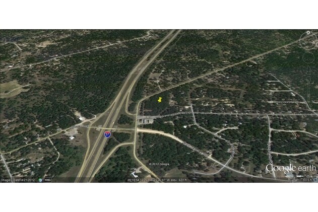
23345 Mathis Rd
San Antonio-New Braunfels, TX
CB 4130B BLK 1 LOT 1 (MORRELL SUBD) NO LABEL OR SERIAL #
04130-201-0010
Bexar
Storebuilding
Texas
B and X Area of moderate flood hazard, usually the area between the limits of the 100-year and 500-year floods.
1
2025
4.74 AC
2025
South
152202
San Antonio
4,907 SF
NEARBY LISTINGS FOR SALE OR LEASE
DEMOGRAPHICS near 23345 Mathis Rd
1 mile
3 mile
5 mile
2025 Total Population
2,342
12,362
20,152
2030 Population
2,485
13,185
21,528
Pop Growth 2025-2030
+ 6.11%
+ 6.66%
+ 6.83%
Average Age
36
36
37
2025 Total Households
700
3,666
6,099
HH Growth 2025-2030
+ 6.29%
+ 6.74%
+ 6.92%
Median Household Inc
$50,614
$48,729
$50,691
Avg Household Size
3.40
3.30
3.20
2025 Avg HH Vehicles
2.00
2.00
2.00
Median Home Value
$168,670
$162,433
$162,715
Median Year Built
1997
1997
1997
Nearby Places
Map Layers
Map Styles
 Street
 Aerial
Layers
 Traffic
 Biking
Places
Listings with unknown addresses are not visible on the map
- Restaurants
- Banks
- Shops
- Fitness
- Groceries
PUBLIC TRANSPORTATION
AIRPORT
San Antonio International
Drive
Walk
Distance
San Antonio International
31 min
27.1 mi
Freight Ports
Port of Corpus Christi
Drive
Walk
Distance
Port of Corpus Christi
126 min
124.0 mi
SALE & LEASE HISTORY
LISTING DATE
SALE/LEASE

Sep 24, 2016
For Sale
Oct 23, 2018
For Sale
May 29, 2018
For Sale
May 18, 2017
For Sale
May 10, 2017
For Sale
Dec 15, 2017
For Sale
Aug 29, 2017
For Sale
Aug 10, 2017
For Sale
Apr 17, 2017
For Sale
Apr 06, 2017
For Sale
Nearby Properties
Address
Land Use
TOTAL SIZE
Lot Size
Zoning
Address
Land Use
TOTAL SIZE
Lot Size
Zoning
2,470.32 AC
Address
Land Use
TOTAL SIZE
Lot Size
Zoning
57,863 SF
36.23 AC
Address
Land Use
TOTAL SIZE
Lot Size
Zoning
5,753,521 SF
709.61 AC
Address
Land Use
TOTAL SIZE
Lot Size
Zoning
300.90 AC
Address
Land Use
TOTAL SIZE
Lot Size
Zoning
485.17 AC
Address
Land Use
TOTAL SIZE
Lot Size
Zoning
1,031.59 AC
Address
Land Use
TOTAL SIZE
Lot Size
Zoning
298.72 AC
Address
Land Use
TOTAL SIZE
Lot Size
Zoning
116,731 SF
9.22 AC
Address
Land Use
TOTAL SIZE
Lot Size
Zoning
47,314 SF
4.53 AC
Address
Land Use
TOTAL SIZE
Lot Size
Zoning
203.51 AC
Address
Land Use
TOTAL SIZE
Lot Size
Zoning
9,673,474 SF
8.35 AC
Address
Land Use
TOTAL SIZE
Lot Size
Zoning
17,500 SF
6.77 AC
Address
Land Use
TOTAL SIZE
Lot Size
Zoning
420 SF
150 AC
Address
Land Use
TOTAL SIZE
Lot Size
Zoning
346,206 SF
2.99 AC
Address
Land Use
TOTAL SIZE
Lot Size
Zoning
295.27 AC
Address
Land Use
TOTAL SIZE
Lot Size
Zoning
298.91 AC
Address
Land Use
TOTAL SIZE
Lot Size
Zoning
21,562 SF
6.88 AC
Address
Land Use
TOTAL SIZE
Lot Size
Zoning
3,183 SF
2.23 AC
Address
Land Use
TOTAL SIZE
Lot Size
Zoning
56,200 SF
2.90 AC
Address
Land Use
TOTAL SIZE
Lot Size
Zoning
784 SF
20.19 AC
Address
Land Use
TOTAL SIZE
Lot Size
Zoning
137.89 AC
Address
Land Use
TOTAL SIZE
Lot Size
Zoning
9,920 SF
3.26 AC
Address
Land Use
TOTAL SIZE
Lot Size
Zoning
840 SF
100 AC
Address
Land Use
TOTAL SIZE
Lot Size
Zoning
10,452 SF
3.41 AC
Address
Land Use
TOTAL SIZE
Lot Size
Zoning
9,173 SF
1.50 AC
Address
Land Use
TOTAL SIZE
Lot Size
Zoning
1,834 SF
40 AC
Address
Land Use
TOTAL SIZE
Lot Size
Zoning
7,320 SF
1.27 AC
Address
Land Use
TOTAL SIZE
Lot Size
Zoning
7,006 SF
1.39 AC
Address
Land Use
TOTAL SIZE
Lot Size
Zoning
3,034 SF
3.42 AC
Address
Land Use
TOTAL SIZE
Lot Size
Zoning
The World's #1 Commercial Real Estate Marketplace
Connect with us
© 2026 CoStar Group
The information above has been obtained from sources believed reliable. While we do not doubt its accuracy we have not verified it and make no guarantee, warranty or representation about it. It is your responsibility to independently confirm its accuracy and completeness. Any projections, opinions, assumptions, or estimates used are for example only and do not represent the current or future performance of the property. The value of this transaction to you depends on tax and other factors which should be evaluated by your tax, financial, and legal advisors. You and your advisors should conduct a careful, independent investigation of the property to determine to your satisfaction the suitability of the property for your needs.