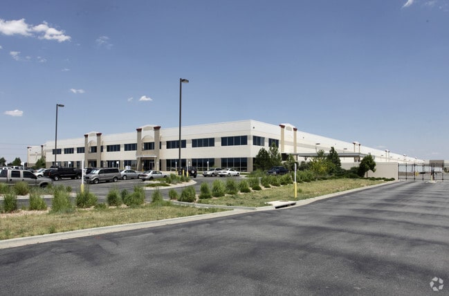
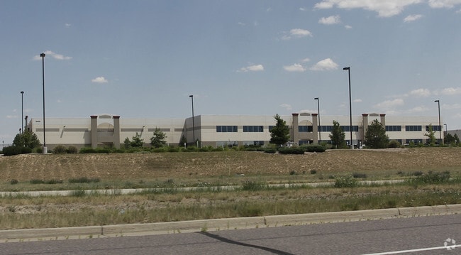
Property Record
23400 E Smith Rd, Aurora, CO 80019


Property Detail
23400 E Smith Rd
Denver-Aurora-Centennial, CO
SUB:PROLOGIS PARK 70 SUBD FILING NO 1 BLK:1 LOT:1
1819-31-3-01-001
Adams
Warehouse
Colorado
2024
1
2025
23.17 AC
008354
SW DIA/Pena Blvd
404,800 SF
Denver
NEARBY LISTINGS FOR SALE OR LEASE
DEMOGRAPHICS near 23400 E Smith Rd
1 mile
3 mile
5 mile
2025 Total Population
4
28,599
91,445
2030 Population
5
30,811
96,788
Pop Growth 2025-2030
+ 25.00%
+ 7.73%
+ 5.84%
Average Age
0
36
36
2025 Total Households
1
8,407
28,418
HH Growth 2025-2030
0.00%
+ 7.30%
+ 5.82%
Median Household Inc
$0
$115,795
$104,816
Avg Household Size
.00
3.10
3.00
2025 Avg HH Vehicles
2.00
2.00
2.00
Median Home Value
$750,000
$573,013
$496,005
Median Year Built
2011
2007
2006
Nearby Places
Map Layers
Map Styles
 Street
 Aerial
Transit
 Traffic
 Biking
Places
Listings with unknown addresses are not visible on the map
- Restaurants
- Banks
- Shops
- Fitness
- Groceries
Nearby Properties
Address
Land Use
TOTAL SIZE
Lot Size
Zoning
Address
Land Use
TOTAL SIZE
Lot Size
Zoning
1,078,683 SF
68.01 AC
Address
Land Use
TOTAL SIZE
Lot Size
Zoning
934,913 SF
116.11 AC
Address
Land Use
TOTAL SIZE
Lot Size
Zoning
150,420 SF
4.75 AC
AR4PD
Address
Land Use
TOTAL SIZE
Lot Size
Zoning
355,937 SF
19.66 AC
RPD
Address
Land Use
TOTAL SIZE
Lot Size
Zoning
506,843 SF
146.96 AC
Address
Land Use
TOTAL SIZE
Lot Size
Zoning
1,016,116 SF
69.40 AC
Address
Land Use
TOTAL SIZE
Lot Size
Zoning
704,978 SF
36.17 AC
Address
Land Use
TOTAL SIZE
Lot Size
Zoning
632,815 SF
34.66 AC
A3
Address
Land Use
TOTAL SIZE
Lot Size
Zoning
555,867 SF
33.81 AC
Address
Land Use
TOTAL SIZE
Lot Size
Zoning
582,400 SF
43.29 AC
Address
Land Use
TOTAL SIZE
Lot Size
Zoning
239,230 SF
100.06 AC
AAE
Address
Land Use
TOTAL SIZE
Lot Size
Zoning
545,010 SF
35.35 AC
Address
Land Use
TOTAL SIZE
Lot Size
Zoning
517,368 SF
29.74 AC
Address
Land Use
TOTAL SIZE
Lot Size
Zoning
522,120 SF
27.70 AC
Address
Land Use
TOTAL SIZE
Lot Size
Zoning
500,358 SF
23.59 AC
Address
Land Use
TOTAL SIZE
Lot Size
Zoning
455,520 SF
53.29 AC
Address
Land Use
TOTAL SIZE
Lot Size
Zoning
433,280 SF
23.46 AC
Address
Land Use
TOTAL SIZE
Lot Size
Zoning
593,928 SF
32.25 AC
Address
Land Use
TOTAL SIZE
Lot Size
Zoning
50,064 SF
3.52 AC
AMU
Address
Land Use
TOTAL SIZE
Lot Size
Zoning
548,510 SF
27.26 AC
Address
Land Use
TOTAL SIZE
Lot Size
Zoning
452,400 SF
20.99 AC
Address
Land Use
TOTAL SIZE
Lot Size
Zoning
432,600 SF
30.98 AC
Address
Land Use
TOTAL SIZE
Lot Size
Zoning
461,580 SF
23.56 AC
Address
Land Use
TOTAL SIZE
Lot Size
Zoning
410,000 SF
31.97 AC
Address
Land Use
TOTAL SIZE
Lot Size
Zoning
409,124 SF
22.18 AC
Address
Land Use
TOTAL SIZE
Lot Size
Zoning
357,850 SF
19.15 AC
Address
Land Use
TOTAL SIZE
Lot Size
Zoning
355,740 SF
18.20 AC
Address
Land Use
TOTAL SIZE
Lot Size
Zoning
334,601 SF
25.93 AC
Address
Land Use
TOTAL SIZE
Lot Size
Zoning
220,000 SF
17.22 AC
The World's #1 Commercial Real Estate Marketplace
Connect with us
© 2026 CoStar Group
The information above has been obtained from sources believed reliable. While we do not doubt its accuracy we have not verified it and make no guarantee, warranty or representation about it. It is your responsibility to independently confirm its accuracy and completeness. Any projections, opinions, assumptions, or estimates used are for example only and do not represent the current or future performance of the property. The value of this transaction to you depends on tax and other factors which should be evaluated by your tax, financial, and legal advisors. You and your advisors should conduct a careful, independent investigation of the property to determine to your satisfaction the suitability of the property for your needs.