Property Record
23465 Rock Haven Way, Sterling, VA 20166

Current Lease Availabilities
NEARBY LISTINGS FOR SALE OR LEASE
Property Detail
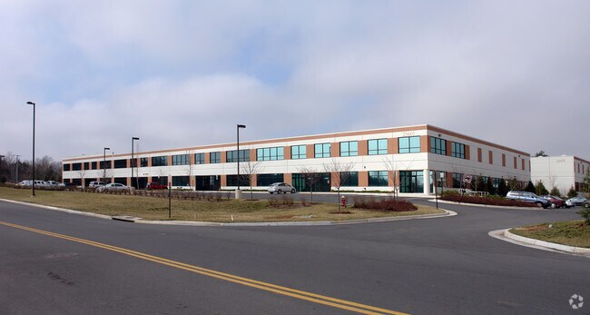
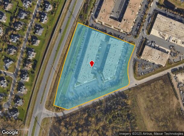
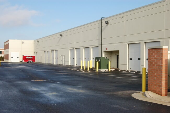
23465 Rock Haven Way
092-25-5088-001
Dulles Trade Center 1
Commercialcondominium
DULLES TRADE CENTER 1 BLDG.D1 UNIT 100 200704200030252 200704200030253P
X
Loudoun
51107C0380E
Virginia
2025
2482
2025
Rt 28/Dulles North
611901
Washington, DC
1,656 SF
Washington-Arlington-Alexandria, DC-VA-MD-WV
DEMOGRAPHICS near 23465 Rock Haven Way
1 Mile
3 Mile
5 Mile
2024 Total Population
2,526
50,590
195,794
2029 Population
2,727
55,243
208,769
Pop Growth 2024-2029
+ 7.96%
+ 9.20%
+ 6.63%
Average Age
34
34
35
2024 Total Households
775
16,275
63,717
HH Growth 2024-2029
+ 8.13%
+ 9.44%
+ 6.70%
Median Household Inc
$204,051
$186,305
$158,146
Avg Household Size
3.20
3.10
3.00
2024 Avg HH Vehicles
2.00
2.00
2.00
Median Home Value
$671,905
$735,168
$684,575
Median Year Built
2011
2010
2005
Nearby Places
- Restaurants
- Banks
- Shops
- Fitness
- Groceries
PUBLIC TRANSPORTATION
AIRPORT
Washington Dulles International
DRIVE
WALK
Distance
Washington Dulles International
16 min
6.6 mi
Ronald Reagan Washington Ntl
DRIVE
WALK
Distance
Ronald Reagan Washington Ntl
49 min
32.4 mi
Freight Ports
Port of Baltimore
DRIVE
WALK
Distance
Port of Baltimore
89 min
64.4 mi
Nearby Properties
Address
Land Use
TOTAL SIZE
Lot Size
Zoning
Address
Land Use
TOTAL SIZE
Lot Size
Zoning
1,137,740 SF
38.21 AC
PDOP
Address
Land Use
TOTAL SIZE
Lot Size
Zoning
525,482 SF
39.73 AC
PDGI
Address
Land Use
TOTAL SIZE
Lot Size
Zoning
538,565 SF
135.31 AC
PDIP
Address
Land Use
TOTAL SIZE
Lot Size
Zoning
784,204 SF
128.54 AC
GI
Address
Land Use
TOTAL SIZE
Lot Size
Zoning
310,717 SF
14.30 AC
PDOP
Address
Land Use
TOTAL SIZE
Lot Size
Zoning
302,180 SF
10.92 AC
PDOP
Address
Land Use
TOTAL SIZE
Lot Size
Zoning
695,321 SF
63.54 AC
PDGI
Address
Land Use
TOTAL SIZE
Lot Size
Zoning
308,630 SF
14.44 AC
PDIP
Address
Land Use
TOTAL SIZE
Lot Size
Zoning
431.05 AC
LB:PRC
Address
Land Use
TOTAL SIZE
Lot Size
Zoning
767,464 SF
GI
Address
Land Use
TOTAL SIZE
Lot Size
Zoning
252,473 SF
9.03 AC
PDIP
Address
Land Use
TOTAL SIZE
Lot Size
Zoning
138,600 SF
8.20 AC
PDIP
Address
Land Use
TOTAL SIZE
Lot Size
Zoning
180,000 SF
10.36 AC
PDOP
Address
Land Use
TOTAL SIZE
Lot Size
Zoning
49.36 AC
IP
Address
Land Use
TOTAL SIZE
Lot Size
Zoning
135,000 SF
7.76 AC
PDOP
Address
Land Use
TOTAL SIZE
Lot Size
Zoning
549,027 SF
21.01 AC
R16
Address
Land Use
TOTAL SIZE
Lot Size
Zoning
326.06 AC
GI
Address
Land Use
TOTAL SIZE
Lot Size
Zoning
113,148 SF
PDIP
Address
Land Use
TOTAL SIZE
Lot Size
Zoning
378,278 SF
112.87 AC
PDGI
Address
Land Use
TOTAL SIZE
Lot Size
Zoning
327,400 SF
37.53 AC
PDGI
Address
Land Use
TOTAL SIZE
Lot Size
Zoning
48.30 AC
PDIP
Address
Land Use
TOTAL SIZE
Lot Size
Zoning
59.20 AC
IP
Address
Land Use
TOTAL SIZE
Lot Size
Zoning
264,155 SF
10.95 AC
PDTRC
Address
Land Use
TOTAL SIZE
Lot Size
Zoning
230.43 AC
PDGI
Address
Land Use
TOTAL SIZE
Lot Size
Zoning
454,700 SF
54.92 AC
PDGI
Address
Land Use
TOTAL SIZE
Lot Size
Zoning
320,609 SF
2.02 AC
PDTRC
Address
Land Use
TOTAL SIZE
Lot Size
Zoning
303,168 SF
41.95 AC
PDCCRC
Address
Land Use
TOTAL SIZE
Lot Size
Zoning
259,361 SF
65.01 AC
PDH4
Address
Land Use
TOTAL SIZE
Lot Size
Zoning
54 AC
PDTC
Address
Land Use
TOTAL SIZE
Lot Size
Zoning
238,594 SF
50.64 AC
PDGI
The World's #1 Commercial Real Estate Marketplace
Connect with us
© 2025 CoStar Group
The information above has been obtained from sources believed reliable. While we do not doubt its accuracy we have not verified it and make no guarantee, warranty or representation about it. It is your responsibility to independently confirm its accuracy and completeness. Any projections, opinions, assumptions, or estimates used are for example only and do not represent the current or future performance of the property. The value of this transaction to you depends on tax and other factors which should be evaluated by your tax, financial, and legal advisors. You and your advisors should conduct a careful, independent investigation of the property to determine to your satisfaction the suitability of the property for your needs.