Property Record
23300 Sierra Hwy, Newhall, CA 91321
Property Detail
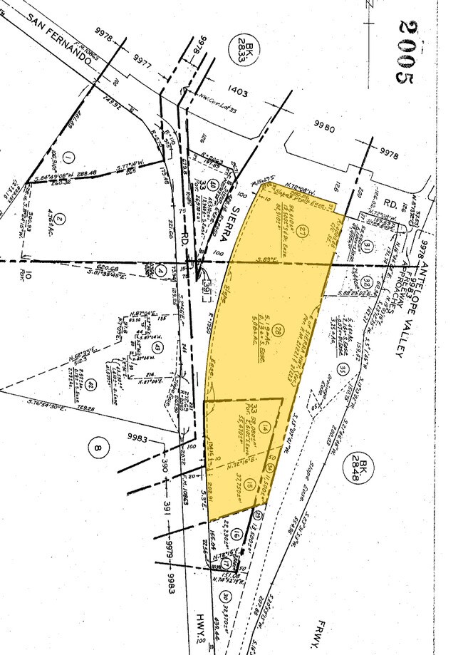
23300 Sierra Hwy
2827-005-014
ST JOHN SUB THAT PART IN NEWHALL CO WATER DIST OF LOT COM N 3 W 819.95 FT FROM INTERSECTION OF S PROLONGATION OF E LINE OF SIERRA HWY (PER FM 10863) WITH SE LINE OF LOT 33 TH N 72 15 E TO NW TH SW THEREON TO BEG PART OF LOT 33
Commercialacreage
LOS ANGELES
SCCR
California
AE The base floodplain where base flood elevations are provided. AE Zones are now used on new format FIRMs instead of A1-A30 Zones.
33
2024
1.26 AC
2025
Santa Clarita Valley
920332
Los Angeles
1,203 SF
Los Angeles-Long Beach-Glendale, CA
NEARBY LISTINGS FOR SALE OR LEASE
DEMOGRAPHICS near 23300 Sierra Hwy
1 mile
3 mile
5 mile
2025 Total Population
7,101
35,437
162,230
2030 Population
7,100
35,170
160,692
Pop Growth 2025-2030
(0.01%)
(0.75%)
(0.95%)
Average Age
36
39
40
2025 Total Households
2,115
11,308
53,511
HH Growth 2025-2030
(0.33%)
(1.03%)
(1.16%)
Median Household Inc
$91,942
$102,419
$108,539
Avg Household Size
3.20
3.00
2.90
2025 Avg HH Vehicles
2.00
2.00
2.00
Median Home Value
$619,318
$759,799
$738,533
Median Year Built
1986
1980
1985
Nearby Places
Map Layers
Map Styles
 Street
 Aerial
Layers
 Traffic
 Biking
Places
Listings with unknown addresses are not visible on the map
- Restaurants
- Banks
- Shops
- Fitness
- Groceries
PUBLIC TRANSPORTATION
COMMUTER RAIL
Newhall (Antelope Valley Line - Southern California Regional Rail Authority (Metrolink))
Drive
Walk
Distance
Newhall (Antelope Valley Line - Southern California Regional Rail Authority (Metrolink))
5 min
2.0 mi
Santa Clarita (Antelope Valley Line - Southern California Regional Rail Authority (Metrolink))
Drive
Walk
Distance
Santa Clarita (Antelope Valley Line - Southern California Regional Rail Authority (Metrolink))
11 min
6.3 mi
AIRPORT
Bob Hope
Drive
Walk
Distance
Bob Hope
21 min
16.0 mi
Los Angeles International
Drive
Walk
Distance
Los Angeles International
42 min
33.1 mi
Freight Ports
The Port of Hueneme
Drive
Walk
Distance
The Port of Hueneme
75 min
52.3 mi
Nearby Properties
Address
Land Use
TOTAL SIZE
Lot Size
Zoning
Address
Land Use
TOTAL SIZE
Lot Size
Zoning
143,163 SF
10.48 AC
SCUR3
Address
Land Use
TOTAL SIZE
Lot Size
Zoning
137,361 SF
7.38 AC
SCUR3
Address
Land Use
TOTAL SIZE
Lot Size
Zoning
220,738 SF
10.27 AC
LAM1
Address
Land Use
TOTAL SIZE
Lot Size
Zoning
144,152 SF
2.39 AC
LCA22-A21*
Address
Land Use
TOTAL SIZE
Lot Size
Zoning
180,584 SF
6.35 AC
SCUR3
Address
Land Use
TOTAL SIZE
Lot Size
Zoning
209,119 SF
3.24 AC
SCBP
Address
Land Use
TOTAL SIZE
Lot Size
Zoning
169,585 SF
9.16 AC
SCBP
Address
Land Use
TOTAL SIZE
Lot Size
Zoning
187,990 SF
9.18 AC
SCBP
Address
Land Use
TOTAL SIZE
Lot Size
Zoning
88,081 SF
4.56 AC
SCCR
Address
Land Use
TOTAL SIZE
Lot Size
Zoning
75,251 SF
1.71 AC
SCUR3
Address
Land Use
TOTAL SIZE
Lot Size
Zoning
57,232 SF
0.27 AC
SCSP
Address
Land Use
TOTAL SIZE
Lot Size
Zoning
135,228 SF
7.80 AC
SCUR3
Address
Land Use
TOTAL SIZE
Lot Size
Zoning
42,767 SF
0.26 AC
SCSP
Address
Land Use
TOTAL SIZE
Lot Size
Zoning
33,578 SF
SCCP
Address
Land Use
TOTAL SIZE
Lot Size
Zoning
188,057 SF
2.70 AC
SCCP
Address
Land Use
TOTAL SIZE
Lot Size
Zoning
92,596 SF
4.59 AC
LAM1
Address
Land Use
TOTAL SIZE
Lot Size
Zoning
48,867 SF
1.26 AC
SCUR2
Address
Land Use
TOTAL SIZE
Lot Size
Zoning
68,670 SF
3.22 AC
LAM1
Address
Land Use
TOTAL SIZE
Lot Size
Zoning
110,126 SF
6.31 AC
SCBP
Address
Land Use
TOTAL SIZE
Lot Size
Zoning
125,282 SF
8.17 AC
SCPI
Address
Land Use
TOTAL SIZE
Lot Size
Zoning
41,192 SF
3.01 AC
SCSP
Address
Land Use
TOTAL SIZE
Lot Size
Zoning
97,613 SF
4.21 AC
SCBP
Address
Land Use
TOTAL SIZE
Lot Size
Zoning
83,136 SF
4.73 AC
SCUR3
Address
Land Use
TOTAL SIZE
Lot Size
Zoning
37,606 SF
3.55 AC
LAM1
Address
Land Use
TOTAL SIZE
Lot Size
Zoning
24,663 SF
1.79 AC
SCMX-C
Address
Land Use
TOTAL SIZE
Lot Size
Zoning
74,112 SF
23.12 AC
SCUR3
Address
Land Use
TOTAL SIZE
Lot Size
Zoning
66,961 SF
4.49 AC
SCBP
Address
Land Use
TOTAL SIZE
Lot Size
Zoning
36,908 SF
2.13 AC
SCSP
The World's #1 Commercial Real Estate Marketplace
Connect with us
© 2026 CoStar Group
The information above has been obtained from sources believed reliable. While we do not doubt its accuracy we have not verified it and make no guarantee, warranty or representation about it. It is your responsibility to independently confirm its accuracy and completeness. Any projections, opinions, assumptions, or estimates used are for example only and do not represent the current or future performance of the property. The value of this transaction to you depends on tax and other factors which should be evaluated by your tax, financial, and legal advisors. You and your advisors should conduct a careful, independent investigation of the property to determine to your satisfaction the suitability of the property for your needs.