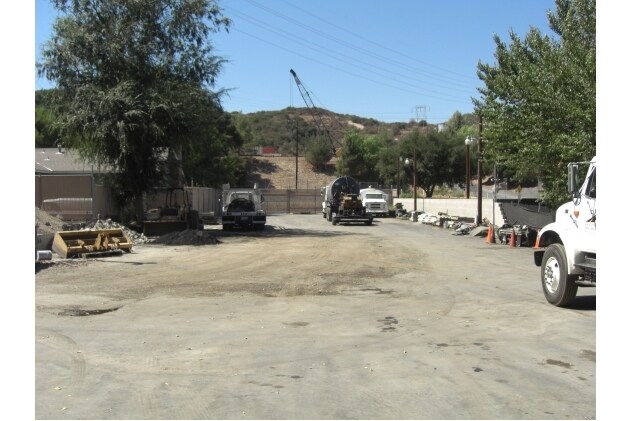
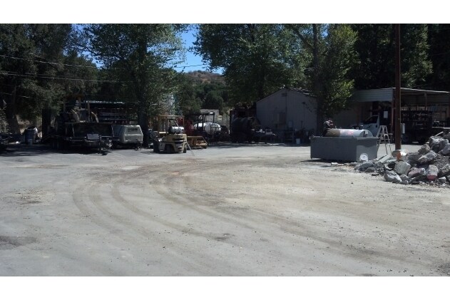
Property Record
23638 Pine St, Newhall, CA 91321


Property Detail
23638 Pine St
2827-007-026
*TR=PARCEL MAP AS PER BK 14 PG 35 OF P M LOT 1
Residentialacreage
Los Angeles
SCBP
California
AO River or stream flood hazard areas, and areas with a 1% or greater chance of shallow flooding each year. These areas have a 26% chance of flooding over the life of a 30-year mortgage.
1
2024
0.51 AC
2025
Santa Clarita Valley
920312
Los Angeles
1,374 SF
Los Angeles-Long Beach-Glendale, CA
NEARBY LISTINGS FOR SALE OR LEASE
DEMOGRAPHICS near 23638 Pine St
1 mile
3 mile
5 mile
2025 Total Population
8,571
44,618
144,093
2030 Population
8,494
44,320
142,915
Pop Growth 2025-2030
(0.90%)
(0.67%)
(0.82%)
Average Age
36
40
41
2025 Total Households
2,424
14,509
48,858
HH Growth 2025-2030
(1.24%)
(0.94%)
(1.03%)
Median Household Inc
$87,629
$110,323
$113,960
Avg Household Size
3.30
2.90
2.90
2025 Avg HH Vehicles
2.00
2.00
2.00
Median Home Value
$686,285
$773,579
$772,449
Median Year Built
1982
1979
1987
Nearby Places
Map Layers
Map Styles
 Street
 Aerial
Transit
 Traffic
 Biking
Places
Listings with unknown addresses are not visible on the map
- Restaurants
- Banks
- Shops
- Fitness
- Groceries
PUBLIC TRANSPORTATION
COMMUTER RAIL
Newhall (Antelope Valley Line - Southern California Regional Rail Authority (Metrolink))
Drive
Walk
Distance
Newhall (Antelope Valley Line - Southern California Regional Rail Authority (Metrolink))
5 min
1.4 mi
Santa Clarita (Antelope Valley Line - Southern California Regional Rail Authority (Metrolink))
Drive
Walk
Distance
Santa Clarita (Antelope Valley Line - Southern California Regional Rail Authority (Metrolink))
12 min
5.6 mi
AIRPORT
Bob Hope
Drive
Walk
Distance
Bob Hope
26 min
17.6 mi
Los Angeles International
Drive
Walk
Distance
Los Angeles International
47 min
34.6 mi
Freight Ports
Port of Long Beach
Drive
Walk
Distance
Port of Long Beach
69 min
54.0 mi
SALE & LEASE HISTORY
LISTING DATE
SALE/LEASE

Sep 25, 2016
For Lease
Nearby Properties
Address
Land Use
TOTAL SIZE
Lot Size
Zoning
Address
Land Use
TOTAL SIZE
Lot Size
Zoning
491,654 SF
17.56 AC
SCPI
Address
Land Use
TOTAL SIZE
Lot Size
Zoning
161,103 SF
4.68 AC
SCUR4
Address
Land Use
TOTAL SIZE
Lot Size
Zoning
143,163 SF
10.48 AC
SCUR3
Address
Land Use
TOTAL SIZE
Lot Size
Zoning
137,361 SF
7.38 AC
SCUR3
Address
Land Use
TOTAL SIZE
Lot Size
Zoning
83,698 SF
8.94 AC
SCPI
Address
Land Use
TOTAL SIZE
Lot Size
Zoning
79,622 SF
1.21 AC
SCPI
Address
Land Use
TOTAL SIZE
Lot Size
Zoning
52,904 SF
3.08 AC
SCPI
Address
Land Use
TOTAL SIZE
Lot Size
Zoning
144,152 SF
2.39 AC
LCA22-A21*
Address
Land Use
TOTAL SIZE
Lot Size
Zoning
106,662 SF
4.04 AC
LCA25*
Address
Land Use
TOTAL SIZE
Lot Size
Zoning
52,194 SF
0.76 AC
SCCP
Address
Land Use
TOTAL SIZE
Lot Size
Zoning
180,584 SF
6.35 AC
SCUR3
Address
Land Use
TOTAL SIZE
Lot Size
Zoning
62,000 SF
2.98 AC
Address
Land Use
TOTAL SIZE
Lot Size
Zoning
449,762 SF
11.98 AC
LCA2
Address
Land Use
TOTAL SIZE
Lot Size
Zoning
55,156 SF
2.08 AC
LACC3DP
Address
Land Use
TOTAL SIZE
Lot Size
Zoning
209,119 SF
3.24 AC
SCBP
Address
Land Use
TOTAL SIZE
Lot Size
Zoning
47,916 SF
2.71 AC
LCA25*
Address
Land Use
TOTAL SIZE
Lot Size
Zoning
169,585 SF
9.16 AC
SCBP
Address
Land Use
TOTAL SIZE
Lot Size
Zoning
187,990 SF
9.18 AC
SCBP
Address
Land Use
TOTAL SIZE
Lot Size
Zoning
51,597 SF
2.13 AC
SCCP
Address
Land Use
TOTAL SIZE
Lot Size
Zoning
75,251 SF
1.71 AC
SCUR3
Address
Land Use
TOTAL SIZE
Lot Size
Zoning
57,232 SF
0.27 AC
SCSP
Address
Land Use
TOTAL SIZE
Lot Size
Zoning
2,480 SF
125.66 AC
SCOS
Address
Land Use
TOTAL SIZE
Lot Size
Zoning
135,228 SF
7.80 AC
SCUR3
Address
Land Use
TOTAL SIZE
Lot Size
Zoning
52,633 SF
1.35 AC
SCCP
Address
Land Use
TOTAL SIZE
Lot Size
Zoning
42,767 SF
0.26 AC
SCSP
Address
Land Use
TOTAL SIZE
Lot Size
Zoning
33,578 SF
SCCP
Address
Land Use
TOTAL SIZE
Lot Size
Zoning
188,057 SF
2.70 AC
SCCP
Address
Land Use
TOTAL SIZE
Lot Size
Zoning
48,867 SF
1.26 AC
SCUR2
Address
Land Use
TOTAL SIZE
Lot Size
Zoning
37,114 SF
2.07 AC
SCPI
The World's #1 Commercial Real Estate Marketplace
Connect with us
© 2026 CoStar Group
The information above has been obtained from sources believed reliable. While we do not doubt its accuracy we have not verified it and make no guarantee, warranty or representation about it. It is your responsibility to independently confirm its accuracy and completeness. Any projections, opinions, assumptions, or estimates used are for example only and do not represent the current or future performance of the property. The value of this transaction to you depends on tax and other factors which should be evaluated by your tax, financial, and legal advisors. You and your advisors should conduct a careful, independent investigation of the property to determine to your satisfaction the suitability of the property for your needs.