Property Record
2387 E Beyer Blvd, San Ysidro, CA 92173


Save to a Folder
{{folder.Name}}
{{folder.ListingIds.length}} Properties
{{folder.ListingIds.length}} Property
Create a New Folder
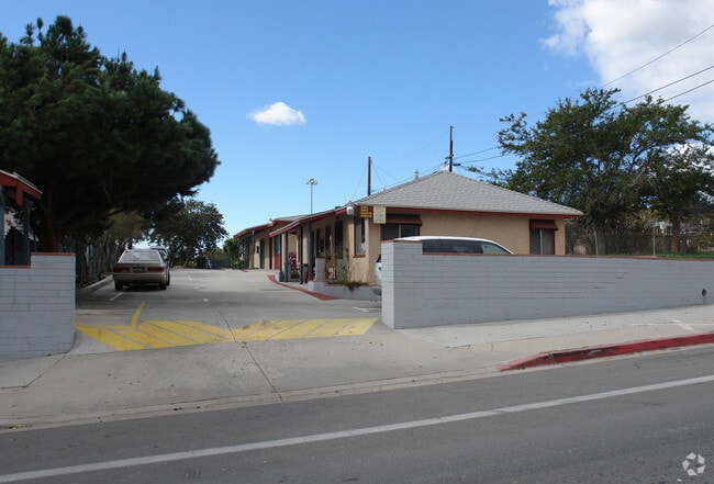
Property Detail
2387 E Beyer Blvd
638-162-36
LOT A-22 DOC76-227713 IN SWQ OF SEQ SEC 36-18-2W&IN TR 001174
Multifamilydwelling
San Diego
RM-1-1
California
B and X Area of moderate flood hazard, usually the area between the limits of the 100-year and 500-year floods.
a-22
2025
0.28 AC
2026
San Ysidro
010015
San Diego
3,104 SF
San Diego-Chula Vista-Carlsbad, CA
NEARBY LISTINGS FOR SALE OR LEASE
DEMOGRAPHICS near 2387 E Beyer Blvd
1 mile
3 mile
5 mile
2025 Total Population
19,431
97,702
218,713
2030 Population
19,402
97,384
218,653
Pop Growth 2025-2030
(0.15%)
(0.33%)
(0.03%)
Average Age
37
38
38
2025 Total Households
5,115
26,333
62,487
HH Growth 2025-2030
(0.27%)
(0.43%)
(0.20%)
Median Household Inc
$78,226
$90,463
$86,942
Avg Household Size
3.60
3.50
3.30
2025 Avg HH Vehicles
2.00
2.00
2.00
Median Home Value
$669,877
$665,707
$690,889
Median Year Built
1983
1982
1977
Nearby Places
Map Layers
Map Styles
 Street
 Aerial
Layers
 Traffic
 Biking
Places
Listings with unknown addresses are not visible on the map
- Restaurants
- Banks
- Shops
- Fitness
- Groceries
PUBLIC TRANSPORTATION
TRANSIT/SUBWAY
Beyer Boulevard (Blue Line - San Diego Metropolitan Transit System Trolley (San Diego Trolley))
Drive
Walk
Distance
Beyer Boulevard (Blue Line - San Diego Metropolitan Transit System Trolley (San Diego Trolley))
2 min
13 min
0.7 mi
San Ysidro Transit Center (Blue Line - San Diego Metropolitan Transit System Trolley (San Diego Trolley))
Drive
Walk
Distance
San Ysidro Transit Center (Blue Line - San Diego Metropolitan Transit System Trolley (San Diego Trolley))
2 min
20 min
1.1 mi
AIRPORT
San Diego International
Drive
Walk
Distance
San Diego International
23 min
18.2 mi
Nearby Properties
Address
Land Use
TOTAL SIZE
Lot Size
Zoning
Address
Land Use
TOTAL SIZE
Lot Size
Zoning
9,999 SF
26.28 AC
CR-2-1
Address
Land Use
TOTAL SIZE
Lot Size
Zoning
119 AC
I-7
Address
Land Use
TOTAL SIZE
Lot Size
Zoning
9,999 SF
10.79 AC
RM-3-7
Address
Land Use
TOTAL SIZE
Lot Size
Zoning
183,595 SF
27.99 AC
CC-1-3
Address
Land Use
TOTAL SIZE
Lot Size
Zoning
10.17 AC
RM-3-7
Address
Land Use
TOTAL SIZE
Lot Size
Zoning
9,999 SF
14.99 AC
RM-2-5
Address
Land Use
TOTAL SIZE
Lot Size
Zoning
9,999 SF
13.04 AC
CR-2-1
Address
Land Use
TOTAL SIZE
Lot Size
Zoning
9,999 SF
8.60 AC
RM-2-5
Address
Land Use
TOTAL SIZE
Lot Size
Zoning
13.24 AC
RM-2-4
Address
Land Use
TOTAL SIZE
Lot Size
Zoning
9,999 SF
12.84 AC
RM-2-4
Address
Land Use
TOTAL SIZE
Lot Size
Zoning
11,742 SF
14.37 AC
RM-2-5
Address
Land Use
TOTAL SIZE
Lot Size
Zoning
9,999 SF
5.36 AC
RM-1-1
Address
Land Use
TOTAL SIZE
Lot Size
Zoning
9,999 SF
4.69 AC
40
Address
Land Use
TOTAL SIZE
Lot Size
Zoning
9,999 SF
4.99 AC
RM-1-1
Address
Land Use
TOTAL SIZE
Lot Size
Zoning
15.39 AC
RM-2-4
Address
Land Use
TOTAL SIZE
Lot Size
Zoning
33.32 AC
ILP
Address
Land Use
TOTAL SIZE
Lot Size
Zoning
25.40 AC
OC-1-1
Address
Land Use
TOTAL SIZE
Lot Size
Zoning
9,999 SF
6.67 AC
RM-2-5
Address
Land Use
TOTAL SIZE
Lot Size
Zoning
9,999 SF
7.09 AC
CR-2-1
Address
Land Use
TOTAL SIZE
Lot Size
Zoning
9,999 SF
5.01 AC
RM-1-1
Address
Land Use
TOTAL SIZE
Lot Size
Zoning
7,397 SF
4.10 AC
R3
Address
Land Use
TOTAL SIZE
Lot Size
Zoning
9,999 SF
7.36 AC
RM-2-5
Address
Land Use
TOTAL SIZE
Lot Size
Zoning
9,999 SF
9.10 AC
RM-1-1
Address
Land Use
TOTAL SIZE
Lot Size
Zoning
9,999 SF
9.92 AC
RM-1-1
Address
Land Use
TOTAL SIZE
Lot Size
Zoning
17.61 AC
IL-3-1
Address
Land Use
TOTAL SIZE
Lot Size
Zoning
9,999 SF
4.47 AC
RM-2-5
Address
Land Use
TOTAL SIZE
Lot Size
Zoning
9,999 SF
5.81 AC
ILP
Address
Land Use
TOTAL SIZE
Lot Size
Zoning
7,850 SF
4.90 AC
RM-1-1
Address
Land Use
TOTAL SIZE
Lot Size
Zoning
9,999 SF
5.10 AC
IL-2-1
Address
Land Use
TOTAL SIZE
Lot Size
Zoning
8,196 SF
7.44 AC
CR-2-1
The World's #1 Commercial Real Estate Marketplace
Connect with us
© 2026 CoStar Group
The information above has been obtained from sources believed reliable. While we do not doubt its accuracy we have not verified it and make no guarantee, warranty or representation about it. It is your responsibility to independently confirm its accuracy and completeness. Any projections, opinions, assumptions, or estimates used are for example only and do not represent the current or future performance of the property. The value of this transaction to you depends on tax and other factors which should be evaluated by your tax, financial, and legal advisors. You and your advisors should conduct a careful, independent investigation of the property to determine to your satisfaction the suitability of the property for your needs.