Property Record
2396 E Miner Ave, Stockton, CA 95205
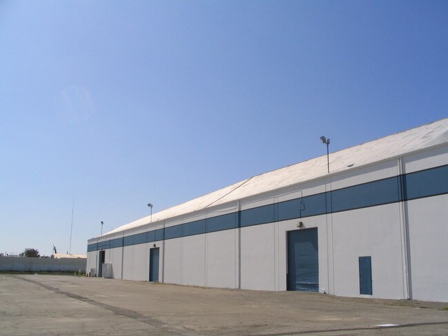
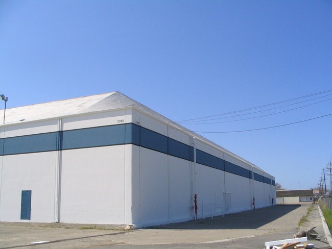

Property Detail
2396 E Miner Ave
Stockton/Modesto
05-FM 153-240-13/14 PER 04103578
Stockton-Lodi, CA
SAN JOAQUIN
153-250-05
California
Industrialacreage
10-24
2025
0.60 AC
2025
NE Stockton
001800
NEARBY LISTINGS FOR SALE OR LEASE
DEMOGRAPHICS near 2396 E Miner Ave
1 mile
3 mile
5 mile
2025 Total Population
18,235
122,768
266,851
2030 Population
18,950
127,946
277,546
Pop Growth 2025-2030
+ 3.92%
+ 4.22%
+ 4.01%
Average Age
34
36
36
2025 Total Households
4,978
36,801
80,547
HH Growth 2025-2030
+ 3.98%
+ 4.49%
+ 4.26%
Median Household Inc
$61,299
$59,040
$67,072
Avg Household Size
3.50
3.20
3.10
2025 Avg HH Vehicles
2.00
2.00
2.00
Median Home Value
$305,644
$355,871
$386,279
Median Year Built
1960
1960
1972
Nearby Places
Map Layers
Map Styles
 Street
 Aerial
Transit
 Traffic
 Biking
Places
Listings with unknown addresses are not visible on the map
- Restaurants
- Banks
- Shops
- Fitness
- Groceries
PUBLIC TRANSPORTATION
COMMUTER RAIL
Stockton- Robert J Cabral Station (ACE Train - Altamont Corridor Express)
Drive
Walk
Distance
Stockton- Robert J Cabral Station (ACE Train - Altamont Corridor Express)
4 min
1.5 mi
Stockton (San Joaquins - Amtrak)
Drive
Walk
Distance
Stockton (San Joaquins - Amtrak)
5 min
2.5 mi
AIRPORT
Stockton Metro
Drive
Walk
Distance
Stockton Metro
12 min
6.1 mi
Freight Ports
Port of Stockton
Drive
Walk
Distance
Port of Stockton
10 min
5.5 mi
SALE & LEASE HISTORY
LISTING DATE
SALE/LEASE

Apr 26, 2017
For Lease
Nearby Properties
Address
Land Use
TOTAL SIZE
Lot Size
Zoning
Address
Land Use
TOTAL SIZE
Lot Size
Zoning
530,700 SF
8.35 AC
Address
Land Use
TOTAL SIZE
Lot Size
Zoning
152,000 SF
1.31 AC
Address
Land Use
TOTAL SIZE
Lot Size
Zoning
4.78 AC
Address
Land Use
TOTAL SIZE
Lot Size
Zoning
780,371 SF
46.04 AC
IG
Address
Land Use
TOTAL SIZE
Lot Size
Zoning
9,750 SF
136.94 AC
AU20
Address
Land Use
TOTAL SIZE
Lot Size
Zoning
502,000 SF
19.76 AC
Address
Land Use
TOTAL SIZE
Lot Size
Zoning
652,548 SF
35.24 AC
IL
Address
Land Use
TOTAL SIZE
Lot Size
Zoning
121,574 SF
5.49 AC
RHD
Address
Land Use
TOTAL SIZE
Lot Size
Zoning
69,954 SF
24.92 AC
Address
Land Use
TOTAL SIZE
Lot Size
Zoning
47.61 AC
Address
Land Use
TOTAL SIZE
Lot Size
Zoning
265,496 SF
12.37 AC
Address
Land Use
TOTAL SIZE
Lot Size
Zoning
219,572 SF
16.53 AC
IL
Address
Land Use
TOTAL SIZE
Lot Size
Zoning
262,560 SF
14.42 AC
Address
Land Use
TOTAL SIZE
Lot Size
Zoning
197,876 SF
10.21 AC
Address
Land Use
TOTAL SIZE
Lot Size
Zoning
15,203 SF
3.65 AC
Address
Land Use
TOTAL SIZE
Lot Size
Zoning
8,000 SF
0.67 AC
Address
Land Use
TOTAL SIZE
Lot Size
Zoning
158,400 SF
8.69 AC
Address
Land Use
TOTAL SIZE
Lot Size
Zoning
62,588 SF
43.56 AC
IW
Address
Land Use
TOTAL SIZE
Lot Size
Zoning
0.79 AC
Address
Land Use
TOTAL SIZE
Lot Size
Zoning
46.75 AC
Address
Land Use
TOTAL SIZE
Lot Size
Zoning
37,846 SF
2.94 AC
Address
Land Use
TOTAL SIZE
Lot Size
Zoning
14.76 AC
Address
Land Use
TOTAL SIZE
Lot Size
Zoning
2.42 AC
Address
Land Use
TOTAL SIZE
Lot Size
Zoning
2,876 SF
10.54 AC
Address
Land Use
TOTAL SIZE
Lot Size
Zoning
178,260 SF
10.75 AC
Address
Land Use
TOTAL SIZE
Lot Size
Zoning
60,477 SF
8.25 AC
Address
Land Use
TOTAL SIZE
Lot Size
Zoning
96,768 SF
6.23 AC
Address
Land Use
TOTAL SIZE
Lot Size
Zoning
129,750 SF
8.63 AC
Address
Land Use
TOTAL SIZE
Lot Size
Zoning
261,860 SF
7.48 AC
IW
Address
Land Use
TOTAL SIZE
Lot Size
Zoning
39,192 SF
13.08 AC
The World's #1 Commercial Real Estate Marketplace
Connect with us
© 2026 CoStar Group
The information above has been obtained from sources believed reliable. While we do not doubt its accuracy we have not verified it and make no guarantee, warranty or representation about it. It is your responsibility to independently confirm its accuracy and completeness. Any projections, opinions, assumptions, or estimates used are for example only and do not represent the current or future performance of the property. The value of this transaction to you depends on tax and other factors which should be evaluated by your tax, financial, and legal advisors. You and your advisors should conduct a careful, independent investigation of the property to determine to your satisfaction the suitability of the property for your needs.