Property Record
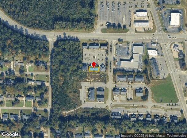
2400 Northside Xing, Macon, GA 31210
NEARBY LISTINGS FOR SALE OR LEASE
Property Detail
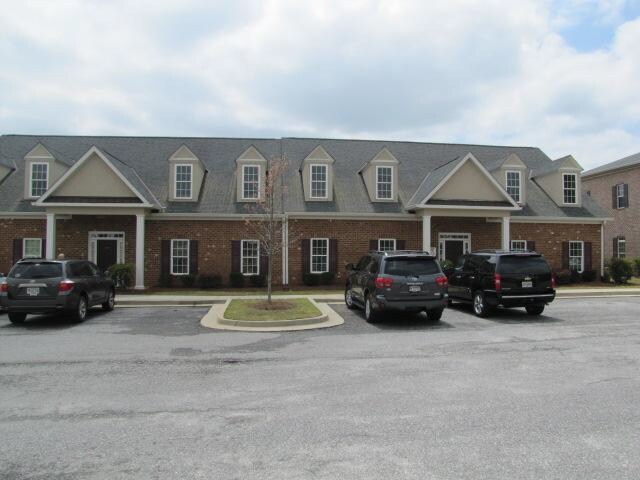
2400 Northside Xing
Macon-Bibb County, GA
Northside Crossing Office Park
M043-0240
NORTHSIDE CROSSING
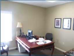
Officebuilding
Bibb
X
Georgia
13169C0215E
24
2025
0.12 AC
2025
Outlying Bibb County
013407
Atlanta
4,692 SF
DEMOGRAPHICS near 2400 Northside Xing
1 Mile
3 Mile
5 Mile
2024 Total Population
5,207
28,620
63,693
2029 Population
5,089
27,980
62,924
Pop Growth 2024-2029
(2.27%)
(2.24%)
(1.21%)
Average Age
38
40
39
2024 Total Households
2,155
12,287
26,924
HH Growth 2024-2029
(2.55%)
(2.24%)
(1.22%)
Median Household Inc
$57,594
$74,435
$63,739
Avg Household Size
2.40
2.30
2.30
2024 Avg HH Vehicles
2.00
2.00
2.00
Median Home Value
$160,119
$195,287
$186,321
Median Year Built
1977
1985
1982
Nearby Places
Map Layers
Map Styles
 Street
 Aerial
- Restaurants
- Banks
- Shops
- Fitness
- Groceries
SALE & LEASE HISTORY
LISTING DATE
SALE/LEASE

Oct 20, 2017
For Lease
Nov 15, 2018
For Sale
Jun 14, 2018
For Lease
Nearby Properties
Address
Land Use
TOTAL SIZE
Lot Size
Zoning
Address
Land Use
TOTAL SIZE
Lot Size
Zoning
83,990 SF
42.03 AC
C-2
Address
Land Use
TOTAL SIZE
Lot Size
Zoning
Address
Land Use
TOTAL SIZE
Lot Size
Zoning
196,702 SF
37.72 AC
PDE
Address
Land Use
TOTAL SIZE
Lot Size
Zoning
3,204 SF
49.78 AC
R-3
Address
Land Use
TOTAL SIZE
Lot Size
Zoning
2,559 SF
45.58 AC
R-3
Address
Land Use
TOTAL SIZE
Lot Size
Zoning
4,671 SF
22.66 AC
R-3
Address
Land Use
TOTAL SIZE
Lot Size
Zoning
94,879 SF
18.77 AC
C-4
Address
Land Use
TOTAL SIZE
Lot Size
Zoning
6,222 SF
56.17 AC
PDR
Address
Land Use
TOTAL SIZE
Lot Size
Zoning
211,536 SF
16.48 AC
C-2
Address
Land Use
TOTAL SIZE
Lot Size
Zoning
62,688 SF
32.47 AC
R-3
Address
Land Use
TOTAL SIZE
Lot Size
Zoning
194,734 SF
6.37 AC
C-2
Address
Land Use
TOTAL SIZE
Lot Size
Zoning
172,808 SF
38.40 AC
C-4/PDE
Address
Land Use
TOTAL SIZE
Lot Size
Zoning
4,734 SF
40 AC
PDE
Address
Land Use
TOTAL SIZE
Lot Size
Zoning
71,021 SF
8.94 AC
PDC
Address
Land Use
TOTAL SIZE
Lot Size
Zoning
231,774 SF
21.27 AC
R-1AAA
Address
Land Use
TOTAL SIZE
Lot Size
Zoning
3,902 SF
53.40 AC
PDE
Address
Land Use
TOTAL SIZE
Lot Size
Zoning
133,220 SF
9.15 AC
C-2
Address
Land Use
TOTAL SIZE
Lot Size
Zoning
51,786 SF
21.05 AC
PDR
Address
Land Use
TOTAL SIZE
Lot Size
Zoning
55,536 SF
20.36 AC
PDE
Address
Land Use
TOTAL SIZE
Lot Size
Zoning
5,376 SF
102.72 AC
R-1AA
Address
Land Use
TOTAL SIZE
Lot Size
Zoning
1,039 SF
14.79 AC
PDR
Address
Land Use
TOTAL SIZE
Lot Size
Zoning
1,452 SF
12.16 AC
R-3
Address
Land Use
TOTAL SIZE
Lot Size
Zoning
6,720 SF
16.69 AC
PDR
Address
Land Use
TOTAL SIZE
Lot Size
Zoning
4,000 SF
2,887.63 AC
001
Address
Land Use
TOTAL SIZE
Lot Size
Zoning
2,366 SF
14.46 AC
PDE
Address
Land Use
TOTAL SIZE
Lot Size
Zoning
125,073 SF
4.89 AC
R-3
Address
Land Use
TOTAL SIZE
Lot Size
Zoning
70,900 SF
2.19 AC
PDE
Address
Land Use
TOTAL SIZE
Lot Size
Zoning
79,904 SF
5.05 AC
PDE
Address
Land Use
TOTAL SIZE
Lot Size
Zoning
64,104 SF
9.17 AC
PDE
Address
Land Use
TOTAL SIZE
Lot Size
Zoning
84,044 SF
22.44 AC
C-4
The World's #1 Commercial Real Estate Marketplace
Connect with us
© 2025 CoStar Group
The information above has been obtained from sources believed reliable. While we do not doubt its accuracy we have not verified it and make no guarantee, warranty or representation about it. It is your responsibility to independently confirm its accuracy and completeness. Any projections, opinions, assumptions, or estimates used are for example only and do not represent the current or future performance of the property. The value of this transaction to you depends on tax and other factors which should be evaluated by your tax, financial, and legal advisors. You and your advisors should conduct a careful, independent investigation of the property to determine to your satisfaction the suitability of the property for your needs.