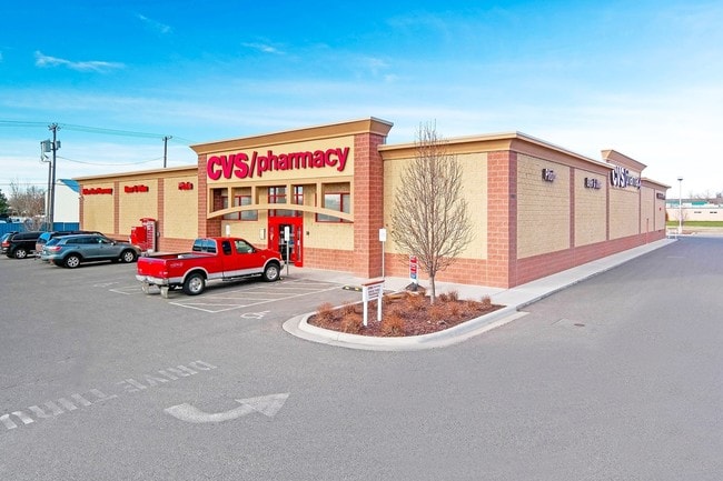
Property Record
2402 Grand Ave, Billings, MT 59102


NEARBY LISTINGS FOR SALE OR LEASE
Property Detail
2402 Grand Ave
03-0926-01-1-12-17-0000
Sweet Subd 2Nd Filing
Commercialnec
SWEET SUBD 2ND FILING, S01, T01 S, R25 E, LOT 1B, 2ND AMD (09)
X
Yellowstone
30111C1265E
Montana
2024
1b
2025
1.40 AC
001803
Other Market Areas
14,504 SF
Billings, MT
DEMOGRAPHICS near 2402 Grand Ave
1 Mile
3 Mile
5 Mile
2024 Total Population
14,328
69,656
110,369
2029 Population
15,493
75,446
119,753
Pop Growth 2024-2029
+ 8.13%
+ 8.31%
+ 8.50%
Average Age
43
41
40
2024 Total Households
6,165
30,407
46,843
HH Growth 2024-2029
+ 8.34%
+ 8.48%
+ 8.66%
Median Household Inc
$76,291
$70,660
$69,624
Avg Household Size
2.20
2.20
2.20
2024 Avg HH Vehicles
2.00
2.00
2.00
Median Home Value
$283,484
$292,188
$297,487
Median Year Built
1969
1974
1978
Nearby Places
Map Layers
Map Styles
 Street
 Aerial
- Restaurants
- Banks
- Shops
- Fitness
- Groceries
PUBLIC TRANSPORTATION
AIRPORT
Billings Logan International
DRIVE
WALK
Distance
Billings Logan International
21 min
7.3 mi
Freight Ports
Port of Everett
DRIVE
WALK
Distance
Port of Everett
884 min
840.8 mi
SALE & LEASE HISTORY
LISTING DATE
SALE/LEASE

Sep 23, 2016
For Sale
Oct 07, 2016
For Sale
Jul 10, 2019
For Sale
Nearby Properties
Address
Land Use
TOTAL SIZE
Lot Size
Zoning
Address
Land Use
TOTAL SIZE
Lot Size
Zoning
650,098 SF
53.35 AC
CI
Address
Land Use
TOTAL SIZE
Lot Size
Zoning
615,777 SF
5.85 AC
MCPZD
Address
Land Use
TOTAL SIZE
Lot Size
Zoning
483,842 SF
55.14 AC
P
Address
Land Use
TOTAL SIZE
Lot Size
Zoning
1,542.56 AC
P
Address
Land Use
TOTAL SIZE
Lot Size
Zoning
343,075 SF
0.56 AC
Address
Land Use
TOTAL SIZE
Lot Size
Zoning
164,242 SF
33.08 AC
P
Address
Land Use
TOTAL SIZE
Lot Size
Zoning
167,261 SF
10.55 AC
R-150
Address
Land Use
TOTAL SIZE
Lot Size
Zoning
136,588 SF
21.01 AC
CI
Address
Land Use
TOTAL SIZE
Lot Size
Zoning
188,030 SF
13.88 AC
A-1
Address
Land Use
TOTAL SIZE
Lot Size
Zoning
259,684 SF
14.73 AC
Address
Land Use
TOTAL SIZE
Lot Size
Zoning
258,977 SF
18.05 AC
CI
Address
Land Use
TOTAL SIZE
Lot Size
Zoning
116,250 SF
9.39 AC
Address
Land Use
TOTAL SIZE
Lot Size
Zoning
138,502 SF
18.97 AC
Address
Land Use
TOTAL SIZE
Lot Size
Zoning
156,883 SF
12.86 AC
Address
Land Use
TOTAL SIZE
Lot Size
Zoning
168,124 SF
14.39 AC
HC
Address
Land Use
TOTAL SIZE
Lot Size
Zoning
70,034 SF
7.29 AC
Address
Land Use
TOTAL SIZE
Lot Size
Zoning
537,468 SF
36.83 AC
CC
Address
Land Use
TOTAL SIZE
Lot Size
Zoning
218,478 SF
18.19 AC
CI
Address
Land Use
TOTAL SIZE
Lot Size
Zoning
109,714 SF
NC
Address
Land Use
TOTAL SIZE
Lot Size
Zoning
177,290 SF
14.59 AC
HC
Address
Land Use
TOTAL SIZE
Lot Size
Zoning
188,907 SF
3.83 AC
CC
Address
Land Use
TOTAL SIZE
Lot Size
Zoning
149,797 SF
12.95 AC
CC
Address
Land Use
TOTAL SIZE
Lot Size
Zoning
26.09 AC
Address
Land Use
TOTAL SIZE
Lot Size
Zoning
1,200 SF
57.17 AC
P
Address
Land Use
TOTAL SIZE
Lot Size
Zoning
409,620 SF
27.42 AC
CI
Address
Land Use
TOTAL SIZE
Lot Size
Zoning
135,273 SF
3.76 AC
R-60
Address
Land Use
TOTAL SIZE
Lot Size
Zoning
180,859 SF
14.39 AC
R-96
Address
Land Use
TOTAL SIZE
Lot Size
Zoning
48,717 SF
1.53 AC
MCPZD
Address
Land Use
TOTAL SIZE
Lot Size
Zoning
109,485 SF
8.87 AC
R-96
Address
Land Use
TOTAL SIZE
Lot Size
Zoning
155,084 SF
13.78 AC
P
The World's #1 Commercial Real Estate Marketplace
Connect with us
© 2026 CoStar Group
The information above has been obtained from sources believed reliable. While we do not doubt its accuracy we have not verified it and make no guarantee, warranty or representation about it. It is your responsibility to independently confirm its accuracy and completeness. Any projections, opinions, assumptions, or estimates used are for example only and do not represent the current or future performance of the property. The value of this transaction to you depends on tax and other factors which should be evaluated by your tax, financial, and legal advisors. You and your advisors should conduct a careful, independent investigation of the property to determine to your satisfaction the suitability of the property for your needs.