Property Record
2403 E Springs Dr, Madison, WI 53704
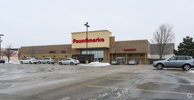

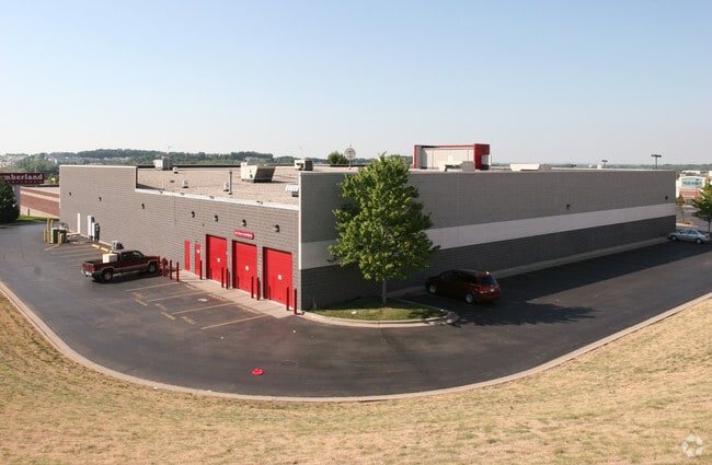

Property Detail
2403 E Springs Dr
0810-271-1404-0
CERTIFIED SURVEY MAP NO 7472 AS RECORDED IN DANE COUNTY REGISTER OF DEEDS IN VOL 38 PAGE 268 OF CERTIFIED SURVEYS, PART OF LOT 4 DESC AS FOL: BEG S COR SD LOT 4 , TH N 46 DEG 10 MIN 20 SEC W 260 FT, TH N 43 DEG 49 MIN 40 SEC E 80.15 FT, TH N 50 DEG 0
Commercialnec
DANE
CC
Wisconsin
B and X Area of moderate flood hazard, usually the area between the limits of the 100-year and 500-year floods.
4
2025
4.61 AC
2025
Northeast Madison
002603
Milwaukee/Madison
113,483 SF
Madison, WI
NEARBY LISTINGS FOR SALE OR LEASE
DEMOGRAPHICS near 2403 E Springs Dr
1 mile
3 mile
5 mile
2025 Total Population
8,320
35,803
114,783
2030 Population
8,670
37,196
119,228
Pop Growth 2025-2030
+ 4.21%
+ 3.89%
+ 3.87%
Average Age
38
39
40
2025 Total Households
3,898
16,057
51,737
HH Growth 2025-2030
+ 4.62%
+ 4.23%
+ 4.22%
Median Household Inc
$76,238
$79,388
$80,281
Avg Household Size
2.10
2.20
2.20
2025 Avg HH Vehicles
2.00
2.00
2.00
Median Home Value
$279,843
$320,116
$340,467
Median Year Built
1991
1990
1978
Nearby Places
Map Layers
Map Styles
 Street
 Aerial
Layers
 Traffic
 Biking
Places
Listings with unknown addresses are not visible on the map
- Restaurants
- Banks
- Shops
- Fitness
- Groceries
PUBLIC TRANSPORTATION
AIRPORT
Dane County Regional/Truax Field
Drive
Walk
Distance
Dane County Regional/Truax Field
11 min
4.8 mi
SALE & LEASE HISTORY
LISTING DATE
SALE/LEASE

Apr 25, 2017
For Lease
Apr 25, 2017
For Sale
Nearby Properties
Address
Land Use
TOTAL SIZE
Lot Size
Zoning
Address
Land Use
TOTAL SIZE
Lot Size
Zoning
287,341 SF
40.17 AC
IL
Address
Land Use
TOTAL SIZE
Lot Size
Zoning
462,477 SF
7.76 AC
CC-T
Address
Land Use
TOTAL SIZE
Lot Size
Zoning
274,139 SF
7.45 AC
SEC
Address
Land Use
TOTAL SIZE
Lot Size
Zoning
385,400 SF
62.07 AC
IL
Address
Land Use
TOTAL SIZE
Lot Size
Zoning
8.49 AC
SFR
Address
Land Use
TOTAL SIZE
Lot Size
Zoning
289,884 SF
19.36 AC
SR-V2
Address
Land Use
TOTAL SIZE
Lot Size
Zoning
50,400 SF
5.74 AC
SE
Address
Land Use
TOTAL SIZE
Lot Size
Zoning
107,751 SF
22.34 AC
IL
Address
Land Use
TOTAL SIZE
Lot Size
Zoning
912,762 SF
24.28 AC
SEC
Address
Land Use
TOTAL SIZE
Lot Size
Zoning
222,830 SF
6.86 AC
TR-U1
Address
Land Use
TOTAL SIZE
Lot Size
Zoning
237,832 SF
CC
Address
Land Use
TOTAL SIZE
Lot Size
Zoning
266,955 SF
12.77 AC
PD
Address
Land Use
TOTAL SIZE
Lot Size
Zoning
286,104 SF
19.47 AC
SR-V2
Address
Land Use
TOTAL SIZE
Lot Size
Zoning
13,780 SF
16.96 AC
SO
Address
Land Use
TOTAL SIZE
Lot Size
Zoning
443,828 SF
25.96 AC
SEC
Address
Land Use
TOTAL SIZE
Lot Size
Zoning
547,019 SF
29.06 AC
RMX
Address
Land Use
TOTAL SIZE
Lot Size
Zoning
737,119 SF
59.57 AC
SEC
Address
Land Use
TOTAL SIZE
Lot Size
Zoning
103,769 SF
11.21 AC
WP-15
Address
Land Use
TOTAL SIZE
Lot Size
Zoning
237,482 SF
8.24 AC
PD
Address
Land Use
TOTAL SIZE
Lot Size
Zoning
46,902 SF
5.28 AC
PD
Address
Land Use
TOTAL SIZE
Lot Size
Zoning
222,532 SF
18.26 AC
PD
Address
Land Use
TOTAL SIZE
Lot Size
Zoning
282,902 SF
24.96 AC
SEC
Address
Land Use
TOTAL SIZE
Lot Size
Zoning
3.03 AC
RH-35
Address
Land Use
TOTAL SIZE
Lot Size
Zoning
109,450 SF
4.33 AC
TR-U1
Address
Land Use
TOTAL SIZE
Lot Size
Zoning
170,180 SF
10.01 AC
PD
Address
Land Use
TOTAL SIZE
Lot Size
Zoning
101,348 SF
6.37 AC
SEC
Address
Land Use
TOTAL SIZE
Lot Size
Zoning
102,649 SF
6.76 AC
SEC
Address
Land Use
TOTAL SIZE
Lot Size
Zoning
131,000 SF
4.51 AC
WP-25
Address
Land Use
TOTAL SIZE
Lot Size
Zoning
152,566 SF
4.21 AC
PD
The World's #1 Commercial Real Estate Marketplace
Connect with us
© 2026 CoStar Group
The information above has been obtained from sources believed reliable. While we do not doubt its accuracy we have not verified it and make no guarantee, warranty or representation about it. It is your responsibility to independently confirm its accuracy and completeness. Any projections, opinions, assumptions, or estimates used are for example only and do not represent the current or future performance of the property. The value of this transaction to you depends on tax and other factors which should be evaluated by your tax, financial, and legal advisors. You and your advisors should conduct a careful, independent investigation of the property to determine to your satisfaction the suitability of the property for your needs.