Property Record
2404 N 2000 W, Clearfield, UT 84015


NEARBY LISTINGS FOR SALE OR LEASE
Property Detail
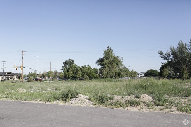
2404 N 2000 W
13-051-0030
BEG 40 RODS N & 330 FT E OF SW COR OF SEC 22-T5N-R2W, SLM; N 8 RODS; E 60 RODS; S 8 RODS; W 60 RODS TO BEG. CONT. 3.00 ACRES
Cropfieldcropsrowcropsallsoilclasses
Davis
X
Utah
49057C0425F
0.75 AC
2025
Davis/Weber Counties
2025
Salt Lake City
125304
Ogden, UT
DEMOGRAPHICS near 2404 N 2000 W
1 Mile
3 Mile
5 Mile
2024 Total Population
13,559
93,909
183,877
2029 Population
14,112
99,280
196,446
Pop Growth 2024-2029
+ 4.08%
+ 5.72%
+ 6.84%
Average Age
34
35
35
2024 Total Households
3,976
28,988
57,511
HH Growth 2024-2029
+ 4.12%
+ 5.79%
+ 7.00%
Median Household Inc
$88,585
$85,762
$83,140
Avg Household Size
3.40
3.20
3.20
2024 Avg HH Vehicles
2.00
2.00
2.00
Median Home Value
$374,324
$359,175
$372,139
Median Year Built
1997
1992
1994
Nearby Places
Map Layers
Map Styles
 Street
 Aerial
- Restaurants
- Banks
- Shops
- Fitness
- Groceries
PUBLIC TRANSPORTATION
COMMUTER RAIL
Roy (FrontRunner North - Utah Transit Authority (UTA))
DRIVE
WALK
Distance
Roy (FrontRunner North - Utah Transit Authority (UTA))
8 min
4.4 mi
Clearfield (FrontRunner North - Utah Transit Authority (UTA))
DRIVE
WALK
Distance
Clearfield (FrontRunner North - Utah Transit Authority (UTA))
12 min
6.4 mi
AIRPORT
Salt Lake City International
DRIVE
WALK
Distance
Salt Lake City International
44 min
34.9 mi
Freight Ports
Port of Stockton
DRIVE
WALK
Distance
Port of Stockton
744 min
725.3 mi
Nearby Properties
Address
Land Use
TOTAL SIZE
Lot Size
Zoning
Address
Land Use
TOTAL SIZE
Lot Size
Zoning
125,164 SF
7.12 AC
Address
Land Use
TOTAL SIZE
Lot Size
Zoning
7,492 SF
8.96 AC
Address
Land Use
TOTAL SIZE
Lot Size
Zoning
5,481 SF
15.54 AC
Address
Land Use
TOTAL SIZE
Lot Size
Zoning
74,995 SF
6.07 AC
Address
Land Use
TOTAL SIZE
Lot Size
Zoning
223,079 SF
22.55 AC
Address
Land Use
TOTAL SIZE
Lot Size
Zoning
57,165 SF
8.50 AC
GC
Address
Land Use
TOTAL SIZE
Lot Size
Zoning
11,877 SF
5.44 AC
CC
Address
Land Use
TOTAL SIZE
Lot Size
Zoning
121,173 SF
11.74 AC
CC
Address
Land Use
TOTAL SIZE
Lot Size
Zoning
69,331 SF
7.46 AC
R2
Address
Land Use
TOTAL SIZE
Lot Size
Zoning
62,246 SF
5.37 AC
PZ
Address
Land Use
TOTAL SIZE
Lot Size
Zoning
21,980 SF
11.68 AC
Address
Land Use
TOTAL SIZE
Lot Size
Zoning
140,015 SF
12.14 AC
PZ
Address
Land Use
TOTAL SIZE
Lot Size
Zoning
88,125 SF
7.17 AC
PZ
Address
Land Use
TOTAL SIZE
Lot Size
Zoning
58,287 SF
5.18 AC
Address
Land Use
TOTAL SIZE
Lot Size
Zoning
50,440 SF
5.26 AC
Address
Land Use
TOTAL SIZE
Lot Size
Zoning
104,180 SF
11.58 AC
I
Address
Land Use
TOTAL SIZE
Lot Size
Zoning
50,432 SF
3.86 AC
R115
Address
Land Use
TOTAL SIZE
Lot Size
Zoning
12,330 SF
20.89 AC
Address
Land Use
TOTAL SIZE
Lot Size
Zoning
45,772 SF
5 AC
Address
Land Use
TOTAL SIZE
Lot Size
Zoning
1,620 SF
3.74 AC
Address
Land Use
TOTAL SIZE
Lot Size
Zoning
20,010 SF
8.33 AC
Address
Land Use
TOTAL SIZE
Lot Size
Zoning
45,160 SF
10.93 AC
Address
Land Use
TOTAL SIZE
Lot Size
Zoning
1,401 SF
6.37 AC
Address
Land Use
TOTAL SIZE
Lot Size
Zoning
33,818 SF
3.27 AC
Address
Land Use
TOTAL SIZE
Lot Size
Zoning
95,394 SF
8.83 AC
Address
Land Use
TOTAL SIZE
Lot Size
Zoning
52.82 AC
Address
Land Use
TOTAL SIZE
Lot Size
Zoning
85,852 SF
1.38 AC
Address
Land Use
TOTAL SIZE
Lot Size
Zoning
16.99 AC
Address
Land Use
TOTAL SIZE
Lot Size
Zoning
85,852 SF
1.29 AC
The World's #1 Commercial Real Estate Marketplace
Connect with us
© 2026 CoStar Group
The information above has been obtained from sources believed reliable. While we do not doubt its accuracy we have not verified it and make no guarantee, warranty or representation about it. It is your responsibility to independently confirm its accuracy and completeness. Any projections, opinions, assumptions, or estimates used are for example only and do not represent the current or future performance of the property. The value of this transaction to you depends on tax and other factors which should be evaluated by your tax, financial, and legal advisors. You and your advisors should conduct a careful, independent investigation of the property to determine to your satisfaction the suitability of the property for your needs.