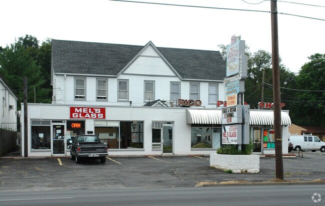
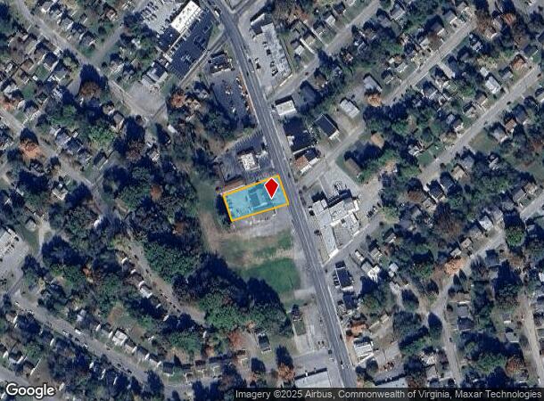
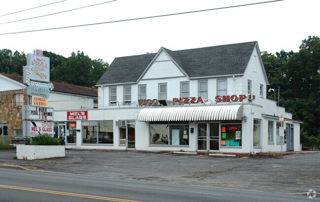
Property Record
2404 Williamson Rd Ne, Roanoke, VA 24012
NEARBY LISTINGS FOR SALE OR LEASE
Property Detail
2404 Williamson Rd Ne
Roanoke, VA
C L And Julia S Wood Map
309-0231
PT LOTS 2 3 & 4 C L WOOD
Multipleuses
Roanoke City
X
Virginia
51161C0166G
2
2025
0.46 AC
2025
Northeast Roanoke
000500
Roanoke
5,107 SF
DEMOGRAPHICS near 2404 Williamson Rd Ne
1 mile
3 mile
5 mile
2024 Total Population
8,941
70,246
144,038
2029 Population
8,687
69,093
142,066
Pop Growth 2024-2029
(2.84%)
(1.64%)
(1.37%)
Average Age
38
39
41
2024 Total Households
3,824
30,887
62,310
HH Growth 2024-2029
(2.85%)
(1.62%)
(1.41%)
Median Household Inc
$34,056
$45,392
$53,919
Avg Household Size
2.30
2.20
2.20
2024 Avg HH Vehicles
2.00
2.00
2.00
Median Home Value
$140,124
$149,235
$182,880
Median Year Built
1954
1959
1965
Nearby Places
Map Layers
Map Styles
 Street
 Aerial
Transit
 Traffic
 Biking
Places
Listings with unknown addresses are not visible on the map
- Restaurants
- Banks
- Shops
- Fitness
- Groceries
PUBLIC TRANSPORTATION
COMMUTER RAIL
Roanoke (Northeast Regional - Amtrak)
Drive
Walk
Distance
Roanoke (Northeast Regional - Amtrak)
4 min
2.1 mi
AIRPORT
Roanoke/Blacksburg Regional (Woodrum Field)
Drive
Walk
Distance
Roanoke/Blacksburg Regional (Woodrum Field)
8 min
3.6 mi
Freight Ports
Virginia Port Authority - Richmond
Drive
Walk
Distance
Virginia Port Authority - Richmond
217 min
161.5 mi
Nearby Properties
Address
Land Use
TOTAL SIZE
Lot Size
Zoning
Address
Land Use
TOTAL SIZE
Lot Size
Zoning
998,139 SF
20.12 AC
INPUD
Address
Land Use
TOTAL SIZE
Lot Size
Zoning
370 SF
105.25 AC
I-2
Address
Land Use
TOTAL SIZE
Lot Size
Zoning
476,613 SF
5.29 AC
D
Address
Land Use
TOTAL SIZE
Lot Size
Zoning
3,850 SF
60.20 AC
INPUD
Address
Land Use
TOTAL SIZE
Lot Size
Zoning
437,578 SF
14.74 AC
CLS
Address
Land Use
TOTAL SIZE
Lot Size
Zoning
96,620 SF
26.84 AC
D
Address
Land Use
TOTAL SIZE
Lot Size
Zoning
217,815 SF
3.02 AC
INPUD
Address
Land Use
TOTAL SIZE
Lot Size
Zoning
87,406 SF
1.15 AC
D
Address
Land Use
TOTAL SIZE
Lot Size
Zoning
211,622 SF
2.18 AC
INPUD
Address
Land Use
TOTAL SIZE
Lot Size
Zoning
219,494 SF
12.01 AC
CLS
Address
Land Use
TOTAL SIZE
Lot Size
Zoning
3,404 SF
17.41 AC
MXPUD
Address
Land Use
TOTAL SIZE
Lot Size
Zoning
1.51 AC
INPUD
Address
Land Use
TOTAL SIZE
Lot Size
Zoning
262,715 SF
5.09 AC
D
Address
Land Use
TOTAL SIZE
Lot Size
Zoning
138,261 SF
22.24 AC
CLS
Address
Land Use
TOTAL SIZE
Lot Size
Zoning
71,696 SF
71.64 AC
INPUD/ROS
Address
Land Use
TOTAL SIZE
Lot Size
Zoning
1.25 AC
D
Address
Land Use
TOTAL SIZE
Lot Size
Zoning
504,343 SF
2.80 AC
INPUD
Address
Land Use
TOTAL SIZE
Lot Size
Zoning
81,500 SF
0.63 AC
D
Address
Land Use
TOTAL SIZE
Lot Size
Zoning
12,220 SF
5.09 AC
D
Address
Land Use
TOTAL SIZE
Lot Size
Zoning
150,151 SF
0.84 AC
D
Address
Land Use
TOTAL SIZE
Lot Size
Zoning
33,249 SF
5.50 AC
D
Address
Land Use
TOTAL SIZE
Lot Size
Zoning
141,056 SF
2.49 AC
D
Address
Land Use
TOTAL SIZE
Lot Size
Zoning
206,418 SF
1.50 AC
D
Address
Land Use
TOTAL SIZE
Lot Size
Zoning
67,486 SF
3.99 AC
RMF
Address
Land Use
TOTAL SIZE
Lot Size
Zoning
73,575 SF
2.52 AC
D
Address
Land Use
TOTAL SIZE
Lot Size
Zoning
122,814 SF
0.98 AC
INPUD
Address
Land Use
TOTAL SIZE
Lot Size
Zoning
238,125 SF
0.37 AC
D
Address
Land Use
TOTAL SIZE
Lot Size
Zoning
209,930 SF
1.49 AC
D
Address
Land Use
TOTAL SIZE
Lot Size
Zoning
160,537 SF
11.08 AC
I-1
Address
Land Use
TOTAL SIZE
Lot Size
Zoning
387,684 SF
27.44 AC
I-1
The World's #1 Commercial Real Estate Marketplace
Connect with us
© 2026 CoStar Group
The information above has been obtained from sources believed reliable. While we do not doubt its accuracy we have not verified it and make no guarantee, warranty or representation about it. It is your responsibility to independently confirm its accuracy and completeness. Any projections, opinions, assumptions, or estimates used are for example only and do not represent the current or future performance of the property. The value of this transaction to you depends on tax and other factors which should be evaluated by your tax, financial, and legal advisors. You and your advisors should conduct a careful, independent investigation of the property to determine to your satisfaction the suitability of the property for your needs.