Property Record
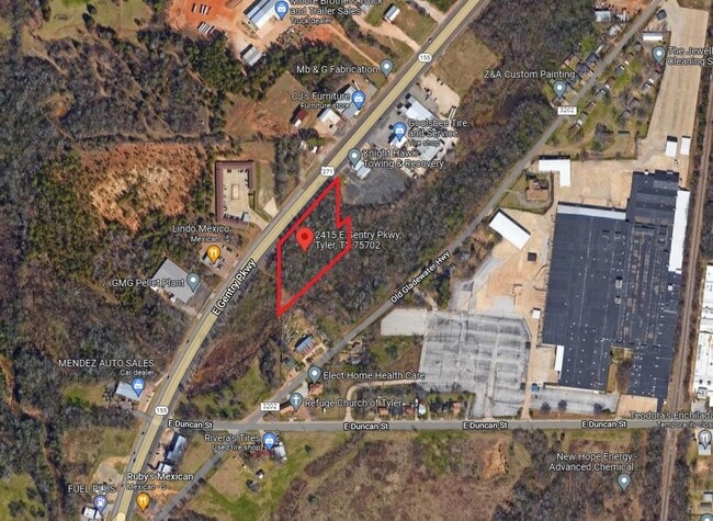
2415 E Gentry Pkwy, Tyler, TX 75708

Property Detail
2415 E Gentry Pkwy
Other Market Areas
CRMC 271 SUBDBLOCK 671 LOT 37A
Tyler, TX
SMITH
1-50000-0671-00-037010
Texas
Commercialacreage
37a
2025
2.19 AC
2025
Tyler
001701
NEARBY LISTINGS FOR SALE OR LEASE
DEMOGRAPHICS near 2415 E Gentry Pkwy
1 mile
3 mile
5 mile
2025 Total Population
4,254
40,493
83,552
2030 Population
4,433
42,746
88,237
Pop Growth 2025-2030
+ 4.21%
+ 5.56%
+ 5.61%
Average Age
35
36
37
2025 Total Households
1,378
13,415
29,624
HH Growth 2025-2030
+ 3.77%
+ 5.12%
+ 5.20%
Median Household Inc
$54,421
$51,565
$56,385
Avg Household Size
2.90
2.70
2.60
2025 Avg HH Vehicles
2.00
2.00
2.00
Median Home Value
$84,265
$102,065
$165,022
Median Year Built
1966
1963
1968
Nearby Places
Map Layers
Map Styles
 Street
 Aerial
Transit
 Traffic
 Biking
Places
Listings with unknown addresses are not visible on the map
- Restaurants
- Banks
- Shops
- Fitness
- Groceries
PUBLIC TRANSPORTATION
AIRPORT
Tyler Pounds Regional
Drive
Walk
Distance
Tyler Pounds Regional
19 min
9.9 mi
SALE & LEASE HISTORY
LISTING DATE
SALE/LEASE

May 25, 2022
For Sale
Nearby Properties
Address
Land Use
TOTAL SIZE
Lot Size
Zoning
Address
Land Use
TOTAL SIZE
Lot Size
Zoning
14,000 SF
144.13 AC
M2
Address
Land Use
TOTAL SIZE
Lot Size
Zoning
12.64 AC
Address
Land Use
TOTAL SIZE
Lot Size
Zoning
503,620 SF
11.42 AC
Address
Land Use
TOTAL SIZE
Lot Size
Zoning
1.47 AC
RMF
Address
Land Use
TOTAL SIZE
Lot Size
Zoning
9.98 AC
Address
Land Use
TOTAL SIZE
Lot Size
Zoning
Address
Land Use
TOTAL SIZE
Lot Size
Zoning
Address
Land Use
TOTAL SIZE
Lot Size
Zoning
Address
Land Use
TOTAL SIZE
Lot Size
Zoning
Address
Land Use
TOTAL SIZE
Lot Size
Zoning
16.53 AC
Address
Land Use
TOTAL SIZE
Lot Size
Zoning
1.78 AC
DBAC
Address
Land Use
TOTAL SIZE
Lot Size
Zoning
Address
Land Use
TOTAL SIZE
Lot Size
Zoning
448,500 SF
2.90 AC
INT
Address
Land Use
TOTAL SIZE
Lot Size
Zoning
238,658 SF
1.97 AC
INT
Address
Land Use
TOTAL SIZE
Lot Size
Zoning
25 AC
INT
Address
Land Use
TOTAL SIZE
Lot Size
Zoning
213,323 SF
1.21 AC
Address
Land Use
TOTAL SIZE
Lot Size
Zoning
Address
Land Use
TOTAL SIZE
Lot Size
Zoning
2.40 AC
Address
Land Use
TOTAL SIZE
Lot Size
Zoning
Address
Land Use
TOTAL SIZE
Lot Size
Zoning
12,810 SF
12.07 AC
R1A
Address
Land Use
TOTAL SIZE
Lot Size
Zoning
20,071 SF
7.43 AC
Address
Land Use
TOTAL SIZE
Lot Size
Zoning
111,030 SF
1.02 AC
Address
Land Use
TOTAL SIZE
Lot Size
Zoning
111,750 SF
26 AC
Address
Land Use
TOTAL SIZE
Lot Size
Zoning
207,919 SF
1.90 AC
DBAC
Address
Land Use
TOTAL SIZE
Lot Size
Zoning
Address
Land Use
TOTAL SIZE
Lot Size
Zoning
83,450 SF
Address
Land Use
TOTAL SIZE
Lot Size
Zoning
1.54 AC
Address
Land Use
TOTAL SIZE
Lot Size
Zoning
25.54 AC
INT
Address
Land Use
TOTAL SIZE
Lot Size
Zoning
181,260 SF
2.06 AC
DBAC
Address
Land Use
TOTAL SIZE
Lot Size
Zoning
7,343 SF
3.12 AC
The World's #1 Commercial Real Estate Marketplace
Connect with us
© 2026 CoStar Group
The information above has been obtained from sources believed reliable. While we do not doubt its accuracy we have not verified it and make no guarantee, warranty or representation about it. It is your responsibility to independently confirm its accuracy and completeness. Any projections, opinions, assumptions, or estimates used are for example only and do not represent the current or future performance of the property. The value of this transaction to you depends on tax and other factors which should be evaluated by your tax, financial, and legal advisors. You and your advisors should conduct a careful, independent investigation of the property to determine to your satisfaction the suitability of the property for your needs.