Property Record
2415 Patterson Rd, Grand Junction, CO 81505

Save to a Folder
{{folder.Name}}
{{folder.ListingIds.length}} Properties
{{folder.ListingIds.length}} Property
Create a New Folder
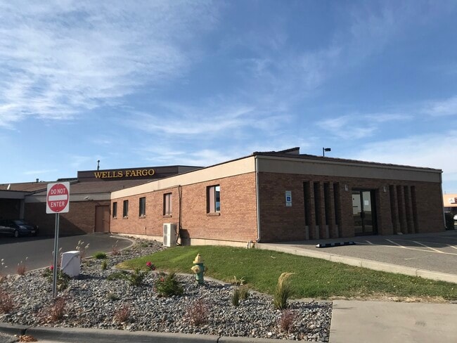
Property Detail
2415 Patterson Rd
2945-043-00-144
BEG N 0DEG0621SEC E 980.02FT & N 89DEG5940SEC E 669.2FT FR SW COR SEC 4 1S 1W N 89DEG5940SEC E 375FT S 0DEG020SEC E 30FT S 47DEG1230SEC W 386.96FT N 33 DEG2802SEC W 34.88FT ALG ARC OF CV TO R RAD IS 433FT CH BRS N 16DEG4411SEC W 249.3FT N 0DEG020SEC
Commercialnec
Mesa
C-1
Colorado
AE The base floodplain where base flood elevations are provided. AE Zones are now used on new format FIRMs instead of A1-A30 Zones.
144
2023
1.48 AC
2024
Colorado Northwest Area
000900
Other Market Areas
10,556 SF
Grand Junction, CO
NEARBY LISTINGS FOR SALE OR LEASE
DEMOGRAPHICS near 2415 Patterson Rd
1 mile
3 mile
5 mile
2025 Total Population
2,697
35,091
74,273
2030 Population
2,854
36,461
76,823
Pop Growth 2025-2030
+ 5.82%
+ 3.90%
+ 3.43%
Average Age
38
43
43
2025 Total Households
1,191
14,662
31,387
HH Growth 2025-2030
+ 6.05%
+ 4.21%
+ 3.66%
Median Household Inc
$67,862
$69,322
$64,477
Avg Household Size
2.30
2.20
2.20
2025 Avg HH Vehicles
2.00
2.00
2.00
Median Home Value
$386,318
$447,733
$428,119
Median Year Built
2008
1988
1985
Nearby Places
Map Layers
Map Styles
 Street
 Aerial
Layers
 Traffic
 Biking
Places
Listings with unknown addresses are not visible on the map
- Restaurants
- Banks
- Shops
- Fitness
- Groceries
PUBLIC TRANSPORTATION
COMMUTER RAIL
Drive
Walk
Distance
8 min
3.3 mi
AIRPORT
Grand Junction Regional
Drive
Walk
Distance
Grand Junction Regional
11 min
6.5 mi
SALE & LEASE HISTORY
LISTING DATE
SALE/LEASE

Nov 11, 2020
For Lease
Nearby Properties
Address
Land Use
TOTAL SIZE
Lot Size
Zoning
Address
Land Use
TOTAL SIZE
Lot Size
Zoning
889,724 SF
22.01 AC
PD
Address
Land Use
TOTAL SIZE
Lot Size
Zoning
278,357 SF
29.28 AC
MU
Address
Land Use
TOTAL SIZE
Lot Size
Zoning
482,392 SF
24.70 AC
CSR
Address
Land Use
TOTAL SIZE
Lot Size
Zoning
429,786 SF
16.99 AC
CSR
Address
Land Use
TOTAL SIZE
Lot Size
Zoning
440,547 SF
29.47 AC
CSR
Address
Land Use
TOTAL SIZE
Lot Size
Zoning
181,976 SF
14.80 AC
CSR
Address
Land Use
TOTAL SIZE
Lot Size
Zoning
90,528 SF
6.09 AC
MU
Address
Land Use
TOTAL SIZE
Lot Size
Zoning
206,585 SF
18.98 AC
C-2
Address
Land Use
TOTAL SIZE
Lot Size
Zoning
130,260 SF
0.20 AC
C-1
Address
Land Use
TOTAL SIZE
Lot Size
Zoning
399,553 SF
C-1
Address
Land Use
TOTAL SIZE
Lot Size
Zoning
127,269 SF
3.21 AC
B-2
Address
Land Use
TOTAL SIZE
Lot Size
Zoning
113,925 SF
0.16 AC
PD
Address
Land Use
TOTAL SIZE
Lot Size
Zoning
82,986 SF
4.20 AC
PD
Address
Land Use
TOTAL SIZE
Lot Size
Zoning
94,818 SF
19.78 AC
RSF-4
Address
Land Use
TOTAL SIZE
Lot Size
Zoning
69,390 SF
0.14 AC
C-1
Address
Land Use
TOTAL SIZE
Lot Size
Zoning
94,639 SF
0.16 AC
C-1
Address
Land Use
TOTAL SIZE
Lot Size
Zoning
93,531 SF
5.19 AC
Address
Land Use
TOTAL SIZE
Lot Size
Zoning
97,602 SF
23.51 AC
RSF-4
Address
Land Use
TOTAL SIZE
Lot Size
Zoning
126,114 SF
13.75 AC
B-2
Address
Land Use
TOTAL SIZE
Lot Size
Zoning
66,178 SF
2.02 AC
PD
Address
Land Use
TOTAL SIZE
Lot Size
Zoning
83,518 SF
1.45 AC
CSR
Address
Land Use
TOTAL SIZE
Lot Size
Zoning
70,394 SF
6.19 AC
PD
Address
Land Use
TOTAL SIZE
Lot Size
Zoning
215,583 SF
20.40 AC
C-1
Address
Land Use
TOTAL SIZE
Lot Size
Zoning
129,062 SF
25.98 AC
RSF-R
Address
Land Use
TOTAL SIZE
Lot Size
Zoning
85,303 SF
8.45 AC
C-2
Address
Land Use
TOTAL SIZE
Lot Size
Zoning
79,905 SF
8.43 AC
PD
Address
Land Use
TOTAL SIZE
Lot Size
Zoning
43,390 SF
3.80 AC
Address
Land Use
TOTAL SIZE
Lot Size
Zoning
435,198 SF
7.55 AC
I-2
Address
Land Use
TOTAL SIZE
Lot Size
Zoning
2,856 SF
108.60 AC
CSR
The World's #1 Commercial Real Estate Marketplace
Connect with us
© 2026 CoStar Group
The information above has been obtained from sources believed reliable. While we do not doubt its accuracy we have not verified it and make no guarantee, warranty or representation about it. It is your responsibility to independently confirm its accuracy and completeness. Any projections, opinions, assumptions, or estimates used are for example only and do not represent the current or future performance of the property. The value of this transaction to you depends on tax and other factors which should be evaluated by your tax, financial, and legal advisors. You and your advisors should conduct a careful, independent investigation of the property to determine to your satisfaction the suitability of the property for your needs.