Property Record
2418 University Ave Se, Minneapolis, MN 55414


NEARBY LISTINGS FOR SALE OR LEASE
Property Detail
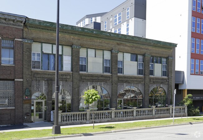
2418 University Ave Se
Minneapolis-St. Paul-Bloomington, MN-WI
Regents Addn
30-029-23-24-0061
LOT 010 BLOCK 023 A REGENTS ADDN LOT 10 BLK 23 ALSO THAT PART OF LOTS 4 AND 5 DESC AS BEG AT SWLY COR OF LOT 10 TH SWLY PAR WITH 25TH AVE SE DIS 91.5 FT TH SELY PAR WITH SWLY T IRREGULAR
Commercialnec
Hennepin
X
Minnesota
27053C0376F
10
2024
0.43 AC
2024
St Paul
104902
Minneapolis/St Paul
25,740 SF
DEMOGRAPHICS near 2418 University Ave Se
1 Mile
3 Mile
5 Mile
2024 Total Population
28,690
212,434
504,065
2029 Population
28,248
209,706
495,339
Pop Growth 2024-2029
(1.54%)
(1.28%)
(1.73%)
Average Age
27
36
37
2024 Total Households
9,720
96,531
221,709
HH Growth 2024-2029
(1.92%)
(1.16%)
(1.72%)
Median Household Inc
$36,536
$61,472
$69,412
Avg Household Size
2.20
2.00
2.10
2024 Avg HH Vehicles
1.00
1.00
1.00
Median Home Value
$361,403
$331,512
$325,526
Median Year Built
1997
1968
1955
Nearby Places
Map Layers
Map Styles
 Street
 Aerial
- Restaurants
- Banks
- Shops
- Fitness
- Groceries
PUBLIC TRANSPORTATION
TRANSIT/SUBWAY
Stadium Village Station (METRO Green Line - Metro Transit)
DRIVE
WALK
Distance
Stadium Village Station (METRO Green Line - Metro Transit)
1 min
4 min
0.2 mi
Prospect Park Station (METRO Green Line - Metro Transit)
DRIVE
WALK
Distance
Prospect Park Station (METRO Green Line - Metro Transit)
1 min
8 min
0.5 mi
East Bank Station (METRO Green Line - Metro Transit)
DRIVE
WALK
Distance
East Bank Station (METRO Green Line - Metro Transit)
2 min
10 min
0.5 mi
Westgate Station (METRO Green Line - Metro Transit)
DRIVE
WALK
Distance
Westgate Station (METRO Green Line - Metro Transit)
3 min
16 min
0.9 mi
COMMUTER RAIL
Target Field Station (Northstar Corridor - Northstar Commuter Rail)
DRIVE
WALK
Distance
Target Field Station (Northstar Corridor - Northstar Commuter Rail)
10 min
3.9 mi
St. Paul-Minneapolis (Empire Builder - Amtrak)
DRIVE
WALK
Distance
St. Paul-Minneapolis (Empire Builder - Amtrak)
13 min
8.0 mi
AIRPORT
Minneapolis-St Paul International/Wold-Chamberlain
DRIVE
WALK
Distance
Minneapolis-St Paul International/Wold-Chamberlain
21 min
10.9 mi
Freight Ports
Port Milwaukee
DRIVE
WALK
Distance
Port Milwaukee
372 min
336.4 mi
SALE & LEASE HISTORY
LISTING DATE
SALE/LEASE

Sep 25, 2016
For Lease
Nearby Properties
Address
Land Use
TOTAL SIZE
Lot Size
Zoning
Address
Land Use
TOTAL SIZE
Lot Size
Zoning
36,300 SF
223.37 AC
Address
Land Use
TOTAL SIZE
Lot Size
Zoning
141,277 SF
44.78 AC
Address
Land Use
TOTAL SIZE
Lot Size
Zoning
1,462,182 SF
1 AC
B4-2
Address
Land Use
TOTAL SIZE
Lot Size
Zoning
2,094,377 SF
2.10 AC
B4-2
Address
Land Use
TOTAL SIZE
Lot Size
Zoning
1,821,999 SF
2.51 AC
B4-2
Address
Land Use
TOTAL SIZE
Lot Size
Zoning
Address
Land Use
TOTAL SIZE
Lot Size
Zoning
1,934,403 SF
1.67 AC
B4-2
Address
Land Use
TOTAL SIZE
Lot Size
Zoning
1,021,060 SF
1.71 AC
B4S-2
Address
Land Use
TOTAL SIZE
Lot Size
Zoning
2,282,334 SF
3.25 AC
B4-2
Address
Land Use
TOTAL SIZE
Lot Size
Zoning
1,054,492 SF
1.70 AC
B4-1
Address
Land Use
TOTAL SIZE
Lot Size
Zoning
495,632 SF
1.72 AC
C1
Address
Land Use
TOTAL SIZE
Lot Size
Zoning
1,208,190 SF
1.20 AC
B4-2
Address
Land Use
TOTAL SIZE
Lot Size
Zoning
176,108 SF
27.45 AC
Address
Land Use
TOTAL SIZE
Lot Size
Zoning
621,608 SF
1.03 AC
B4-2
Address
Land Use
TOTAL SIZE
Lot Size
Zoning
458,470 SF
1.18 AC
OR3
Address
Land Use
TOTAL SIZE
Lot Size
Zoning
907,129 SF
1.65 AC
B4-1
Address
Land Use
TOTAL SIZE
Lot Size
Zoning
442,731 SF
0.97 AC
B4S-2
Address
Land Use
TOTAL SIZE
Lot Size
Zoning
1,044,454 SF
1.08 AC
B4-2
Address
Land Use
TOTAL SIZE
Lot Size
Zoning
1,261,574 SF
2.52 AC
B4-2
Address
Land Use
TOTAL SIZE
Lot Size
Zoning
695,624 SF
3.67 AC
C2
Address
Land Use
TOTAL SIZE
Lot Size
Zoning
2.67 AC
C3A
Address
Land Use
TOTAL SIZE
Lot Size
Zoning
615,172 SF
1.98 AC
I1
Address
Land Use
TOTAL SIZE
Lot Size
Zoning
722,423 SF
1.33 AC
B4-2
Address
Land Use
TOTAL SIZE
Lot Size
Zoning
1,424,796 SF
1.13 AC
B4-1
Address
Land Use
TOTAL SIZE
Lot Size
Zoning
577,656 SF
2.92 AC
C3A
Address
Land Use
TOTAL SIZE
Lot Size
Zoning
557,654 SF
3.15 AC
C2
Address
Land Use
TOTAL SIZE
Lot Size
Zoning
478,616 SF
2.28 AC
C2
Address
Land Use
TOTAL SIZE
Lot Size
Zoning
513,403 SF
0.73 AC
C2
Address
Land Use
TOTAL SIZE
Lot Size
Zoning
1,235,416 SF
1.12 AC
B4-2
Address
Land Use
TOTAL SIZE
Lot Size
Zoning
323,404 SF
2.54 AC
B4S-2
The World's #1 Commercial Real Estate Marketplace
Connect with us
© 2026 CoStar Group
The information above has been obtained from sources believed reliable. While we do not doubt its accuracy we have not verified it and make no guarantee, warranty or representation about it. It is your responsibility to independently confirm its accuracy and completeness. Any projections, opinions, assumptions, or estimates used are for example only and do not represent the current or future performance of the property. The value of this transaction to you depends on tax and other factors which should be evaluated by your tax, financial, and legal advisors. You and your advisors should conduct a careful, independent investigation of the property to determine to your satisfaction the suitability of the property for your needs.