Property Record
2424 Alpine Rd, Eau Claire, WI 54703
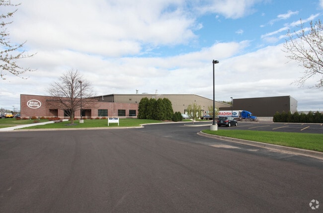

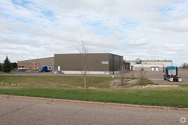
Property Detail
2424 Alpine Rd
Eau Claire, WI
LOT 1 CSM 678921 REC V 6 P 68 BEING PRT NW NW & NE NW SEC 12-27-10 EX NSP R/W DESC V 964 P 111
14-1448
Eau Claire
Industrialgeneral
Wisconsin
I1P
1
B and X Area of moderate flood hazard, usually the area between the limits of the 100-year and 500-year floods.
13.74 AC
2025
Eau Claire/Menomonie
2025
Other Market Areas
001401
NEARBY LISTINGS FOR SALE OR LEASE
DEMOGRAPHICS near 2424 Alpine Rd
1 mile
3 mile
5 mile
2025 Total Population
2,205
25,334
65,379
2030 Population
2,285
26,101
67,021
Pop Growth 2025-2030
+ 3.63%
+ 3.03%
+ 2.51%
Average Age
41
38
38
2025 Total Households
924
10,740
26,679
HH Growth 2025-2030
+ 3.57%
+ 3.12%
+ 2.66%
Median Household Inc
$74,122
$68,812
$70,270
Avg Household Size
2.30
2.30
2.20
2025 Avg HH Vehicles
2.00
2.00
2.00
Median Home Value
$283,262
$241,005
$247,225
Median Year Built
2000
1976
1973
Nearby Places
Map Layers
Map Styles
 Street
 Aerial
Layers
 Traffic
 Biking
Places
Listings with unknown addresses are not visible on the map
- Restaurants
- Banks
- Shops
- Fitness
- Groceries
Nearby Properties
Address
Land Use
TOTAL SIZE
Lot Size
Zoning
Address
Land Use
TOTAL SIZE
Lot Size
Zoning
119.93 AC
Address
Land Use
TOTAL SIZE
Lot Size
Zoning
203,723 SF
Address
Land Use
TOTAL SIZE
Lot Size
Zoning
33.32 AC
I1
Address
Land Use
TOTAL SIZE
Lot Size
Zoning
206,042 SF
5.59 AC
Address
Land Use
TOTAL SIZE
Lot Size
Zoning
0.78 AC
Address
Land Use
TOTAL SIZE
Lot Size
Zoning
61.27 AC
C2
Address
Land Use
TOTAL SIZE
Lot Size
Zoning
40.76 AC
I1P
Address
Land Use
TOTAL SIZE
Lot Size
Zoning
21.83 AC
I1
Address
Land Use
TOTAL SIZE
Lot Size
Zoning
66.12 AC
I1
Address
Land Use
TOTAL SIZE
Lot Size
Zoning
1.05 AC
P
Address
Land Use
TOTAL SIZE
Lot Size
Zoning
105,434 SF
1.55 AC
CBD
Address
Land Use
TOTAL SIZE
Lot Size
Zoning
65,378 SF
1.83 AC
Address
Land Use
TOTAL SIZE
Lot Size
Zoning
68,024 SF
0.80 AC
CBD
Address
Land Use
TOTAL SIZE
Lot Size
Zoning
169,740 SF
19.59 AC
C3P
Address
Land Use
TOTAL SIZE
Lot Size
Zoning
163,428 SF
30.30 AC
I1P
Address
Land Use
TOTAL SIZE
Lot Size
Zoning
Address
Land Use
TOTAL SIZE
Lot Size
Zoning
Address
Land Use
TOTAL SIZE
Lot Size
Zoning
66,497 SF
0.81 AC
CBDP
Address
Land Use
TOTAL SIZE
Lot Size
Zoning
36.59 AC
I1
Address
Land Use
TOTAL SIZE
Lot Size
Zoning
207,960 SF
9.22 AC
I1P
Address
Land Use
TOTAL SIZE
Lot Size
Zoning
38,808 SF
11.65 AC
I1P
Address
Land Use
TOTAL SIZE
Lot Size
Zoning
103,890 SF
6.30 AC
R4P
Address
Land Use
TOTAL SIZE
Lot Size
Zoning
10.68 AC
I1P
Address
Land Use
TOTAL SIZE
Lot Size
Zoning
70,965 SF
0.78 AC
CBD
Address
Land Use
TOTAL SIZE
Lot Size
Zoning
73,414 SF
2.46 AC
C3P
Address
Land Use
TOTAL SIZE
Lot Size
Zoning
14.28 AC
I1P
Address
Land Use
TOTAL SIZE
Lot Size
Zoning
38.99 AC
I1
Address
Land Use
TOTAL SIZE
Lot Size
Zoning
25.27 AC
I2
Address
Land Use
TOTAL SIZE
Lot Size
Zoning
69,320 SF
5.98 AC
Address
Land Use
TOTAL SIZE
Lot Size
Zoning
50,980 SF
1.99 AC
R3P
The World's #1 Commercial Real Estate Marketplace
Connect with us
© 2026 CoStar Group
The information above has been obtained from sources believed reliable. While we do not doubt its accuracy we have not verified it and make no guarantee, warranty or representation about it. It is your responsibility to independently confirm its accuracy and completeness. Any projections, opinions, assumptions, or estimates used are for example only and do not represent the current or future performance of the property. The value of this transaction to you depends on tax and other factors which should be evaluated by your tax, financial, and legal advisors. You and your advisors should conduct a careful, independent investigation of the property to determine to your satisfaction the suitability of the property for your needs.