Property Record
2425 Claribel Rd, Riverbank, CA 95367
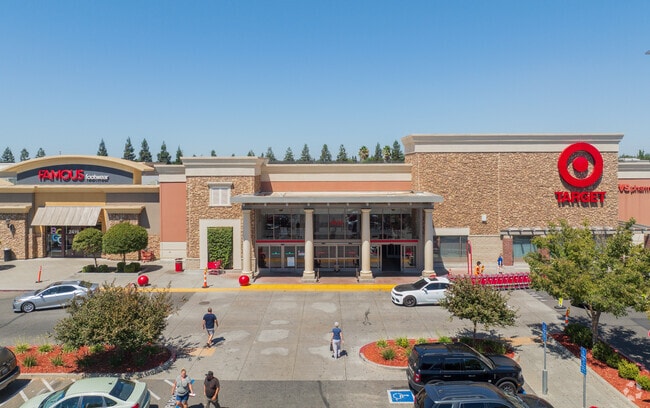


Property Detail
2425 Claribel Rd
Storebuilding
STANISLAUS
PC
California
B and X Area of moderate flood hazard, usually the area between the limits of the 100-year and 500-year floods.
10 AC
2025
Modesto
2025
Stockton/Modesto
000407
Modesto, CA
123,575 SF
075-93-31
NEARBY LISTINGS FOR SALE OR LEASE
DEMOGRAPHICS near 2425 Claribel Rd
1 mile
3 mile
5 mile
2025 Total Population
10,694
73,442
179,388
2030 Population
10,819
74,001
180,661
Pop Growth 2025-2030
+ 1.17%
+ 0.76%
+ 0.71%
Average Age
36
38
39
2025 Total Households
3,110
24,258
62,224
HH Growth 2025-2030
+ 1.22%
+ 0.74%
+ 0.70%
Median Household Inc
$131,139
$91,743
$89,086
Avg Household Size
3.40
3.00
2.80
2025 Avg HH Vehicles
3.00
2.00
2.00
Median Home Value
$583,275
$490,071
$469,792
Median Year Built
2002
1989
1978
Nearby Places
Map Layers
Map Styles
 Street
 Aerial
Layers
 Traffic
 Biking
Places
Listings with unknown addresses are not visible on the map
- Restaurants
- Banks
- Shops
- Fitness
- Groceries
PUBLIC TRANSPORTATION
AIRPORT
Stockton Metro
Drive
Walk
Distance
Stockton Metro
37 min
25.3 mi
Freight Ports
Port of Stockton
Drive
Walk
Distance
Port of Stockton
46 min
33.8 mi
Nearby Properties
Address
Land Use
TOTAL SIZE
Lot Size
Zoning
Address
Land Use
TOTAL SIZE
Lot Size
Zoning
224,940 SF
9.40 AC
MODSP
Address
Land Use
TOTAL SIZE
Lot Size
Zoning
231,178 SF
10.04 AC
R3
Address
Land Use
TOTAL SIZE
Lot Size
Zoning
156,854 SF
12.20 AC
PC
Address
Land Use
TOTAL SIZE
Lot Size
Zoning
15.68 AC
RIVPD
Address
Land Use
TOTAL SIZE
Lot Size
Zoning
79,458 SF
5.32 AC
Address
Land Use
TOTAL SIZE
Lot Size
Zoning
120,160 SF
6 AC
MODPD
Address
Land Use
TOTAL SIZE
Lot Size
Zoning
186,665 SF
10.22 AC
Address
Land Use
TOTAL SIZE
Lot Size
Zoning
233,787 SF
14.65 AC
Address
Land Use
TOTAL SIZE
Lot Size
Zoning
119,046 SF
8.94 AC
Address
Land Use
TOTAL SIZE
Lot Size
Zoning
60,156 SF
16.20 AC
Address
Land Use
TOTAL SIZE
Lot Size
Zoning
72,338 SF
5.98 AC
RIVC1
Address
Land Use
TOTAL SIZE
Lot Size
Zoning
188,676 SF
13.27 AC
Address
Land Use
TOTAL SIZE
Lot Size
Zoning
117,526 SF
5.56 AC
Address
Land Use
TOTAL SIZE
Lot Size
Zoning
9,000 SF
0.92 AC
Address
Land Use
TOTAL SIZE
Lot Size
Zoning
140,669 SF
10.96 AC
PC
Address
Land Use
TOTAL SIZE
Lot Size
Zoning
77,578 SF
7.93 AC
Address
Land Use
TOTAL SIZE
Lot Size
Zoning
79,560 SF
3.88 AC
Address
Land Use
TOTAL SIZE
Lot Size
Zoning
79,599 SF
5.04 AC
Address
Land Use
TOTAL SIZE
Lot Size
Zoning
56,265 SF
4.94 AC
MODPD
Address
Land Use
TOTAL SIZE
Lot Size
Zoning
147,749 SF
8.84 AC
Address
Land Use
TOTAL SIZE
Lot Size
Zoning
117,959 SF
5.06 AC
MODSP
Address
Land Use
TOTAL SIZE
Lot Size
Zoning
65,978 SF
5.84 AC
PC
Address
Land Use
TOTAL SIZE
Lot Size
Zoning
46,795 SF
8.79 AC
COUPD
Address
Land Use
TOTAL SIZE
Lot Size
Zoning
31,012 SF
11.08 AC
MODPD
Address
Land Use
TOTAL SIZE
Lot Size
Zoning
37.92 AC
Address
Land Use
TOTAL SIZE
Lot Size
Zoning
91,945 SF
4.65 AC
PI
Address
Land Use
TOTAL SIZE
Lot Size
Zoning
83,987 SF
4.59 AC
RIVR3
Address
Land Use
TOTAL SIZE
Lot Size
Zoning
88,274 SF
6.32 AC
PC
Address
Land Use
TOTAL SIZE
Lot Size
Zoning
59,827 SF
2.02 AC
The World's #1 Commercial Real Estate Marketplace
Connect with us
© 2026 CoStar Group
The information above has been obtained from sources believed reliable. While we do not doubt its accuracy we have not verified it and make no guarantee, warranty or representation about it. It is your responsibility to independently confirm its accuracy and completeness. Any projections, opinions, assumptions, or estimates used are for example only and do not represent the current or future performance of the property. The value of this transaction to you depends on tax and other factors which should be evaluated by your tax, financial, and legal advisors. You and your advisors should conduct a careful, independent investigation of the property to determine to your satisfaction the suitability of the property for your needs.