Property Record
24314 The Old Rd, Newhall, CA 91321


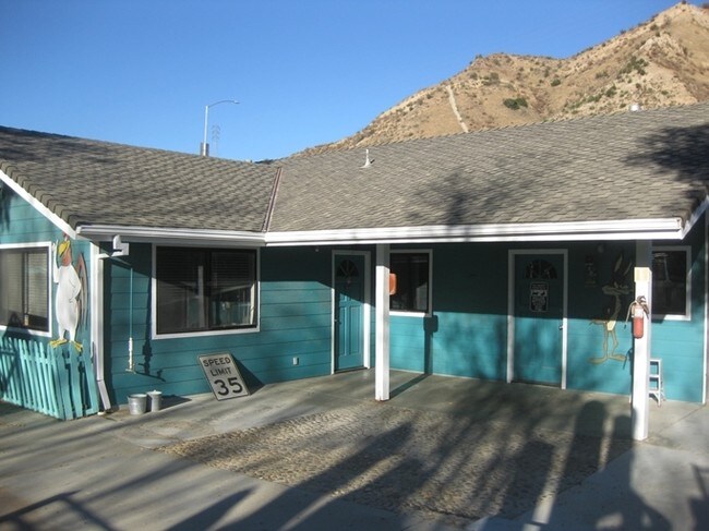

Property Detail
24314 The Old Rd
2826-023-023
*TR=PARCEL MAP AS PER BK 75 PG 30-32 OF P M LOT 1
Publicstorage
Los Angeles
LCA22-A21*
California
A Areas with a 1% annual chance of flooding and a 26% chance of flooding over the life of a 30-year mortgage.
1
2024
2.39 AC
2025
Santa Clarita Valley
920326
Los Angeles
144,152 SF
Los Angeles-Long Beach-Glendale, CA
NEARBY LISTINGS FOR SALE OR LEASE
DEMOGRAPHICS near 24314 The Old Rd
1 mile
3 mile
5 mile
2025 Total Population
2,611
52,670
102,749
2030 Population
2,605
52,272
102,210
Pop Growth 2025-2030
(0.23%)
(0.76%)
(0.52%)
Average Age
42
40
41
2025 Total Households
845
17,413
35,291
HH Growth 2025-2030
(0.47%)
(0.99%)
(0.78%)
Median Household Inc
$149,463
$111,762
$120,436
Avg Household Size
2.90
2.90
2.80
2025 Avg HH Vehicles
2.00
2.00
2.00
Median Home Value
$780,567
$803,046
$856,591
Median Year Built
1976
1982
1987
Nearby Places
Map Layers
Map Styles
 Street
 Aerial
Transit
 Traffic
 Biking
Places
Listings with unknown addresses are not visible on the map
- Restaurants
- Banks
- Shops
- Fitness
- Groceries
PUBLIC TRANSPORTATION
COMMUTER RAIL
Newhall (Antelope Valley Line - Southern California Regional Rail Authority (Metrolink))
Drive
Walk
Distance
Newhall (Antelope Valley Line - Southern California Regional Rail Authority (Metrolink))
9 min
4.1 mi
Santa Clarita (Antelope Valley Line - Southern California Regional Rail Authority (Metrolink))
Drive
Walk
Distance
Santa Clarita (Antelope Valley Line - Southern California Regional Rail Authority (Metrolink))
12 min
7.5 mi
AIRPORT
Bob Hope
Drive
Walk
Distance
Bob Hope
23 min
17.1 mi
Los Angeles International
Drive
Walk
Distance
Los Angeles International
44 min
34.2 mi
Nearby Properties
Address
Land Use
TOTAL SIZE
Lot Size
Zoning
Address
Land Use
TOTAL SIZE
Lot Size
Zoning
491,654 SF
17.56 AC
SCPI
Address
Land Use
TOTAL SIZE
Lot Size
Zoning
173,298 SF
12.42 AC
LCA25*
Address
Land Use
TOTAL SIZE
Lot Size
Zoning
291,344 SF
15.32 AC
LCA2
Address
Land Use
TOTAL SIZE
Lot Size
Zoning
1,014,267 SF
59.95 AC
SCPI
Address
Land Use
TOTAL SIZE
Lot Size
Zoning
245,053 SF
19.81 AC
LCA25*
Address
Land Use
TOTAL SIZE
Lot Size
Zoning
139,196 SF
8.79 AC
SCUR5
Address
Land Use
TOTAL SIZE
Lot Size
Zoning
143,163 SF
10.48 AC
SCUR3
Address
Land Use
TOTAL SIZE
Lot Size
Zoning
137,361 SF
7.38 AC
SCUR3
Address
Land Use
TOTAL SIZE
Lot Size
Zoning
83,698 SF
8.94 AC
SCPI
Address
Land Use
TOTAL SIZE
Lot Size
Zoning
271,399 SF
7.49 AC
LCA25*
Address
Land Use
TOTAL SIZE
Lot Size
Zoning
86,201 SF
3.68 AC
SCUR4
Address
Land Use
TOTAL SIZE
Lot Size
Zoning
138,025 SF
14.51 AC
LCA2
Address
Land Use
TOTAL SIZE
Lot Size
Zoning
79,622 SF
1.21 AC
SCPI
Address
Land Use
TOTAL SIZE
Lot Size
Zoning
52,904 SF
3.08 AC
SCPI
Address
Land Use
TOTAL SIZE
Lot Size
Zoning
106,662 SF
4.04 AC
LCA25*
Address
Land Use
TOTAL SIZE
Lot Size
Zoning
52,194 SF
0.76 AC
SCCP
Address
Land Use
TOTAL SIZE
Lot Size
Zoning
180,584 SF
6.35 AC
SCUR3
Address
Land Use
TOTAL SIZE
Lot Size
Zoning
62,000 SF
2.98 AC
Address
Land Use
TOTAL SIZE
Lot Size
Zoning
48,283 SF
5.38 AC
LCA25*
Address
Land Use
TOTAL SIZE
Lot Size
Zoning
49,625 SF
5.48 AC
LCA2
Address
Land Use
TOTAL SIZE
Lot Size
Zoning
449,762 SF
11.98 AC
LCA2
Address
Land Use
TOTAL SIZE
Lot Size
Zoning
55,156 SF
2.08 AC
LACC3DP
Address
Land Use
TOTAL SIZE
Lot Size
Zoning
209,119 SF
3.24 AC
SCBP
Address
Land Use
TOTAL SIZE
Lot Size
Zoning
47,916 SF
2.71 AC
LCA25*
Address
Land Use
TOTAL SIZE
Lot Size
Zoning
169,585 SF
9.16 AC
SCBP
Address
Land Use
TOTAL SIZE
Lot Size
Zoning
187,990 SF
9.18 AC
SCBP
Address
Land Use
TOTAL SIZE
Lot Size
Zoning
35,000 SF
2.68 AC
LCA2
Address
Land Use
TOTAL SIZE
Lot Size
Zoning
66,737 SF
4.74 AC
LCA2
The World's #1 Commercial Real Estate Marketplace
Connect with us
© 2026 CoStar Group
The information above has been obtained from sources believed reliable. While we do not doubt its accuracy we have not verified it and make no guarantee, warranty or representation about it. It is your responsibility to independently confirm its accuracy and completeness. Any projections, opinions, assumptions, or estimates used are for example only and do not represent the current or future performance of the property. The value of this transaction to you depends on tax and other factors which should be evaluated by your tax, financial, and legal advisors. You and your advisors should conduct a careful, independent investigation of the property to determine to your satisfaction the suitability of the property for your needs.