Property Record
2443 Naglee Rd, Tracy, CA 95304
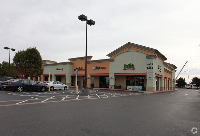


Property Detail
2443 Naglee Rd
212-290-26
03-FM 212-290-15/PT 14/PT TO 25 PER 02143177
Regionalshoppingcenterormallwithanchorstore
SAN JOAQUIN
B and X Area of moderate flood hazard, usually the area between the limits of the 100-year and 500-year floods.
California
2025
1.72 AC
2025
Tracy/Manteca
005214
Stockton/Modesto
10,900 SF
Stockton-Lodi, CA
NEARBY LISTINGS FOR SALE OR LEASE
DEMOGRAPHICS near 2443 Naglee Rd
1 mile
3 mile
5 mile
2025 Total Population
12,236
68,763
129,757
2030 Population
12,855
71,609
136,395
Pop Growth 2025-2030
+ 5.06%
+ 4.14%
+ 5.12%
Average Age
37
38
37
2025 Total Households
3,589
20,844
38,250
HH Growth 2025-2030
+ 5.13%
+ 4.23%
+ 5.17%
Median Household Inc
$120,851
$113,381
$129,289
Avg Household Size
3.30
3.20
3.30
2025 Avg HH Vehicles
3.00
2.00
3.00
Median Home Value
$782,760
$706,266
$756,059
Median Year Built
2001
1991
1999
Nearby Places
Map Layers
Map Styles
 Street
 Aerial
Transit
 Traffic
 Biking
Places
Listings with unknown addresses are not visible on the map
- Restaurants
- Banks
- Shops
- Fitness
- Groceries
PUBLIC TRANSPORTATION
COMMUTER RAIL
Drive
Walk
Distance
11 min
5.8 mi
AIRPORT
Stockton Metro
Drive
Walk
Distance
Stockton Metro
26 min
20.3 mi
Freight Ports
Port of Stockton
Drive
Walk
Distance
Port of Stockton
29 min
23.6 mi
Nearby Properties
Address
Land Use
TOTAL SIZE
Lot Size
Zoning
Address
Land Use
TOTAL SIZE
Lot Size
Zoning
1,120,082 SF
94.93 AC
AG40
Address
Land Use
TOTAL SIZE
Lot Size
Zoning
1,034,066 SF
61.05 AC
Address
Land Use
TOTAL SIZE
Lot Size
Zoning
8.90 AC
Address
Land Use
TOTAL SIZE
Lot Size
Zoning
925,475 SF
42.09 AC
Address
Land Use
TOTAL SIZE
Lot Size
Zoning
1,601 SF
17.08 AC
PUD1
Address
Land Use
TOTAL SIZE
Lot Size
Zoning
3.77 AC
Address
Land Use
TOTAL SIZE
Lot Size
Zoning
483,967 SF
77.75 AC
Address
Land Use
TOTAL SIZE
Lot Size
Zoning
726,000 SF
32.29 AC
M1
Address
Land Use
TOTAL SIZE
Lot Size
Zoning
10.15 AC
PUD1
Address
Land Use
TOTAL SIZE
Lot Size
Zoning
9,327 SF
12.06 AC
Address
Land Use
TOTAL SIZE
Lot Size
Zoning
22,726 SF
8.96 AC
PUD1
Address
Land Use
TOTAL SIZE
Lot Size
Zoning
442,350 SF
27.01 AC
CN
Address
Land Use
TOTAL SIZE
Lot Size
Zoning
575,167 SF
46.44 AC
Address
Land Use
TOTAL SIZE
Lot Size
Zoning
265,000 SF
10.83 AC
Address
Land Use
TOTAL SIZE
Lot Size
Zoning
49,264 SF
9 AC
Address
Land Use
TOTAL SIZE
Lot Size
Zoning
148,663 SF
16.37 AC
Address
Land Use
TOTAL SIZE
Lot Size
Zoning
225,000 SF
11.13 AC
M
Address
Land Use
TOTAL SIZE
Lot Size
Zoning
126,204 SF
110.07 AC
Address
Land Use
TOTAL SIZE
Lot Size
Zoning
155,942 SF
11.90 AC
Address
Land Use
TOTAL SIZE
Lot Size
Zoning
95.54 AC
Address
Land Use
TOTAL SIZE
Lot Size
Zoning
64,582 SF
3.10 AC
Address
Land Use
TOTAL SIZE
Lot Size
Zoning
190,388 SF
13.50 AC
Address
Land Use
TOTAL SIZE
Lot Size
Zoning
1,347 SF
4.96 AC
Address
Land Use
TOTAL SIZE
Lot Size
Zoning
55,576 SF
2.65 AC
Address
Land Use
TOTAL SIZE
Lot Size
Zoning
109,438 SF
6.23 AC
Address
Land Use
TOTAL SIZE
Lot Size
Zoning
13,990 SF
8.30 AC
Address
Land Use
TOTAL SIZE
Lot Size
Zoning
62,246 SF
5.82 AC
NS
Address
Land Use
TOTAL SIZE
Lot Size
Zoning
283,712 SF
13.14 AC
Address
Land Use
TOTAL SIZE
Lot Size
Zoning
47,064 SF
2.36 AC
GC
The World's #1 Commercial Real Estate Marketplace
Connect with us
© 2026 CoStar Group
The information above has been obtained from sources believed reliable. While we do not doubt its accuracy we have not verified it and make no guarantee, warranty or representation about it. It is your responsibility to independently confirm its accuracy and completeness. Any projections, opinions, assumptions, or estimates used are for example only and do not represent the current or future performance of the property. The value of this transaction to you depends on tax and other factors which should be evaluated by your tax, financial, and legal advisors. You and your advisors should conduct a careful, independent investigation of the property to determine to your satisfaction the suitability of the property for your needs.