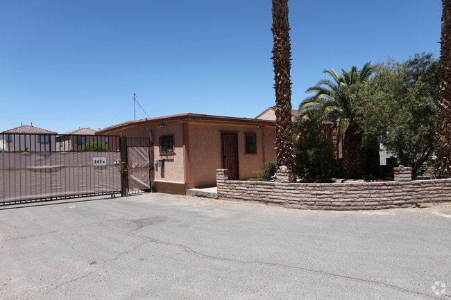
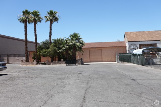
Property Record
231 Elliott Rd, Henderson, NV 89011
Current Lease Availabilities
NEARBY LISTINGS FOR SALE OR LEASE
Property Detail
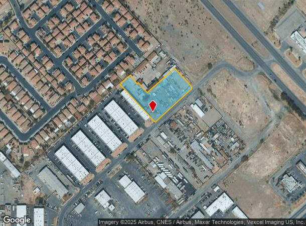
231 Elliott Rd
Las Vegas-Henderson-North Las Vegas, NV
Parcel Map File 54 Page 4
178-02-601-003
PARCEL MAP FILE 54 PAGE 4 LOT 1
Commercialnec
Clark
X
Nevada
32003C2585F
1
2024
1.58 AC
2025
East Las Vegas
005112
Las Vegas
7,415 SF
DEMOGRAPHICS near 231 Elliott Rd
1 Mile
3 Mile
5 Mile
2024 Total Population
9,531
108,104
279,139
2029 Population
10,018
116,556
300,001
Pop Growth 2024-2029
+ 5.11%
+ 7.82%
+ 7.47%
Average Age
37
39
41
2024 Total Households
3,594
41,902
108,008
HH Growth 2024-2029
+ 5.04%
+ 7.79%
+ 7.48%
Median Household Inc
$64,108
$66,407
$67,093
Avg Household Size
2.60
2.50
2.50
2024 Avg HH Vehicles
2.00
2.00
2.00
Median Home Value
$287,519
$344,378
$360,367
Median Year Built
1997
1999
1995
Nearby Places
Map Layers
Map Styles
 Street
 Aerial
- Restaurants
- Banks
- Shops
- Fitness
- Groceries
PUBLIC TRANSPORTATION
AIRPORT
Harry Reid International
DRIVE
WALK
Distance
Harry Reid International
17 min
10.2 mi
Boulder City Municipal
DRIVE
WALK
Distance
Boulder City Municipal
23 min
15.8 mi
Nearby Properties
Address
Land Use
TOTAL SIZE
Lot Size
Zoning
Address
Land Use
TOTAL SIZE
Lot Size
Zoning
678,168 SF
69.69 AC
Address
Land Use
TOTAL SIZE
Lot Size
Zoning
251,075 SF
24.28 AC
Address
Land Use
TOTAL SIZE
Lot Size
Zoning
62,258 SF
59.95 AC
Address
Land Use
TOTAL SIZE
Lot Size
Zoning
14,840 SF
38.54 AC
CC
Address
Land Use
TOTAL SIZE
Lot Size
Zoning
31,463 SF
191.46 AC
PS
Address
Land Use
TOTAL SIZE
Lot Size
Zoning
8,047 SF
17.42 AC
Address
Land Use
TOTAL SIZE
Lot Size
Zoning
7,825 SF
15.41 AC
Address
Land Use
TOTAL SIZE
Lot Size
Zoning
358,212 SF
9.06 AC
CC
Address
Land Use
TOTAL SIZE
Lot Size
Zoning
410,084 SF
16.74 AC
RH24
Address
Land Use
TOTAL SIZE
Lot Size
Zoning
404,030 SF
20.17 AC
RE
Address
Land Use
TOTAL SIZE
Lot Size
Zoning
8,168 SF
15.22 AC
Address
Land Use
TOTAL SIZE
Lot Size
Zoning
10.50 AC
Address
Land Use
TOTAL SIZE
Lot Size
Zoning
5,658 SF
16.18 AC
RH24
Address
Land Use
TOTAL SIZE
Lot Size
Zoning
387,990 SF
22.04 AC
Address
Land Use
TOTAL SIZE
Lot Size
Zoning
1,500 SF
25.08 AC
Address
Land Use
TOTAL SIZE
Lot Size
Zoning
9,493 SF
15.37 AC
Address
Land Use
TOTAL SIZE
Lot Size
Zoning
100.25 AC
RS1
Address
Land Use
TOTAL SIZE
Lot Size
Zoning
4,446 SF
15.81 AC
CC
Address
Land Use
TOTAL SIZE
Lot Size
Zoning
3,289 SF
22.36 AC
R3
Address
Land Use
TOTAL SIZE
Lot Size
Zoning
383,889 SF
31.11 AC
Address
Land Use
TOTAL SIZE
Lot Size
Zoning
38.36 AC
Address
Land Use
TOTAL SIZE
Lot Size
Zoning
9,000 SF
96.81 AC
RE
Address
Land Use
TOTAL SIZE
Lot Size
Zoning
4,578 SF
13.23 AC
H:RH-24-MP
Address
Land Use
TOTAL SIZE
Lot Size
Zoning
40,031 SF
21.25 AC
Address
Land Use
TOTAL SIZE
Lot Size
Zoning
6,670 SF
14.18 AC
C2
Address
Land Use
TOTAL SIZE
Lot Size
Zoning
35.42 AC
PS
Address
Land Use
TOTAL SIZE
Lot Size
Zoning
314,454 SF
22.94 AC
CC
Address
Land Use
TOTAL SIZE
Lot Size
Zoning
4,496 SF
15.59 AC
H:RH-24-MP
Address
Land Use
TOTAL SIZE
Lot Size
Zoning
239,288 SF
14.10 AC
Address
Land Use
TOTAL SIZE
Lot Size
Zoning
250,076 SF
24.61 AC
The World's #1 Commercial Real Estate Marketplace
Connect with us
© 2026 CoStar Group
The information above has been obtained from sources believed reliable. While we do not doubt its accuracy we have not verified it and make no guarantee, warranty or representation about it. It is your responsibility to independently confirm its accuracy and completeness. Any projections, opinions, assumptions, or estimates used are for example only and do not represent the current or future performance of the property. The value of this transaction to you depends on tax and other factors which should be evaluated by your tax, financial, and legal advisors. You and your advisors should conduct a careful, independent investigation of the property to determine to your satisfaction the suitability of the property for your needs.