Property Record
2480 N Randall Rd, Elgin, IL 60123
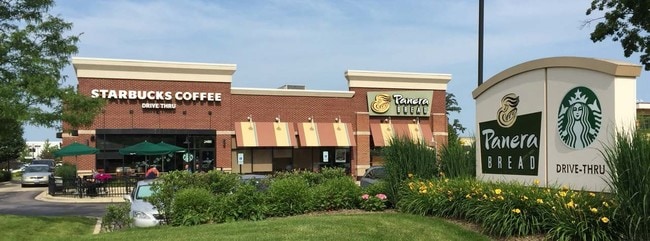

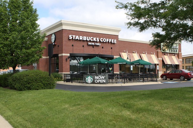
Property Detail
2480 N Randall Rd
Chicago-Naperville-Elgin, IL-IN
LTS 76 THRU 81 IN THE GROVE
03-30-276-040
Kane
Commercialnec
Illinois
B and X Area of moderate flood hazard, usually the area between the limits of the 100-year and 500-year floods.
76-81
2024
1.46 AC
2024
Far Northwest
850600
Chicago
6,442 SF
NEARBY LISTINGS FOR SALE OR LEASE
DEMOGRAPHICS near 2480 N Randall Rd
1 mile
3 mile
5 mile
2025 Total Population
2,452
41,175
145,248
2030 Population
2,519
41,796
147,250
Pop Growth 2025-2030
+ 2.73%
+ 1.51%
+ 1.38%
Average Age
44
40
39
2025 Total Households
909
14,770
49,146
HH Growth 2025-2030
+ 2.64%
+ 1.48%
+ 1.36%
Median Household Inc
$113,061
$111,469
$98,581
Avg Household Size
2.70
2.80
2.90
2025 Avg HH Vehicles
3.00
2.00
2.00
Median Home Value
$396,462
$334,832
$295,981
Median Year Built
1990
1991
1980
Nearby Places
Map Layers
Map Styles
 Street
 Aerial
Layers
 Traffic
 Biking
Places
Listings with unknown addresses are not visible on the map
- Restaurants
- Banks
- Shops
- Fitness
- Groceries
PUBLIC TRANSPORTATION
COMMUTER RAIL
Big Timber Road Station (Milwaukee District West Line - Northeast Illinois Regional Commuter Railroad (Metra))
Drive
Walk
Distance
Big Timber Road Station (Milwaukee District West Line - Northeast Illinois Regional Commuter Railroad (Metra))
7 min
2.8 mi
Elgin Station (Milwaukee District West Line - Northeast Illinois Regional Commuter Railroad (Metra))
Drive
Walk
Distance
Elgin Station (Milwaukee District West Line - Northeast Illinois Regional Commuter Railroad (Metra))
12 min
5.8 mi
AIRPORT
Chicago O'Hare International
Drive
Walk
Distance
Chicago O'Hare International
37 min
29.2 mi
Chicago Midway International
Drive
Walk
Distance
Chicago Midway International
62 min
45.6 mi
SALE & LEASE HISTORY
LISTING DATE
SALE/LEASE

Sep 23, 2016
For Sale
Mar 14, 2017
For Sale
Nearby Properties
Address
Land Use
TOTAL SIZE
Lot Size
Zoning
Address
Land Use
TOTAL SIZE
Lot Size
Zoning
Address
Land Use
TOTAL SIZE
Lot Size
Zoning
551,248 SF
28.94 AC
Address
Land Use
TOTAL SIZE
Lot Size
Zoning
61.92 AC
Address
Land Use
TOTAL SIZE
Lot Size
Zoning
23.54 AC
Address
Land Use
TOTAL SIZE
Lot Size
Zoning
37.65 AC
Address
Land Use
TOTAL SIZE
Lot Size
Zoning
10.88 AC
Address
Land Use
TOTAL SIZE
Lot Size
Zoning
547,668 SF
30.17 AC
Address
Land Use
TOTAL SIZE
Lot Size
Zoning
27.33 AC
Address
Land Use
TOTAL SIZE
Lot Size
Zoning
18.73 AC
Address
Land Use
TOTAL SIZE
Lot Size
Zoning
411,943 SF
17 AC
Address
Land Use
TOTAL SIZE
Lot Size
Zoning
20.02 AC
Address
Land Use
TOTAL SIZE
Lot Size
Zoning
20.33 AC
Address
Land Use
TOTAL SIZE
Lot Size
Zoning
22.04 AC
Address
Land Use
TOTAL SIZE
Lot Size
Zoning
14.36 AC
Address
Land Use
TOTAL SIZE
Lot Size
Zoning
20.93 AC
Address
Land Use
TOTAL SIZE
Lot Size
Zoning
Address
Land Use
TOTAL SIZE
Lot Size
Zoning
307,150 SF
29.72 AC
Address
Land Use
TOTAL SIZE
Lot Size
Zoning
18.55 AC
Address
Land Use
TOTAL SIZE
Lot Size
Zoning
522,133 SF
16 AC
Address
Land Use
TOTAL SIZE
Lot Size
Zoning
7.92 AC
Address
Land Use
TOTAL SIZE
Lot Size
Zoning
14.01 AC
Address
Land Use
TOTAL SIZE
Lot Size
Zoning
342,700 SF
19 AC
Address
Land Use
TOTAL SIZE
Lot Size
Zoning
Address
Land Use
TOTAL SIZE
Lot Size
Zoning
99,800 SF
0.53 AC
Address
Land Use
TOTAL SIZE
Lot Size
Zoning
10.87 AC
Address
Land Use
TOTAL SIZE
Lot Size
Zoning
9.17 AC
Address
Land Use
TOTAL SIZE
Lot Size
Zoning
250,000 SF
13.22 AC
Address
Land Use
TOTAL SIZE
Lot Size
Zoning
250,530 SF
12 AC
Address
Land Use
TOTAL SIZE
Lot Size
Zoning
251,200 SF
13.99 AC
Address
Land Use
TOTAL SIZE
Lot Size
Zoning
11.16 AC
The World's #1 Commercial Real Estate Marketplace
Connect with us
© 2026 CoStar Group
The information above has been obtained from sources believed reliable. While we do not doubt its accuracy we have not verified it and make no guarantee, warranty or representation about it. It is your responsibility to independently confirm its accuracy and completeness. Any projections, opinions, assumptions, or estimates used are for example only and do not represent the current or future performance of the property. The value of this transaction to you depends on tax and other factors which should be evaluated by your tax, financial, and legal advisors. You and your advisors should conduct a careful, independent investigation of the property to determine to your satisfaction the suitability of the property for your needs.