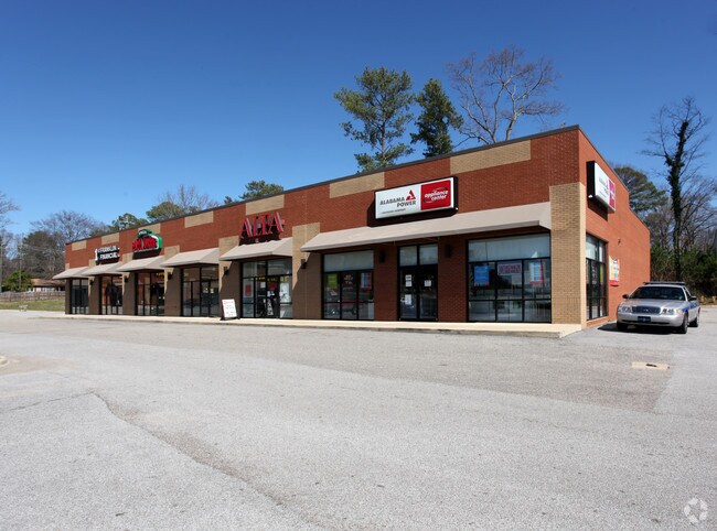
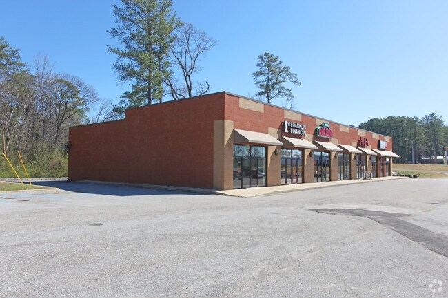
Property Record
2492 Palomino Ln, Birmingham, AL 35214
NEARBY LISTINGS FOR SALE OR LEASE
Property Detail
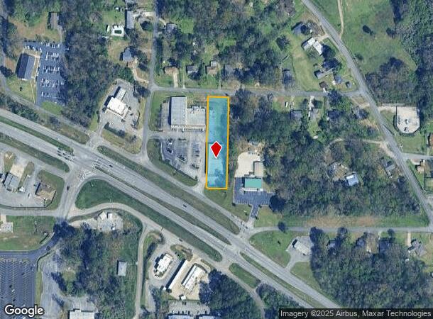
2492 Palomino Ln
Birmingham, AL
Westwood 21-2-4
21-00-02-4-006-008.000
LOT 24 WESTWOOD SUR
Storebuilding
Jefferson
X
Alabama
01073C0358H
24
2023
0.92 AC
2024
Bessemer
012103
Birmingham
9,800 SF
DEMOGRAPHICS near 2492 Palomino Ln
1 Mile
3 Mile
5 Mile
2024 Total Population
2,625
15,820
33,242
2029 Population
2,564
15,460
32,842
Pop Growth 2024-2029
(2.32%)
(2.28%)
(1.20%)
Average Age
42
42
42
2024 Total Households
1,037
6,284
13,508
HH Growth 2024-2029
(2.31%)
(2.36%)
(1.19%)
Median Household Inc
$57,616
$53,728
$50,555
Avg Household Size
2.50
2.40
2.40
2024 Avg HH Vehicles
2.00
2.00
2.00
Median Home Value
$149,631
$144,203
$125,544
Median Year Built
1970
1971
1971
Nearby Places
Map Layers
Map Styles
 Street
 Aerial
- Restaurants
- Banks
- Shops
- Fitness
- Groceries
PUBLIC TRANSPORTATION
COMMUTER RAIL
DRIVE
WALK
Distance
16 min
9.5 mi
AIRPORT
Birmingham-Shuttlesworth International
DRIVE
WALK
Distance
Birmingham-Shuttlesworth International
23 min
14.3 mi
Nearby Properties
Address
Land Use
TOTAL SIZE
Lot Size
Zoning
Address
Land Use
TOTAL SIZE
Lot Size
Zoning
32,922 SF
15 AC
I3
Address
Land Use
TOTAL SIZE
Lot Size
Zoning
181,399 SF
20.91 AC
A1
Address
Land Use
TOTAL SIZE
Lot Size
Zoning
137,177 SF
10 AC
INST
Address
Land Use
TOTAL SIZE
Lot Size
Zoning
123,937 SF
7.79 AC
R4
Address
Land Use
TOTAL SIZE
Lot Size
Zoning
31,817 SF
2.17 AC
CP-C
Address
Land Use
TOTAL SIZE
Lot Size
Zoning
109,753 SF
6.18 AC
R5
Address
Land Use
TOTAL SIZE
Lot Size
Zoning
44,194 SF
3 AC
I
Address
Land Use
TOTAL SIZE
Lot Size
Zoning
87,260 SF
8.20 AC
A1-C
Address
Land Use
TOTAL SIZE
Lot Size
Zoning
82,172 SF
4.39 AC
R4
Address
Land Use
TOTAL SIZE
Lot Size
Zoning
46,492 SF
4.62 AC
A1-C
Address
Land Use
TOTAL SIZE
Lot Size
Zoning
31,438 SF
8 AC
B2
Address
Land Use
TOTAL SIZE
Lot Size
Zoning
26,458 SF
3.88 AC
INST
Address
Land Use
TOTAL SIZE
Lot Size
Zoning
57,685 SF
6.70 AC
I3
Address
Land Use
TOTAL SIZE
Lot Size
Zoning
34,498 SF
4.70 AC
INST
Address
Land Use
TOTAL SIZE
Lot Size
Zoning
37,100 SF
22.70 AC
INST
Address
Land Use
TOTAL SIZE
Lot Size
Zoning
16,219 SF
5.77 AC
INST
Address
Land Use
TOTAL SIZE
Lot Size
Zoning
25,417 SF
6.26 AC
B3
Address
Land Use
TOTAL SIZE
Lot Size
Zoning
1,200 SF
8.30 AC
A1
Address
Land Use
TOTAL SIZE
Lot Size
Zoning
30,693 SF
12 AC
INST
Address
Land Use
TOTAL SIZE
Lot Size
Zoning
47,248 SF
17.51 AC
C1-A
Address
Land Use
TOTAL SIZE
Lot Size
Zoning
26,114 SF
1.72 AC
C1
Address
Land Use
TOTAL SIZE
Lot Size
Zoning
26,364 SF
3.50 AC
IN
Address
Land Use
TOTAL SIZE
Lot Size
Zoning
42,642 SF
6 AC
A1-C
Address
Land Use
TOTAL SIZE
Lot Size
Zoning
24,566 SF
2 AC
R1
Address
Land Use
TOTAL SIZE
Lot Size
Zoning
9,625 SF
5.31 AC
C1
Address
Land Use
TOTAL SIZE
Lot Size
Zoning
4,387 SF
0.90 AC
A1-C
Address
Land Use
TOTAL SIZE
Lot Size
Zoning
16,500 SF
1.84 AC
C1
Address
Land Use
TOTAL SIZE
Lot Size
Zoning
13,784 SF
1.77 AC
C1
Address
Land Use
TOTAL SIZE
Lot Size
Zoning
32,580 SF
5.18 AC
C1
Address
Land Use
TOTAL SIZE
Lot Size
Zoning
21,728 SF
3.27 AC
R-1
The World's #1 Commercial Real Estate Marketplace
Connect with us
© 2026 CoStar Group
The information above has been obtained from sources believed reliable. While we do not doubt its accuracy we have not verified it and make no guarantee, warranty or representation about it. It is your responsibility to independently confirm its accuracy and completeness. Any projections, opinions, assumptions, or estimates used are for example only and do not represent the current or future performance of the property. The value of this transaction to you depends on tax and other factors which should be evaluated by your tax, financial, and legal advisors. You and your advisors should conduct a careful, independent investigation of the property to determine to your satisfaction the suitability of the property for your needs.