Property Record
250 High St, Hamilton, OH 45011


Save to a Folder
{{folder.Name}}
{{folder.ListingIds.length}} Properties
{{folder.ListingIds.length}} Property
Create a New Folder
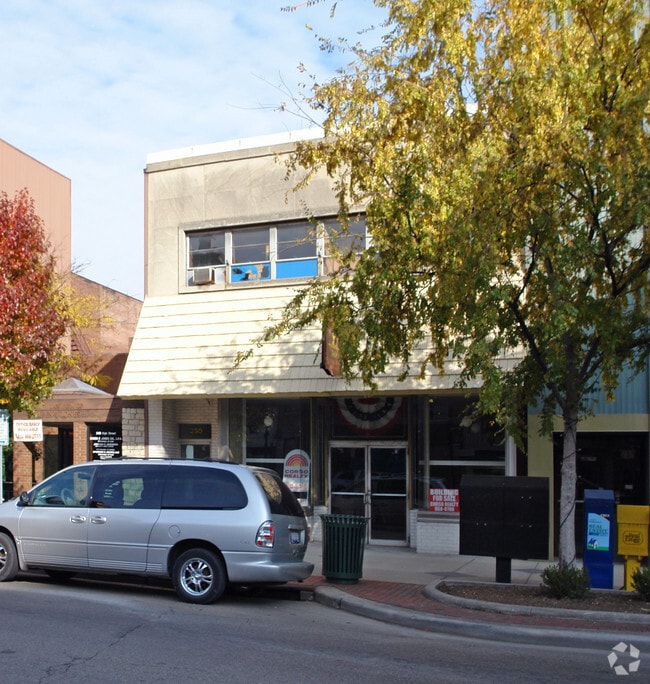
Property Detail
250 High St
Cincinnati, OH-KY-IN
114 W 28 OF E 53 OF S 88
P6421-002-000-082
Butler
Commercialnec
Ohio
B and X Area of moderate flood hazard, usually the area between the limits of the 100-year and 500-year floods.
114
2025
0.06 AC
2025
Butler County
014600
Cincinnati/Dayton
7,356 SF
NEARBY LISTINGS FOR SALE OR LEASE
DEMOGRAPHICS near 250 High St
1 mile
3 mile
5 mile
2025 Total Population
17,681
73,202
123,858
2030 Population
18,349
75,343
127,153
Pop Growth 2025-2030
+ 3.78%
+ 2.92%
+ 2.66%
Average Age
36
39
40
2025 Total Households
6,431
28,482
47,547
HH Growth 2025-2030
+ 4.07%
+ 3.02%
+ 2.73%
Median Household Inc
$46,430
$58,795
$68,831
Avg Household Size
2.40
2.40
2.50
2025 Avg HH Vehicles
1.00
2.00
2.00
Median Home Value
$118,318
$180,407
$227,199
Median Year Built
1946
1956
1969
Nearby Places
Map Layers
Map Styles
 Street
 Aerial
Layers
 Traffic
 Biking
Places
Listings with unknown addresses are not visible on the map
- Restaurants
- Banks
- Shops
- Fitness
- Groceries
PUBLIC TRANSPORTATION
AIRPORT
Cincinnati/Northern Kentucky International
Drive
Walk
Distance
Cincinnati/Northern Kentucky International
65 min
45.4 mi
Freight Ports
Port of Toledo
Drive
Walk
Distance
Port of Toledo
226 min
190.9 mi
SALE & LEASE HISTORY
LISTING DATE
SALE/LEASE

May 05, 2023
For Lease
Nearby Properties
Address
Land Use
TOTAL SIZE
Lot Size
Zoning
Address
Land Use
TOTAL SIZE
Lot Size
Zoning
659,723 SF
27.80 AC
Address
Land Use
TOTAL SIZE
Lot Size
Zoning
336,010 SF
5.56 AC
ADV
Address
Land Use
TOTAL SIZE
Lot Size
Zoning
34,129 SF
13.88 AC
Address
Land Use
TOTAL SIZE
Lot Size
Zoning
14.65 AC
Address
Land Use
TOTAL SIZE
Lot Size
Zoning
14,559 SF
27.50 AC
Address
Land Use
TOTAL SIZE
Lot Size
Zoning
112,027 SF
0.78 AC
Address
Land Use
TOTAL SIZE
Lot Size
Zoning
28.47 AC
Address
Land Use
TOTAL SIZE
Lot Size
Zoning
30.51 AC
Address
Land Use
TOTAL SIZE
Lot Size
Zoning
2.75 AC
Address
Land Use
TOTAL SIZE
Lot Size
Zoning
34.58 AC
Address
Land Use
TOTAL SIZE
Lot Size
Zoning
0.37 AC
Address
Land Use
TOTAL SIZE
Lot Size
Zoning
215,969 SF
16.08 AC
ADV
Address
Land Use
TOTAL SIZE
Lot Size
Zoning
178,152 SF
63.48 AC
Address
Land Use
TOTAL SIZE
Lot Size
Zoning
124,549 SF
9.75 AC
Address
Land Use
TOTAL SIZE
Lot Size
Zoning
32,000 SF
10.24 AC
Address
Land Use
TOTAL SIZE
Lot Size
Zoning
220,612 SF
1.79 AC
Address
Land Use
TOTAL SIZE
Lot Size
Zoning
259,203 SF
22.23 AC
Address
Land Use
TOTAL SIZE
Lot Size
Zoning
85,353 SF
7.85 AC
Address
Land Use
TOTAL SIZE
Lot Size
Zoning
446,660 SF
30.51 AC
Address
Land Use
TOTAL SIZE
Lot Size
Zoning
310,200 SF
28.23 AC
Address
Land Use
TOTAL SIZE
Lot Size
Zoning
75,402 SF
0.45 AC
Address
Land Use
TOTAL SIZE
Lot Size
Zoning
85,926 SF
35.50 AC
Address
Land Use
TOTAL SIZE
Lot Size
Zoning
166,169 SF
12.19 AC
Address
Land Use
TOTAL SIZE
Lot Size
Zoning
53,048 SF
27.49 AC
Address
Land Use
TOTAL SIZE
Lot Size
Zoning
225,687 SF
22.43 AC
Address
Land Use
TOTAL SIZE
Lot Size
Zoning
Address
Land Use
TOTAL SIZE
Lot Size
Zoning
Address
Land Use
TOTAL SIZE
Lot Size
Zoning
216,812 SF
26.35 AC
Address
Land Use
TOTAL SIZE
Lot Size
Zoning
111,174 SF
17.78 AC
Address
Land Use
TOTAL SIZE
Lot Size
Zoning
51,906 SF
0.81 AC
The World's #1 Commercial Real Estate Marketplace
Connect with us
© 2026 CoStar Group
The information above has been obtained from sources believed reliable. While we do not doubt its accuracy we have not verified it and make no guarantee, warranty or representation about it. It is your responsibility to independently confirm its accuracy and completeness. Any projections, opinions, assumptions, or estimates used are for example only and do not represent the current or future performance of the property. The value of this transaction to you depends on tax and other factors which should be evaluated by your tax, financial, and legal advisors. You and your advisors should conduct a careful, independent investigation of the property to determine to your satisfaction the suitability of the property for your needs.