Property Record
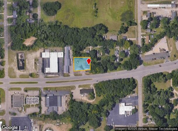
2510 W Dickman Rd, Springfield, MI 49037

NEARBY LISTINGS FOR SALE OR LEASE
Property Detail
2510 W Dickman Rd
Battle Creek, MI
Schieber Park
54-210-008-00
SP CITY, SCHIEBER PARK, LOTS 11 & 12 & OUTLOT A EXC N 90 FT
Autorepair
Calhoun
X
Michigan
26025C0178C
11a
2024
0.56 AC
2025
Battle Crk/W Calhoun Cnty
001300
West Michigan
5,289 SF
DEMOGRAPHICS near 2510 W Dickman Rd
1 mile
3 mile
5 mile
2024 Total Population
5,290
42,359
73,026
2029 Population
5,211
42,051
72,351
Pop Growth 2024-2029
(1.49%)
(0.73%)
(0.92%)
Average Age
39
39
39
2024 Total Households
2,191
17,296
29,752
HH Growth 2024-2029
(1.55%)
(0.78%)
(0.95%)
Median Household Inc
$50,220
$43,981
$48,124
Avg Household Size
2.30
2.30
2.30
2024 Avg HH Vehicles
2.00
2.00
2.00
Median Home Value
$81,111
$94,274
$114,892
Median Year Built
1953
1955
1958
Nearby Places
Map Layers
Map Styles
 Street
 Aerial
Transit
 Traffic
 Biking
Places
Listings with unknown addresses are not visible on the map
- Restaurants
- Banks
- Shops
- Fitness
- Groceries
PUBLIC TRANSPORTATION
COMMUTER RAIL
Drive
Walk
Distance
4 min
2.4 mi
AIRPORT
Kalamazoo/Battle Creek International
Drive
Walk
Distance
Kalamazoo/Battle Creek International
32 min
21.6 mi
Nearby Properties
Address
Land Use
TOTAL SIZE
Lot Size
Zoning
Address
Land Use
TOTAL SIZE
Lot Size
Zoning
337,297 SF
18.85 AC
T4
Address
Land Use
TOTAL SIZE
Lot Size
Zoning
291,206 SF
18.98 AC
T4
Address
Land Use
TOTAL SIZE
Lot Size
Zoning
158,242 SF
28.01 AC
B1
Address
Land Use
TOTAL SIZE
Lot Size
Zoning
183,198 SF
17.72 AC
RM-1
Address
Land Use
TOTAL SIZE
Lot Size
Zoning
174,064 SF
T4
Address
Land Use
TOTAL SIZE
Lot Size
Zoning
52,764 SF
3.52 AC
AG
Address
Land Use
TOTAL SIZE
Lot Size
Zoning
123,060 SF
10.53 AC
I2
Address
Land Use
TOTAL SIZE
Lot Size
Zoning
131,048 SF
12.28 AC
R1A
Address
Land Use
TOTAL SIZE
Lot Size
Zoning
415,320 SF
50.04 AC
I2
Address
Land Use
TOTAL SIZE
Lot Size
Zoning
308,111 SF
50.82 AC
I2
Address
Land Use
TOTAL SIZE
Lot Size
Zoning
111,002 SF
AG
Address
Land Use
TOTAL SIZE
Lot Size
Zoning
134,482 SF
17.15 AC
MFR
Address
Land Use
TOTAL SIZE
Lot Size
Zoning
93,223 SF
34.81 AC
MFR
Address
Land Use
TOTAL SIZE
Lot Size
Zoning
158,242 SF
25.25 AC
B1
Address
Land Use
TOTAL SIZE
Lot Size
Zoning
134,355 SF
5.35 AC
MFR
Address
Land Use
TOTAL SIZE
Lot Size
Zoning
308,395 SF
24.34 AC
I2
Address
Land Use
TOTAL SIZE
Lot Size
Zoning
150,018 SF
13.12 AC
MFR
Address
Land Use
TOTAL SIZE
Lot Size
Zoning
129,598 SF
0.62 AC
T5
Address
Land Use
TOTAL SIZE
Lot Size
Zoning
113,070 SF
6.35 AC
MFR
Address
Land Use
TOTAL SIZE
Lot Size
Zoning
191,099 SF
29.08 AC
I2
Address
Land Use
TOTAL SIZE
Lot Size
Zoning
199,664 SF
24.70 AC
I2
Address
Land Use
TOTAL SIZE
Lot Size
Zoning
34,452 SF
1.12 AC
T4
Address
Land Use
TOTAL SIZE
Lot Size
Zoning
65,362 SF
5.04 AC
MFR
Address
Land Use
TOTAL SIZE
Lot Size
Zoning
96,142 SF
13.73 AC
MFR
Address
Land Use
TOTAL SIZE
Lot Size
Zoning
161,104 SF
38.28 AC
I2
Address
Land Use
TOTAL SIZE
Lot Size
Zoning
106,703 SF
9.69 AC
MFR
Address
Land Use
TOTAL SIZE
Lot Size
Zoning
57,235 SF
15.54 AC
R1A
Address
Land Use
TOTAL SIZE
Lot Size
Zoning
94,222 SF
I2
Address
Land Use
TOTAL SIZE
Lot Size
Zoning
49,412 SF
Address
Land Use
TOTAL SIZE
Lot Size
Zoning
50,812 SF
14.12 AC
MFR
The World's #1 Commercial Real Estate Marketplace
Connect with us
© 2026 CoStar Group
The information above has been obtained from sources believed reliable. While we do not doubt its accuracy we have not verified it and make no guarantee, warranty or representation about it. It is your responsibility to independently confirm its accuracy and completeness. Any projections, opinions, assumptions, or estimates used are for example only and do not represent the current or future performance of the property. The value of this transaction to you depends on tax and other factors which should be evaluated by your tax, financial, and legal advisors. You and your advisors should conduct a careful, independent investigation of the property to determine to your satisfaction the suitability of the property for your needs.