Property Record
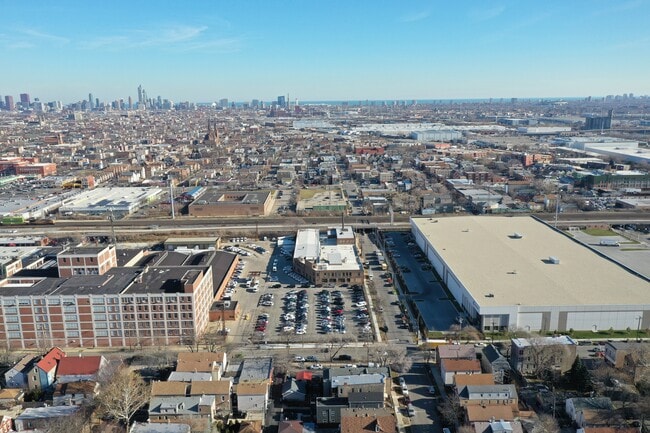
2500 W 24Th St, Chicago, IL 60608

NEARBY LISTINGS FOR SALE OR LEASE
Property Detail
2500 W 24Th St
16-25-208-010-0000
S J Walkers
Industrialgeneral
Cook
X
Illinois
17031C0505J
0.13 AC
2023
South Chicago
2025
Chicago
843200
Chicago-Naperville-Elgin, IL-IN
DEMOGRAPHICS near 2500 W 24Th St
1 Mile
3 Mile
5 Mile
2024 Total Population
31,793
278,984
968,750
2029 Population
29,120
259,480
920,875
Pop Growth 2024-2029
(8.41%)
(6.99%)
(4.94%)
Average Age
36
36
37
2024 Total Households
9,831
100,695
402,292
HH Growth 2024-2029
(9.53%)
(7.02%)
(4.42%)
Median Household Inc
$48,262
$49,805
$71,649
Avg Household Size
2.70
2.60
2.30
2024 Avg HH Vehicles
1.00
1.00
1.00
Median Home Value
$250,055
$289,810
$334,646
Median Year Built
1947
1948
1960
Nearby Places
Map Layers
Map Styles
 Street
 Aerial
- Restaurants
- Banks
- Shops
- Fitness
- Groceries
PUBLIC TRANSPORTATION
TRANSIT/SUBWAY
Western Station (Pink Line) (Pink Line - Chicago Transit Authority "L" Trains (The "L"))
DRIVE
WALK
Distance
Western Station (Pink Line) (Pink Line - Chicago Transit Authority "L" Trains (The "L"))
1 min
10 min
0.6 mi
California Station (Pink Line) (Pink Line - Chicago Transit Authority "L" Trains (The "L"))
DRIVE
WALK
Distance
California Station (Pink Line) (Pink Line - Chicago Transit Authority "L" Trains (The "L"))
2 min
14 min
0.8 mi
Damen Station (Pink Line) (Pink Line - Chicago Transit Authority "L" Trains (The "L"))
DRIVE
WALK
Distance
Damen Station (Pink Line) (Pink Line - Chicago Transit Authority "L" Trains (The "L"))
3 min
18 min
1.0 mi
COMMUTER RAIL
Western Avenue Station (Bnsf) (Burlington Northern-Santa Fe Railway Line - Northeast Illinois Regional Commuter Railroad (Metra))
DRIVE
WALK
Distance
Western Avenue Station (Bnsf) (Burlington Northern-Santa Fe Railway Line - Northeast Illinois Regional Commuter Railroad (Metra))
1 min
18 min
0.8 mi
Halsted Station (Burlington Northern-Santa Fe Railway Line - Northeast Illinois Regional Commuter Railroad (Metra))
DRIVE
WALK
Distance
Halsted Station (Burlington Northern-Santa Fe Railway Line - Northeast Illinois Regional Commuter Railroad (Metra))
6 min
2.9 mi
AIRPORT
Chicago Midway International
DRIVE
WALK
Distance
Chicago Midway International
12 min
6.4 mi
Chicago O'Hare International
DRIVE
WALK
Distance
Chicago O'Hare International
31 min
19.8 mi
Freight Ports
Port Milwaukee
DRIVE
WALK
Distance
Port Milwaukee
109 min
88.0 mi
SALE & LEASE HISTORY
LISTING DATE
SALE/LEASE

Jan 27, 2021
For Lease
Aug 18, 2023
For Sale
Apr 03, 2020
For Sale
Nearby Properties
Address
Land Use
TOTAL SIZE
Lot Size
Zoning
Address
Land Use
TOTAL SIZE
Lot Size
Zoning
1.44 AC
PD 30
Address
Land Use
TOTAL SIZE
Lot Size
Zoning
73,700 SF
0.48 AC
RM-6.5
Address
Land Use
TOTAL SIZE
Lot Size
Zoning
662,088 SF
4.91 AC
PD 504
Address
Land Use
TOTAL SIZE
Lot Size
Zoning
474,979 SF
29.67 AC
PD 553
Address
Land Use
TOTAL SIZE
Lot Size
Zoning
979,674 SF
6.01 AC
PD 924
Address
Land Use
TOTAL SIZE
Lot Size
Zoning
408,203 SF
2.02 AC
DS-5
Address
Land Use
TOTAL SIZE
Lot Size
Zoning
0.85 AC
DS-3
Address
Land Use
TOTAL SIZE
Lot Size
Zoning
3.17 AC
PD 96
Address
Land Use
TOTAL SIZE
Lot Size
Zoning
131,800 SF
0.57 AC
PD 1344
Address
Land Use
TOTAL SIZE
Lot Size
Zoning
3.29 AC
PD 522
Address
Land Use
TOTAL SIZE
Lot Size
Zoning
2.67 AC
PD 522
Address
Land Use
TOTAL SIZE
Lot Size
Zoning
131,800 SF
0.43 AC
PD 1344
Address
Land Use
TOTAL SIZE
Lot Size
Zoning
4.11 AC
M2-3
Address
Land Use
TOTAL SIZE
Lot Size
Zoning
460,333 SF
2.62 AC
C2-3
Address
Land Use
TOTAL SIZE
Lot Size
Zoning
365,137 SF
0.74 AC
PD 1392
Address
Land Use
TOTAL SIZE
Lot Size
Zoning
110,806 SF
0.86 AC
POS-1,PD 9
Address
Land Use
TOTAL SIZE
Lot Size
Zoning
552,300 SF
0.69 AC
PMD 11
Address
Land Use
TOTAL SIZE
Lot Size
Zoning
10,600 SF
0.25 AC
PD 1423
Address
Land Use
TOTAL SIZE
Lot Size
Zoning
176,800 SF
0.61 AC
DX-7
Address
Land Use
TOTAL SIZE
Lot Size
Zoning
4.85 AC
PD 1505
Address
Land Use
TOTAL SIZE
Lot Size
Zoning
Address
Land Use
TOTAL SIZE
Lot Size
Zoning
27.31 AC
PD 1424
Address
Land Use
TOTAL SIZE
Lot Size
Zoning
333,340 SF
Address
Land Use
TOTAL SIZE
Lot Size
Zoning
154,000 SF
0.66 AC
PD 1500
Address
Land Use
TOTAL SIZE
Lot Size
Zoning
121,250 SF
0.84 AC
PD 30
Address
Land Use
TOTAL SIZE
Lot Size
Zoning
0.41 AC
DR-3
Address
Land Use
TOTAL SIZE
Lot Size
Zoning
800 SF
0.20 AC
PD 1423
Address
Land Use
TOTAL SIZE
Lot Size
Zoning
133,354 SF
PD 1198
Address
Land Use
TOTAL SIZE
Lot Size
Zoning
225,784 SF
0.69 AC
DS-3
Address
Land Use
TOTAL SIZE
Lot Size
Zoning
169,435 SF
11.35 AC
PD 307
The World's #1 Commercial Real Estate Marketplace
Connect with us
© 2026 CoStar Group
The information above has been obtained from sources believed reliable. While we do not doubt its accuracy we have not verified it and make no guarantee, warranty or representation about it. It is your responsibility to independently confirm its accuracy and completeness. Any projections, opinions, assumptions, or estimates used are for example only and do not represent the current or future performance of the property. The value of this transaction to you depends on tax and other factors which should be evaluated by your tax, financial, and legal advisors. You and your advisors should conduct a careful, independent investigation of the property to determine to your satisfaction the suitability of the property for your needs.