Property Record
2525 Clay Bank Rd, Fairfield, CA 94533


Save to a Folder
{{folder.Name}}
{{folder.ListingIds.length}} Properties
{{folder.ListingIds.length}} Property
Create a New Folder
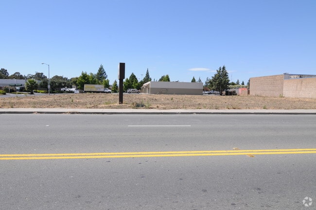
Property Detail
2525 Clay Bank Rd
Vallejo, CA
BK-BG 32-27 LOT 2
0168-320-170
Solano
Commercialnec
California
C and X Area of minimal flood hazard, usually depicted on FIRMs as above the 500-year flood level.
2
2024
1.34 AC
2025
Fairfield
252316
North Bay/Santa Rosa
15,527 SF
NEARBY LISTINGS FOR SALE OR LEASE
DEMOGRAPHICS near 2525 Clay Bank Rd
1 mile
3 mile
5 mile
2025 Total Population
19,841
105,407
159,518
2030 Population
20,085
106,523
161,395
Pop Growth 2025-2030
+ 1.23%
+ 1.06%
+ 1.18%
Average Age
39
39
39
2025 Total Households
6,351
34,175
50,660
HH Growth 2025-2030
+ 1.17%
+ 1.01%
+ 1.22%
Median Household Inc
$91,542
$96,504
$98,323
Avg Household Size
3.00
3.00
2.90
2025 Avg HH Vehicles
2.00
2.00
2.00
Median Home Value
$574,888
$642,459
$663,311
Median Year Built
1980
1982
1983
Nearby Places
Map Layers
Map Styles
 Street
 Aerial
Layers
 Traffic
 Biking
Places
Listings with unknown addresses are not visible on the map
- Restaurants
- Banks
- Shops
- Fitness
- Groceries
PUBLIC TRANSPORTATION
COMMUTER RAIL
Fairfield-Vacaville Amtrak Station (Capitol Corridor - Amtrak)
Drive
Walk
Distance
Fairfield-Vacaville Amtrak Station (Capitol Corridor - Amtrak)
6 min
3.4 mi
Suisun-Fairfield (Capitol Corridor - Capitol Corridor Joint Powers Authority)
Drive
Walk
Distance
Suisun-Fairfield (Capitol Corridor - Capitol Corridor Joint Powers Authority)
8 min
4.0 mi
Freight Ports
Port of Richmond
Drive
Walk
Distance
Port of Richmond
52 min
39.1 mi
Nearby Properties
Address
Land Use
TOTAL SIZE
Lot Size
Zoning
Address
Land Use
TOTAL SIZE
Lot Size
Zoning
Address
Land Use
TOTAL SIZE
Lot Size
Zoning
317,493 SF
21.54 AC
Address
Land Use
TOTAL SIZE
Lot Size
Zoning
999,999 SF
55.81 AC
LTD IND
Address
Land Use
TOTAL SIZE
Lot Size
Zoning
67.79 AC
Address
Land Use
TOTAL SIZE
Lot Size
Zoning
143,531 SF
13.45 AC
Address
Land Use
TOTAL SIZE
Lot Size
Zoning
172,856 SF
10.11 AC
Address
Land Use
TOTAL SIZE
Lot Size
Zoning
184,572 SF
10.95 AC
Address
Land Use
TOTAL SIZE
Lot Size
Zoning
Address
Land Use
TOTAL SIZE
Lot Size
Zoning
144,972 SF
18.47 AC
Address
Land Use
TOTAL SIZE
Lot Size
Zoning
300,897 SF
14.63 AC
Address
Land Use
TOTAL SIZE
Lot Size
Zoning
140,853 SF
25.35 AC
Address
Land Use
TOTAL SIZE
Lot Size
Zoning
8.80 AC
Address
Land Use
TOTAL SIZE
Lot Size
Zoning
260,356 SF
25.40 AC
Address
Land Use
TOTAL SIZE
Lot Size
Zoning
177,945 SF
18.31 AC
Address
Land Use
TOTAL SIZE
Lot Size
Zoning
90,416 SF
6.03 AC
MULTIRE
Address
Land Use
TOTAL SIZE
Lot Size
Zoning
113,320 SF
6.63 AC
Address
Land Use
TOTAL SIZE
Lot Size
Zoning
151,537 SF
8.66 AC
Address
Land Use
TOTAL SIZE
Lot Size
Zoning
144,466 SF
8.07 AC
MULTI-RES
Address
Land Use
TOTAL SIZE
Lot Size
Zoning
76,195 SF
8.43 AC
Address
Land Use
TOTAL SIZE
Lot Size
Zoning
72,718 SF
4.58 AC
Address
Land Use
TOTAL SIZE
Lot Size
Zoning
285,080 SF
15.35 AC
Address
Land Use
TOTAL SIZE
Lot Size
Zoning
185,292 SF
10.18 AC
Address
Land Use
TOTAL SIZE
Lot Size
Zoning
102,528 SF
4.87 AC
Address
Land Use
TOTAL SIZE
Lot Size
Zoning
53,960 SF
8.22 AC
Address
Land Use
TOTAL SIZE
Lot Size
Zoning
111,717 SF
11.05 AC
COMML
Address
Land Use
TOTAL SIZE
Lot Size
Zoning
44,950 SF
12.88 AC
MG 1/2
Address
Land Use
TOTAL SIZE
Lot Size
Zoning
185,266 SF
11.83 AC
Address
Land Use
TOTAL SIZE
Lot Size
Zoning
167,051 SF
11.97 AC
Address
Land Use
TOTAL SIZE
Lot Size
Zoning
64,863 SF
2.08 AC
COMML/MOT
Address
Land Use
TOTAL SIZE
Lot Size
Zoning
159,990 SF
11.93 AC
The World's #1 Commercial Real Estate Marketplace
Connect with us
© 2026 CoStar Group
The information above has been obtained from sources believed reliable. While we do not doubt its accuracy we have not verified it and make no guarantee, warranty or representation about it. It is your responsibility to independently confirm its accuracy and completeness. Any projections, opinions, assumptions, or estimates used are for example only and do not represent the current or future performance of the property. The value of this transaction to you depends on tax and other factors which should be evaluated by your tax, financial, and legal advisors. You and your advisors should conduct a careful, independent investigation of the property to determine to your satisfaction the suitability of the property for your needs.