Property Record
2525 Milford Square Pike, Quakertown, PA 18951


NEARBY LISTINGS FOR SALE OR LEASE
Property Detail
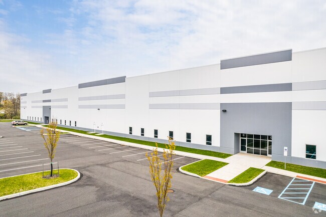
2525 Milford Square Pike
Philadelphia
2525 Milford Square Pike
Philadelphia-Camden-Wilmington, PA-NJ-DE-MD
19.577A LOT S S SR663 465 FT W T354
23-015-118
Bucks
Warehouse
Pennsylvania
2024
s
2025
19.58 AC
106402
Bucks
125,000 SF
DEMOGRAPHICS near 2525 Milford Square Pike
1 Mile
3 Mile
5 Mile
2024 Total Population
4,222
27,595
43,232
2029 Population
4,203
27,381
42,971
Pop Growth 2024-2029
(0.45%)
(0.78%)
(0.60%)
Average Age
42
42
43
2024 Total Households
1,599
10,557
16,359
HH Growth 2024-2029
(0.50%)
(0.92%)
(0.73%)
Median Household Inc
$95,077
$82,709
$88,645
Avg Household Size
2.60
2.50
2.60
2024 Avg HH Vehicles
2.00
2.00
2.00
Median Home Value
$308,772
$280,584
$317,875
Median Year Built
1982
1979
1979
Nearby Places
Map Layers
Map Styles
 Street
 Aerial
- Restaurants
- Banks
- Shops
- Fitness
- Groceries
PUBLIC TRANSPORTATION
AIRPORT
Lehigh Valley International
DRIVE
WALK
Distance
Lehigh Valley International
35 min
19.4 mi
Freight Ports
Port of Philadelphia
DRIVE
WALK
Distance
Port of Philadelphia
64 min
39.7 mi
SALE & LEASE HISTORY
LISTING DATE
SALE/LEASE

Jul 09, 2023
For Lease
Apr 12, 2019
For Lease
Nearby Properties
Address
Land Use
TOTAL SIZE
Lot Size
Zoning
Address
Land Use
TOTAL SIZE
Lot Size
Zoning
935,540 SF
76.84 AC
RA
Address
Land Use
TOTAL SIZE
Lot Size
Zoning
276,132 SF
61.72 AC
PC
Address
Land Use
TOTAL SIZE
Lot Size
Zoning
51,884 SF
40.42 AC
EXT
Address
Land Use
TOTAL SIZE
Lot Size
Zoning
203,923 SF
34.17 AC
HC
Address
Land Use
TOTAL SIZE
Lot Size
Zoning
157,360 SF
17.34 AC
SRC
Address
Land Use
TOTAL SIZE
Lot Size
Zoning
145,197 SF
17.11 AC
PC
Address
Land Use
TOTAL SIZE
Lot Size
Zoning
248,895 SF
18.33 AC
I
Address
Land Use
TOTAL SIZE
Lot Size
Zoning
264,600 SF
33.38 AC
PI
Address
Land Use
TOTAL SIZE
Lot Size
Zoning
127,968 SF
15.38 AC
PC
Address
Land Use
TOTAL SIZE
Lot Size
Zoning
14,450 SF
7.16 AC
R4
Address
Land Use
TOTAL SIZE
Lot Size
Zoning
86,827 SF
11.84 AC
PC
Address
Land Use
TOTAL SIZE
Lot Size
Zoning
362,576 SF
25.24 AC
PI
Address
Land Use
TOTAL SIZE
Lot Size
Zoning
1 SF
15.66 AC
PC
Address
Land Use
TOTAL SIZE
Lot Size
Zoning
215,368 SF
24.49 AC
SRM
Address
Land Use
TOTAL SIZE
Lot Size
Zoning
208,937 SF
20.07 AC
PC
Address
Land Use
TOTAL SIZE
Lot Size
Zoning
145,800 SF
11.66 AC
P1
Address
Land Use
TOTAL SIZE
Lot Size
Zoning
67,443 SF
1.97 AC
NC
Address
Land Use
TOTAL SIZE
Lot Size
Zoning
58,391 SF
9.45 AC
PC
Address
Land Use
TOTAL SIZE
Lot Size
Zoning
7.98 AC
PI
Address
Land Use
TOTAL SIZE
Lot Size
Zoning
186,547 SF
18.74 AC
PI
Address
Land Use
TOTAL SIZE
Lot Size
Zoning
1,200 SF
17.50 AC
PI
Address
Land Use
TOTAL SIZE
Lot Size
Zoning
114,400 SF
9.96 AC
P1
Address
Land Use
TOTAL SIZE
Lot Size
Zoning
117,432 SF
11.92 AC
PI
Address
Land Use
TOTAL SIZE
Lot Size
Zoning
36,450 SF
3.09 AC
HC
Address
Land Use
TOTAL SIZE
Lot Size
Zoning
12,734 SF
4.68 AC
HC
Address
Land Use
TOTAL SIZE
Lot Size
Zoning
34,206 SF
11.49 AC
PC
Address
Land Use
TOTAL SIZE
Lot Size
Zoning
48,457 SF
2.73 AC
PC
Address
Land Use
TOTAL SIZE
Lot Size
Zoning
22,950 SF
1.97 AC
HR
Address
Land Use
TOTAL SIZE
Lot Size
Zoning
53,124 SF
3.37 AC
PC
The World's #1 Commercial Real Estate Marketplace
Connect with us
© 2026 CoStar Group
The information above has been obtained from sources believed reliable. While we do not doubt its accuracy we have not verified it and make no guarantee, warranty or representation about it. It is your responsibility to independently confirm its accuracy and completeness. Any projections, opinions, assumptions, or estimates used are for example only and do not represent the current or future performance of the property. The value of this transaction to you depends on tax and other factors which should be evaluated by your tax, financial, and legal advisors. You and your advisors should conduct a careful, independent investigation of the property to determine to your satisfaction the suitability of the property for your needs.