Property Record
2540 N 29Th Ave, Phoenix, AZ 85009
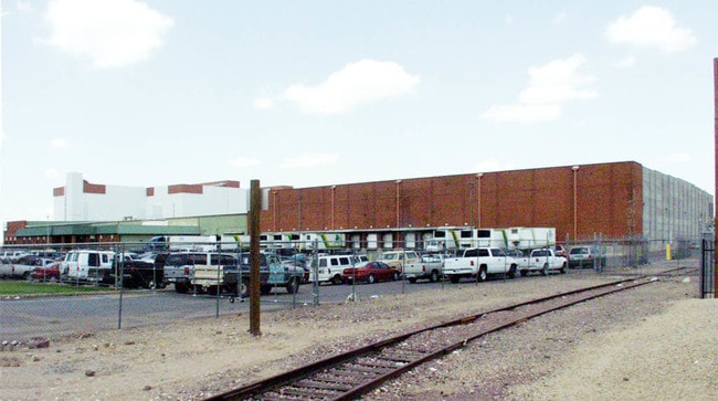


Property Detail
2540 N 29Th Ave
108-08-017E
SHAMROCK CENTER MCR 428-12
Industrialgeneral
Maricopa
A-1
Arizona
C and X Area of minimal flood hazard, usually depicted on FIRMs as above the 500-year flood level.
1
2025
27.08 AC
2025
W Phx S of Thomas Rd
112100
Phoenix
449,802 SF
Phoenix-Mesa-Chandler, AZ
NEARBY LISTINGS FOR SALE OR LEASE
DEMOGRAPHICS near 2540 N 29Th Ave
1 mile
3 mile
5 mile
2025 Total Population
10,386
172,162
426,099
2030 Population
10,667
178,215
441,990
Pop Growth 2025-2030
+ 2.71%
+ 3.52%
+ 3.73%
Average Age
35
34
35
2025 Total Households
3,041
56,105
148,276
HH Growth 2025-2030
+ 2.76%
+ 3.92%
+ 4.16%
Median Household Inc
$58,290
$57,321
$59,210
Avg Household Size
3.20
2.80
2.70
2025 Avg HH Vehicles
2.00
2.00
2.00
Median Home Value
$308,139
$325,986
$351,638
Median Year Built
1966
1968
1971
Nearby Places
Map Layers
Map Styles
 Street
 Aerial
Layers
 Traffic
 Biking
Places
Listings with unknown addresses are not visible on the map
- Restaurants
- Banks
- Shops
- Fitness
- Groceries
PUBLIC TRANSPORTATION
AIRPORT
Phoenix Sky Harbor International
Drive
Walk
Distance
Phoenix Sky Harbor International
18 min
9.8 mi
Phoenix-Mesa Gateway
Drive
Walk
Distance
Phoenix-Mesa Gateway
50 min
36.3 mi
Freight Ports
Port of San Diego
Drive
Walk
Distance
Port of San Diego
394 min
353.3 mi
Nearby Properties
Address
Land Use
TOTAL SIZE
Lot Size
Zoning
Address
Land Use
TOTAL SIZE
Lot Size
Zoning
1.85 AC
Address
Land Use
TOTAL SIZE
Lot Size
Zoning
270,000 SF
12.90 AC
I-1
Address
Land Use
TOTAL SIZE
Lot Size
Zoning
437,102 SF
1.02 AC
C-2
Address
Land Use
TOTAL SIZE
Lot Size
Zoning
2,334,671 SF
32.63 AC
C-2
Address
Land Use
TOTAL SIZE
Lot Size
Zoning
191,120 SF
1.43 AC
C-C
Address
Land Use
TOTAL SIZE
Lot Size
Zoning
96,183 SF
11.04 AC
R-6
Address
Land Use
TOTAL SIZE
Lot Size
Zoning
91,000 SF
7.57 AC
I-1
Address
Land Use
TOTAL SIZE
Lot Size
Zoning
686,094 SF
5.09 AC
C-C
Address
Land Use
TOTAL SIZE
Lot Size
Zoning
610,451 SF
4.21 AC
C-C
Address
Land Use
TOTAL SIZE
Lot Size
Zoning
69,542 SF
4.92 AC
I-P
Address
Land Use
TOTAL SIZE
Lot Size
Zoning
455,023 SF
1.95 AC
C-C
Address
Land Use
TOTAL SIZE
Lot Size
Zoning
860,020 SF
5.89 AC
C2
Address
Land Use
TOTAL SIZE
Lot Size
Zoning
377,037 SF
35.46 AC
R1-6
Address
Land Use
TOTAL SIZE
Lot Size
Zoning
956,022 SF
14.86 AC
Address
Land Use
TOTAL SIZE
Lot Size
Zoning
547,141 SF
18.52 AC
R-6
Address
Land Use
TOTAL SIZE
Lot Size
Zoning
184,363 SF
1.24 AC
WU
Address
Land Use
TOTAL SIZE
Lot Size
Zoning
416,837 SF
5.35 AC
C-2
Address
Land Use
TOTAL SIZE
Lot Size
Zoning
42,631 SF
2.90 AC
A-2
Address
Land Use
TOTAL SIZE
Lot Size
Zoning
329,830 SF
12.18 AC
Address
Land Use
TOTAL SIZE
Lot Size
Zoning
32,600 SF
2.38 AC
R-5
Address
Land Use
TOTAL SIZE
Lot Size
Zoning
337,487 SF
39 AC
R-6
Address
Land Use
TOTAL SIZE
Lot Size
Zoning
335,897 SF
2.07 AC
R-5
Address
Land Use
TOTAL SIZE
Lot Size
Zoning
550,683 SF
1.98 AC
C-C
Address
Land Use
TOTAL SIZE
Lot Size
Zoning
250,448 SF
3.59 AC
C-3
Address
Land Use
TOTAL SIZE
Lot Size
Zoning
14.16 AC
Address
Land Use
TOTAL SIZE
Lot Size
Zoning
560,729 SF
5.57 AC
DTCGTWY
Address
Land Use
TOTAL SIZE
Lot Size
Zoning
378,071 SF
1.52 AC
C-C
Address
Land Use
TOTAL SIZE
Lot Size
Zoning
250,878 SF
10.87 AC
C-2
Address
Land Use
TOTAL SIZE
Lot Size
Zoning
464,812 SF
35.43 AC
R16
The World's #1 Commercial Real Estate Marketplace
Connect with us
© 2026 CoStar Group
The information above has been obtained from sources believed reliable. While we do not doubt its accuracy we have not verified it and make no guarantee, warranty or representation about it. It is your responsibility to independently confirm its accuracy and completeness. Any projections, opinions, assumptions, or estimates used are for example only and do not represent the current or future performance of the property. The value of this transaction to you depends on tax and other factors which should be evaluated by your tax, financial, and legal advisors. You and your advisors should conduct a careful, independent investigation of the property to determine to your satisfaction the suitability of the property for your needs.