Property Record
2540 N 35Th Ave, Phoenix, AZ 85009


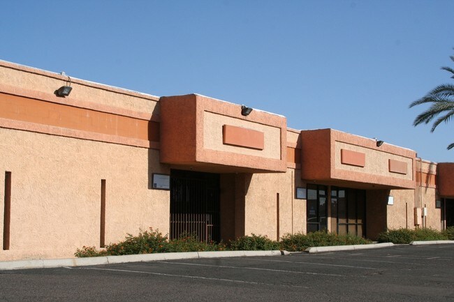
Property Detail
2540 N 35Th Ave
108-11-050
THOMAS INDUSTRIAL PARK LTD MCR 235-31
Warehouse
Maricopa
I-P
Arizona
C and X Area of minimal flood hazard, usually depicted on FIRMs as above the 500-year flood level.
d
2025
4.92 AC
2025
W Phx S of Thomas Rd
112201
Phoenix
69,542 SF
Phoenix-Mesa-Chandler, AZ
NEARBY LISTINGS FOR SALE OR LEASE
DEMOGRAPHICS near 2540 N 35Th Ave
1 mile
3 mile
5 mile
2025 Total Population
21,376
168,300
442,625
2030 Population
21,857
173,358
458,207
Pop Growth 2025-2030
+ 2.25%
+ 3.01%
+ 3.52%
Average Age
35
33
34
2025 Total Households
6,008
48,097
147,422
HH Growth 2025-2030
+ 2.28%
+ 3.24%
+ 3.97%
Median Household Inc
$55,597
$55,432
$58,473
Avg Household Size
3.30
3.20
2.80
2025 Avg HH Vehicles
2.00
2.00
2.00
Median Home Value
$269,334
$287,195
$332,248
Median Year Built
1964
1969
1972
Nearby Places
Map Layers
Map Styles
 Street
 Aerial
Layers
 Traffic
 Biking
Places
Listings with unknown addresses are not visible on the map
- Restaurants
- Banks
- Shops
- Fitness
- Groceries
PUBLIC TRANSPORTATION
AIRPORT
Phoenix Sky Harbor International
Drive
Walk
Distance
Phoenix Sky Harbor International
18 min
10.8 mi
Phoenix-Mesa Gateway
Drive
Walk
Distance
Phoenix-Mesa Gateway
50 min
37.6 mi
Freight Ports
Port of San Diego
Drive
Walk
Distance
Port of San Diego
392 min
352.2 mi
Nearby Properties
Address
Land Use
TOTAL SIZE
Lot Size
Zoning
Address
Land Use
TOTAL SIZE
Lot Size
Zoning
270,000 SF
12.90 AC
I-1
Address
Land Use
TOTAL SIZE
Lot Size
Zoning
91,000 SF
7.57 AC
I-1
Address
Land Use
TOTAL SIZE
Lot Size
Zoning
377,037 SF
35.46 AC
R1-6
Address
Land Use
TOTAL SIZE
Lot Size
Zoning
956,022 SF
14.86 AC
Address
Land Use
TOTAL SIZE
Lot Size
Zoning
547,141 SF
18.52 AC
R-6
Address
Land Use
TOTAL SIZE
Lot Size
Zoning
42,631 SF
2.90 AC
A-2
Address
Land Use
TOTAL SIZE
Lot Size
Zoning
281,038 SF
7.71 AC
Address
Land Use
TOTAL SIZE
Lot Size
Zoning
32,600 SF
2.38 AC
R-5
Address
Land Use
TOTAL SIZE
Lot Size
Zoning
337,487 SF
39 AC
R-6
Address
Land Use
TOTAL SIZE
Lot Size
Zoning
335,897 SF
2.07 AC
R-5
Address
Land Use
TOTAL SIZE
Lot Size
Zoning
14.16 AC
Address
Land Use
TOTAL SIZE
Lot Size
Zoning
449,802 SF
27.08 AC
A-1
Address
Land Use
TOTAL SIZE
Lot Size
Zoning
464,812 SF
35.43 AC
R16
Address
Land Use
TOTAL SIZE
Lot Size
Zoning
316,386 SF
45.04 AC
R16
Address
Land Use
TOTAL SIZE
Lot Size
Zoning
25.91 AC
A1
Address
Land Use
TOTAL SIZE
Lot Size
Zoning
350,874 SF
28.66 AC
C-C
Address
Land Use
TOTAL SIZE
Lot Size
Zoning
554,011 SF
26.10 AC
I-P
Address
Land Use
TOTAL SIZE
Lot Size
Zoning
211,015 SF
9.59 AC
R-6
Address
Land Use
TOTAL SIZE
Lot Size
Zoning
532,713 SF
27.31 AC
Address
Land Use
TOTAL SIZE
Lot Size
Zoning
100,000 SF
77.44 AC
R1-6
Address
Land Use
TOTAL SIZE
Lot Size
Zoning
200,538 SF
2.09 AC
R-5
Address
Land Use
TOTAL SIZE
Lot Size
Zoning
874,407 SF
38.57 AC
I-P
Address
Land Use
TOTAL SIZE
Lot Size
Zoning
18,522 SF
1.69 AC
R-6
Address
Land Use
TOTAL SIZE
Lot Size
Zoning
503,510 SF
27.80 AC
I-1
Address
Land Use
TOTAL SIZE
Lot Size
Zoning
208,563 SF
9.78 AC
R-6
Address
Land Use
TOTAL SIZE
Lot Size
Zoning
454,368 SF
23.36 AC
I-1
Address
Land Use
TOTAL SIZE
Lot Size
Zoning
250,180 SF
16.16 AC
C-C
Address
Land Use
TOTAL SIZE
Lot Size
Zoning
74,208 SF
7.25 AC
I-P
Address
Land Use
TOTAL SIZE
Lot Size
Zoning
351,054 SF
1.73 AC
C-C
The World's #1 Commercial Real Estate Marketplace
Connect with us
© 2026 CoStar Group
The information above has been obtained from sources believed reliable. While we do not doubt its accuracy we have not verified it and make no guarantee, warranty or representation about it. It is your responsibility to independently confirm its accuracy and completeness. Any projections, opinions, assumptions, or estimates used are for example only and do not represent the current or future performance of the property. The value of this transaction to you depends on tax and other factors which should be evaluated by your tax, financial, and legal advisors. You and your advisors should conduct a careful, independent investigation of the property to determine to your satisfaction the suitability of the property for your needs.