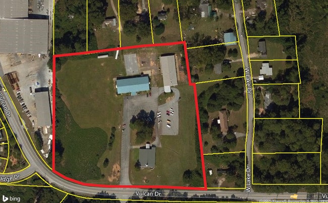
Property Record
2548 Vulcan Dr, Lithia Springs, GA 30122

NEARBY LISTINGS FOR SALE OR LEASE
Property Detail
2548 Vulcan Dr
7182-06-2-0-018
Pine Valley
Commercialnec
CHURCH/ SCHOOL/5.262 ACRES, TR..1, VULCAN DR
X
Douglas
13097C0068D
Georgia
2024
5.26 AC
2024
Douglasville/Lithia Springs
080204
Atlanta
21,512 SF
Atlanta-Sandy Springs-Roswell, GA
DEMOGRAPHICS near 2548 Vulcan Dr
1 Mile
3 Mile
5 Mile
2024 Total Population
4,240
35,117
98,241
2029 Population
4,494
36,894
102,347
Pop Growth 2024-2029
+ 5.99%
+ 5.06%
+ 4.18%
Average Age
37
37
37
2024 Total Households
1,693
13,480
35,619
HH Growth 2024-2029
+ 6.02%
+ 5.03%
+ 4.22%
Median Household Inc
$56,293
$53,344
$62,425
Avg Household Size
2.50
2.60
2.70
2024 Avg HH Vehicles
2.00
2.00
2.00
Median Home Value
$144,677
$174,732
$202,550
Median Year Built
1999
1990
1990
Nearby Places
Map Layers
Map Styles
 Street
 Aerial
- Restaurants
- Banks
- Shops
- Fitness
- Groceries
PUBLIC TRANSPORTATION
AIRPORT
Hartsfield - Jackson Atlanta International
DRIVE
WALK
Distance
Hartsfield - Jackson Atlanta International
35 min
24.9 mi
Freight Ports
Georgia Ports - Savannah
DRIVE
WALK
Distance
Georgia Ports - Savannah
298 min
264.2 mi
SALE & LEASE HISTORY
LISTING DATE
SALE/LEASE

Dec 27, 2016
For Sale
Nearby Properties
Address
Land Use
TOTAL SIZE
Lot Size
Zoning
Address
Land Use
TOTAL SIZE
Lot Size
Zoning
840,110 SF
53.36 AC
PUD
Address
Land Use
TOTAL SIZE
Lot Size
Zoning
320,073 SF
38.78 AC
R-MF
Address
Land Use
TOTAL SIZE
Lot Size
Zoning
417,860 SF
40.32 AC
LI
Address
Land Use
TOTAL SIZE
Lot Size
Zoning
330,754 SF
27.25 AC
R-6
Address
Land Use
TOTAL SIZE
Lot Size
Zoning
318,456 SF
30.91 AC
R-MF
Address
Land Use
TOTAL SIZE
Lot Size
Zoning
222,846 SF
50.74 AC
R-6
Address
Land Use
TOTAL SIZE
Lot Size
Zoning
285,933 SF
46.22 AC
R-MF
Address
Land Use
TOTAL SIZE
Lot Size
Zoning
494,858 SF
43.29 AC
IL
Address
Land Use
TOTAL SIZE
Lot Size
Zoning
281,844 SF
38.66 AC
R-MF
Address
Land Use
TOTAL SIZE
Lot Size
Zoning
603,952 SF
37.71 AC
IL
Address
Land Use
TOTAL SIZE
Lot Size
Zoning
245,812 SF
30.90 AC
DCD
Address
Land Use
TOTAL SIZE
Lot Size
Zoning
527,000 SF
30.38 AC
LI
Address
Land Use
TOTAL SIZE
Lot Size
Zoning
240,612 SF
23.22 AC
R-6
Address
Land Use
TOTAL SIZE
Lot Size
Zoning
635,664 SF
35.94 AC
5
Address
Land Use
TOTAL SIZE
Lot Size
Zoning
400,000 SF
66.21 AC
IL
Address
Land Use
TOTAL SIZE
Lot Size
Zoning
380,000 SF
33.97 AC
IL
Address
Land Use
TOTAL SIZE
Lot Size
Zoning
312,093 SF
19.79 AC
PUD
Address
Land Use
TOTAL SIZE
Lot Size
Zoning
312,240 SF
24.58 AC
PUD
Address
Land Use
TOTAL SIZE
Lot Size
Zoning
261,794 SF
2.32 AC
DCD
Address
Land Use
TOTAL SIZE
Lot Size
Zoning
225,600 SF
50.68 AC
LI-R
Address
Land Use
TOTAL SIZE
Lot Size
Zoning
122,697 SF
13.02 AC
PUD
Address
Land Use
TOTAL SIZE
Lot Size
Zoning
284,307 SF
15.75 AC
LI-R
Address
Land Use
TOTAL SIZE
Lot Size
Zoning
296,942 SF
72.27 AC
IL
Address
Land Use
TOTAL SIZE
Lot Size
Zoning
247,000 SF
17.77 AC
PUD
Address
Land Use
TOTAL SIZE
Lot Size
Zoning
266,904 SF
53.52 AC
DCD
Address
Land Use
TOTAL SIZE
Lot Size
Zoning
261,100 SF
18.52 AC
PUD
Address
Land Use
TOTAL SIZE
Lot Size
Zoning
222,414 SF
11.51 AC
PUD
Address
Land Use
TOTAL SIZE
Lot Size
Zoning
202,400 SF
12.70 AC
LI
Address
Land Use
TOTAL SIZE
Lot Size
Zoning
183,750 SF
10.39 AC
PUD
Address
Land Use
TOTAL SIZE
Lot Size
Zoning
182,092 SF
9.70 AC
IL
The World's #1 Commercial Real Estate Marketplace
Connect with us
© 2026 CoStar Group
The information above has been obtained from sources believed reliable. While we do not doubt its accuracy we have not verified it and make no guarantee, warranty or representation about it. It is your responsibility to independently confirm its accuracy and completeness. Any projections, opinions, assumptions, or estimates used are for example only and do not represent the current or future performance of the property. The value of this transaction to you depends on tax and other factors which should be evaluated by your tax, financial, and legal advisors. You and your advisors should conduct a careful, independent investigation of the property to determine to your satisfaction the suitability of the property for your needs.