Property Record
255 Moffat Blvd, Manteca, CA 95336


NEARBY LISTINGS FOR SALE OR LEASE
Property Detail
255 Moffat Blvd
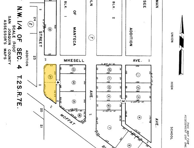
221-060-21
Mikesell Add #2
Autorepair
TWP 02S RGE 07E SEC 04 QTR NW4
X
San Joaquin
06077C0640F
California
2025
0.30 AC
2025
Tracy/Manteca
005109
Stockton/Modesto
2,880 SF
Stockton-Lodi, CA
DEMOGRAPHICS near 255 Moffat Blvd
1 Mile
3 Mile
5 Mile
2024 Total Population
17,961
89,263
114,452
2029 Population
18,942
94,493
120,970
Pop Growth 2024-2029
+ 5.46%
+ 5.86%
+ 5.69%
Average Age
37
38
38
2024 Total Households
5,824
28,349
35,742
HH Growth 2024-2029
+ 5.49%
+ 5.88%
+ 5.74%
Median Household Inc
$67,851
$88,592
$90,549
Avg Household Size
3.00
3.10
3.10
2024 Avg HH Vehicles
2.00
2.00
2.00
Median Home Value
$398,618
$480,109
$481,365
Median Year Built
1969
1991
1993
Nearby Places
Map Layers
Map Styles
 Street
 Aerial
- Restaurants
- Banks
- Shops
- Fitness
- Groceries
PUBLIC TRANSPORTATION
COMMUTER RAIL
Lathrop/Manteca (Altamont Corridor Express - Altamont Commuter Express (ACE))
DRIVE
WALK
Distance
Lathrop/Manteca (Altamont Corridor Express - Altamont Commuter Express (ACE))
9 min
3.2 mi
AIRPORT
Stockton Metro
DRIVE
WALK
Distance
Stockton Metro
17 min
8.8 mi
Freight Ports
Port of Stockton
DRIVE
WALK
Distance
Port of Stockton
26 min
17.7 mi
SALE & LEASE HISTORY
LISTING DATE
SALE/LEASE

Sep 23, 2016
For Sale
Nov 02, 2016
For Sale
Apr 04, 2017
For Sale
Nearby Properties
Address
Land Use
TOTAL SIZE
Lot Size
Zoning
Address
Land Use
TOTAL SIZE
Lot Size
Zoning
510,086 SF
28.72 AC
Address
Land Use
TOTAL SIZE
Lot Size
Zoning
832,994 SF
106.05 AC
Address
Land Use
TOTAL SIZE
Lot Size
Zoning
26,118 SF
10.80 AC
Address
Land Use
TOTAL SIZE
Lot Size
Zoning
552,450 SF
27.84 AC
Address
Land Use
TOTAL SIZE
Lot Size
Zoning
565,580 SF
56.99 AC
Address
Land Use
TOTAL SIZE
Lot Size
Zoning
21,924 SF
9.27 AC
Address
Land Use
TOTAL SIZE
Lot Size
Zoning
350,415 SF
17.45 AC
Address
Land Use
TOTAL SIZE
Lot Size
Zoning
8,840 SF
7.51 AC
Address
Land Use
TOTAL SIZE
Lot Size
Zoning
374,976 SF
15.18 AC
Address
Land Use
TOTAL SIZE
Lot Size
Zoning
286,072 SF
19.41 AC
Address
Land Use
TOTAL SIZE
Lot Size
Zoning
106,576 SF
6.85 AC
Address
Land Use
TOTAL SIZE
Lot Size
Zoning
10,000 SF
15.18 AC
Address
Land Use
TOTAL SIZE
Lot Size
Zoning
19,912 SF
6.49 AC
C1
Address
Land Use
TOTAL SIZE
Lot Size
Zoning
608,500 SF
31.59 AC
Address
Land Use
TOTAL SIZE
Lot Size
Zoning
82,329 SF
5.96 AC
Address
Land Use
TOTAL SIZE
Lot Size
Zoning
175,025 SF
9.06 AC
Address
Land Use
TOTAL SIZE
Lot Size
Zoning
7.89 AC
Address
Land Use
TOTAL SIZE
Lot Size
Zoning
17.25 AC
GC
Address
Land Use
TOTAL SIZE
Lot Size
Zoning
10.05 AC
Address
Land Use
TOTAL SIZE
Lot Size
Zoning
406,580 SF
18.65 AC
Address
Land Use
TOTAL SIZE
Lot Size
Zoning
66.42 AC
AU20
Address
Land Use
TOTAL SIZE
Lot Size
Zoning
231,840 SF
11.78 AC
Address
Land Use
TOTAL SIZE
Lot Size
Zoning
161,474 SF
10.03 AC
Address
Land Use
TOTAL SIZE
Lot Size
Zoning
322,560 SF
12.85 AC
Address
Land Use
TOTAL SIZE
Lot Size
Zoning
116,872 SF
8.12 AC
Address
Land Use
TOTAL SIZE
Lot Size
Zoning
6,000 SF
3.96 AC
Address
Land Use
TOTAL SIZE
Lot Size
Zoning
984 SF
43.37 AC
Address
Land Use
TOTAL SIZE
Lot Size
Zoning
16,000 SF
2 AC
Address
Land Use
TOTAL SIZE
Lot Size
Zoning
2.21 AC
Address
Land Use
TOTAL SIZE
Lot Size
Zoning
85,933 SF
3.32 AC
The World's #1 Commercial Real Estate Marketplace
Connect with us
© 2026 CoStar Group
The information above has been obtained from sources believed reliable. While we do not doubt its accuracy we have not verified it and make no guarantee, warranty or representation about it. It is your responsibility to independently confirm its accuracy and completeness. Any projections, opinions, assumptions, or estimates used are for example only and do not represent the current or future performance of the property. The value of this transaction to you depends on tax and other factors which should be evaluated by your tax, financial, and legal advisors. You and your advisors should conduct a careful, independent investigation of the property to determine to your satisfaction the suitability of the property for your needs.