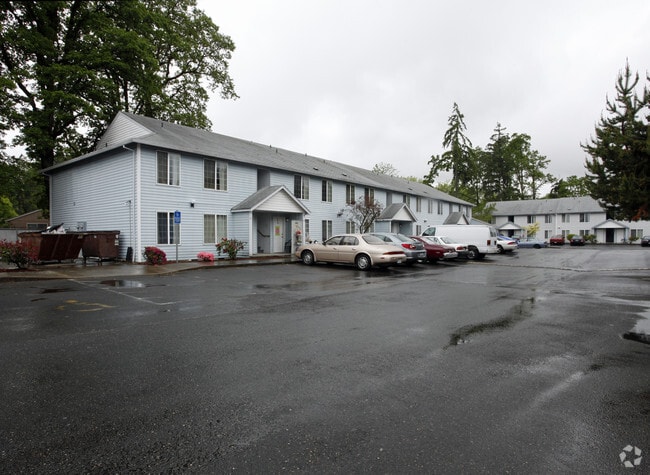
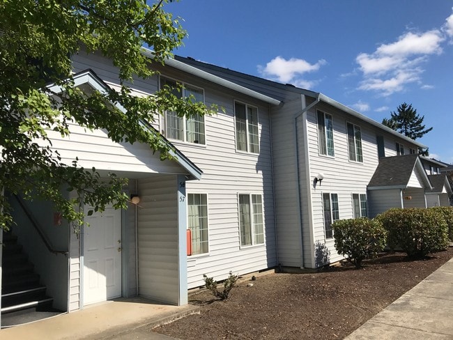
Property Record
2580 Gable Rd, Saint Helens, OR 97051

Save to a Folder
{{folder.Name}}
{{folder.ListingIds.length}} Properties
{{folder.ListingIds.length}} Property
Create a New Folder
Property Detail
2580 Gable Rd
4105-CD-01400
GREENWOOD ACRES LOT - PT TR 15
Multipleuses
COLUMBIA
SH:AR
Oregon
B and X Area of moderate flood hazard, usually the area between the limits of the 100-year and 500-year floods.
3.66 AC
2025
Columbia County
2025
Portland
970800
Portland-Vancouver-Hillsboro, OR-WA
63,982 SF
NEARBY LISTINGS FOR SALE OR LEASE
-
-
View all Saint Helens listings for sale on LoopNet.com
DEMOGRAPHICS near 2580 Gable Rd
1 mile
3 mile
5 mile
2025 Total Population
8,639
20,142
24,787
2030 Population
8,911
20,602
25,305
Pop Growth 2025-2030
+ 3.15%
+ 2.28%
+ 2.09%
Average Age
40
41
42
2025 Total Households
3,216
7,754
9,460
HH Growth 2025-2030
+ 3.30%
+ 2.33%
+ 2.14%
Median Household Inc
$87,386
$86,576
$88,343
Avg Household Size
2.60
2.50
2.60
2025 Avg HH Vehicles
2.00
2.00
2.00
Median Home Value
$426,826
$418,131
$438,464
Median Year Built
1990
1978
1979
Nearby Places
Map Layers
Map Styles
 Street
 Aerial
Layers
 Traffic
 Biking
Places
Listings with unknown addresses are not visible on the map
- Restaurants
- Banks
- Shops
- Fitness
- Groceries
PUBLIC TRANSPORTATION
AIRPORT
Portland International
Drive
Walk
Distance
Portland International
63 min
33.6 mi
Freight Ports
Port of Kalama, WA
Drive
Walk
Distance
Port of Kalama, WA
54 min
34.7 mi
SALE & LEASE HISTORY
LISTING DATE
SALE/LEASE

Sep 12, 2017
For Sale
Sep 12, 2017
For Sale
Nearby Properties
Address
Land Use
TOTAL SIZE
Lot Size
Zoning
Address
Land Use
TOTAL SIZE
Lot Size
Zoning
92,593 SF
7.72 AC
SH:GC
Address
Land Use
TOTAL SIZE
Lot Size
Zoning
52.02 AC
SH:PL
Address
Land Use
TOTAL SIZE
Lot Size
Zoning
89,327 SF
10.39 AC
SH:GC
Address
Land Use
TOTAL SIZE
Lot Size
Zoning
10 SF
10.57 AC
SH:GC
Address
Land Use
TOTAL SIZE
Lot Size
Zoning
4.71 AC
SH:HI
Address
Land Use
TOTAL SIZE
Lot Size
Zoning
18.15 AC
SH:HI
Address
Land Use
TOTAL SIZE
Lot Size
Zoning
38,596 SF
2.55 AC
SH:HC
Address
Land Use
TOTAL SIZE
Lot Size
Zoning
57,763 SF
2.39 AC
SH:R7
Address
Land Use
TOTAL SIZE
Lot Size
Zoning
19.79 AC
SH:HI
Address
Land Use
TOTAL SIZE
Lot Size
Zoning
36.02 AC
SH:HI
Address
Land Use
TOTAL SIZE
Lot Size
Zoning
39,958 SF
145.24 AC
CO:M-1
Address
Land Use
TOTAL SIZE
Lot Size
Zoning
42,120 SF
2.32 AC
SH:HC
Address
Land Use
TOTAL SIZE
Lot Size
Zoning
19.79 AC
Address
Land Use
TOTAL SIZE
Lot Size
Zoning
38.35 AC
CO:CS-I
Address
Land Use
TOTAL SIZE
Lot Size
Zoning
20.83 AC
SH:HI
Address
Land Use
TOTAL SIZE
Lot Size
Zoning
16,618 SF
1.57 AC
SH:HC
Address
Land Use
TOTAL SIZE
Lot Size
Zoning
64,035 SF
5.02 AC
CO:M-2
Address
Land Use
TOTAL SIZE
Lot Size
Zoning
14,199 SF
1.52 AC
SH:HC
Address
Land Use
TOTAL SIZE
Lot Size
Zoning
53,915 SF
2.40 AC
SH:HC
Address
Land Use
TOTAL SIZE
Lot Size
Zoning
22,061 SF
1.82 AC
SH:HC
Address
Land Use
TOTAL SIZE
Lot Size
Zoning
57,576 SF
5.04 AC
SH:LI
Address
Land Use
TOTAL SIZE
Lot Size
Zoning
22,764 SF
2.63 AC
SH:GC
Address
Land Use
TOTAL SIZE
Lot Size
Zoning
10,520 SF
0.93 AC
SH:GC
Address
Land Use
TOTAL SIZE
Lot Size
Zoning
23,805 SF
1.59 AC
SH:HC
Address
Land Use
TOTAL SIZE
Lot Size
Zoning
215,435 SF
15.92 AC
SH:GC
Address
Land Use
TOTAL SIZE
Lot Size
Zoning
12.03 AC
CO:CS-I
Address
Land Use
TOTAL SIZE
Lot Size
Zoning
15,573 SF
2.31 AC
SH:MU
Address
Land Use
TOTAL SIZE
Lot Size
Zoning
20,098 SF
1.37 AC
SH:AR
The World's #1 Commercial Real Estate Marketplace
Connect with us
© 2026 CoStar Group
The information above has been obtained from sources believed reliable. While we do not doubt its accuracy we have not verified it and make no guarantee, warranty or representation about it. It is your responsibility to independently confirm its accuracy and completeness. Any projections, opinions, assumptions, or estimates used are for example only and do not represent the current or future performance of the property. The value of this transaction to you depends on tax and other factors which should be evaluated by your tax, financial, and legal advisors. You and your advisors should conduct a careful, independent investigation of the property to determine to your satisfaction the suitability of the property for your needs.