Property Record
2600 S Abilene St W, Aurora, CO 80014
NEARBY LISTINGS FOR SALE OR LEASE
Property Detail
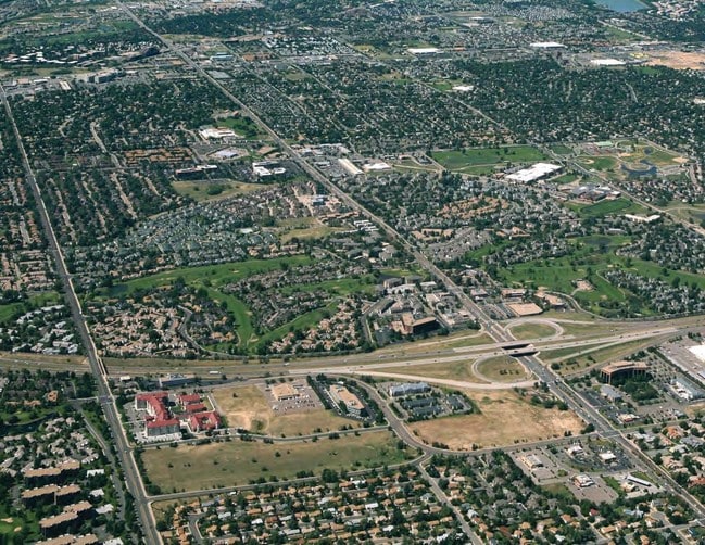
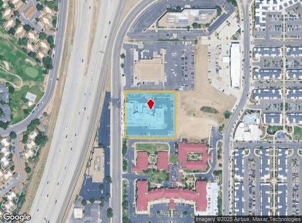
2600 S Abilene St W
Denver-Aurora-Lakewood, CO
Southeast Crossing Subdivision Filing No
1975-30-3-14-002
SUBDIVISIONCD 057752 SUBDIVISIONNAME SOUTHEAST CROSSING SUB 2ND FLG BLOCK 001 LOT 001 LOT 1 BLK 1 SOUTHEAST CROSSING SUB 2ND FLG EX ROAD
Hotel
Arapahoe
X
Colorado
08005C0187K
001
2024
2.06 AC
2024
Aurora
081400
Denver
82,092 SF
DEMOGRAPHICS near 2600 S Abilene St W
1 Mile
3 Mile
5 Mile
2024 Total Population
18,901
168,441
420,093
2029 Population
18,980
168,918
422,117
Pop Growth 2024-2029
+ 0.42%
+ 0.28%
+ 0.48%
Average Age
48
39
39
2024 Total Households
9,318
67,471
167,819
HH Growth 2024-2029
+ 0.42%
+ 0.31%
+ 0.55%
Median Household Inc
$58,722
$68,028
$71,555
Avg Household Size
1.90
2.40
2.40
2024 Avg HH Vehicles
2.00
2.00
2.00
Median Home Value
$350,791
$381,120
$415,474
Median Year Built
1979
1980
1983
Nearby Places
Map Layers
Map Styles
 Street
 Aerial
- Restaurants
- Banks
- Shops
- Fitness
- Groceries
PUBLIC TRANSPORTATION
TRANSIT/SUBWAY
Iliff Station (18th & California Station to Florida Station - Regional Transportation District, Lincoln Station to Peoria Station - Regional Transportation District)
DRIVE
WALK
Distance
Iliff Station (18th & California Station to Florida Station - Regional Transportation District, Lincoln Station to Peoria Station - Regional Transportation District)
6 min
11 min
0.6 mi
COMMUTER RAIL
Peoria Station Track 1 (Union Station to Denver Airport Station - Regional Transportation District)
DRIVE
WALK
Distance
Peoria Station Track 1 (Union Station to Denver Airport Station - Regional Transportation District)
14 min
9.2 mi
Peoria Station Track 2 (Union Station to Denver Airport Station - Regional Transportation District)
DRIVE
WALK
Distance
Peoria Station Track 2 (Union Station to Denver Airport Station - Regional Transportation District)
14 min
9.3 mi
AIRPORT
Denver International
DRIVE
WALK
Distance
Denver International
27 min
21.0 mi
Freight Ports
Tulsa Port Of Catoosa
DRIVE
WALK
Distance
Tulsa Port Of Catoosa
723 min
702.8 mi
Nearby Properties
Address
Land Use
TOTAL SIZE
Lot Size
Zoning
Address
Land Use
TOTAL SIZE
Lot Size
Zoning
496,493 SF
33.45 AC
Address
Land Use
TOTAL SIZE
Lot Size
Zoning
476,186 SF
42.62 AC
Address
Land Use
TOTAL SIZE
Lot Size
Zoning
277,940 SF
31.61 AC
Address
Land Use
TOTAL SIZE
Lot Size
Zoning
613,600 SF
29.40 AC
R-3
Address
Land Use
TOTAL SIZE
Lot Size
Zoning
277,985 SF
19.07 AC
Address
Land Use
TOTAL SIZE
Lot Size
Zoning
201,600 SF
44.67 AC
R1
Address
Land Use
TOTAL SIZE
Lot Size
Zoning
130,531 SF
3.41 AC
Address
Land Use
TOTAL SIZE
Lot Size
Zoning
540,380 SF
26.03 AC
RR3
Address
Land Use
TOTAL SIZE
Lot Size
Zoning
364,024 SF
23.23 AC
PUD
Address
Land Use
TOTAL SIZE
Lot Size
Zoning
368,462 SF
11.68 AC
RZMF
Address
Land Use
TOTAL SIZE
Lot Size
Zoning
138,750 SF
12.17 AC
OS-A
Address
Land Use
TOTAL SIZE
Lot Size
Zoning
462,048 SF
5.34 AC
RB3
Address
Land Use
TOTAL SIZE
Lot Size
Zoning
521,364 SF
14.88 AC
PUD
Address
Land Use
TOTAL SIZE
Lot Size
Zoning
1,344,255 SF
15.88 AC
AMU
Address
Land Use
TOTAL SIZE
Lot Size
Zoning
350,692 SF
13.51 AC
R-2-A
Address
Land Use
TOTAL SIZE
Lot Size
Zoning
238,669 SF
5.58 AC
B-2
Address
Land Use
TOTAL SIZE
Lot Size
Zoning
105,809 SF
48.79 AC
Address
Land Use
TOTAL SIZE
Lot Size
Zoning
353,956 SF
8.28 AC
R-3
Address
Land Use
TOTAL SIZE
Lot Size
Zoning
127,530 SF
20.76 AC
Address
Land Use
TOTAL SIZE
Lot Size
Zoning
345,688 SF
15.15 AC
PUD
Address
Land Use
TOTAL SIZE
Lot Size
Zoning
293,100 SF
10.50 AC
S-MU-5
Address
Land Use
TOTAL SIZE
Lot Size
Zoning
145,510 SF
9.61 AC
Address
Land Use
TOTAL SIZE
Lot Size
Zoning
135,050 SF
19.38 AC
Address
Land Use
TOTAL SIZE
Lot Size
Zoning
314,961 SF
10.56 AC
R-3
Address
Land Use
TOTAL SIZE
Lot Size
Zoning
92,228 SF
12.39 AC
PUD
Address
Land Use
TOTAL SIZE
Lot Size
Zoning
301,472 SF
6.20 AC
S-MU-8
Address
Land Use
TOTAL SIZE
Lot Size
Zoning
187,528 SF
6.15 AC
Address
Land Use
TOTAL SIZE
Lot Size
Zoning
325,111 SF
18.13 AC
PUD
Address
Land Use
TOTAL SIZE
Lot Size
Zoning
344,071 SF
17.10 AC
Address
Land Use
TOTAL SIZE
Lot Size
Zoning
208,310 SF
8.72 AC
The World's #1 Commercial Real Estate Marketplace
Connect with us
© 2025 CoStar Group
The information above has been obtained from sources believed reliable. While we do not doubt its accuracy we have not verified it and make no guarantee, warranty or representation about it. It is your responsibility to independently confirm its accuracy and completeness. Any projections, opinions, assumptions, or estimates used are for example only and do not represent the current or future performance of the property. The value of this transaction to you depends on tax and other factors which should be evaluated by your tax, financial, and legal advisors. You and your advisors should conduct a careful, independent investigation of the property to determine to your satisfaction the suitability of the property for your needs.