Property Record
2601 San Bruno Ave, San Francisco, CA 94134
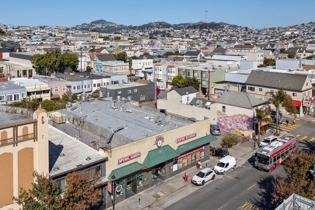
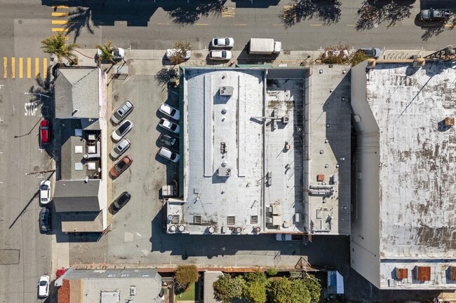
This Property Is For Sale
NEARBY LISTINGS FOR SALE OR LEASE
-
-
-
-
-
-
-
-
-
-
-
-
-
-
-
No Photo
-
-
-
-
View all San Francisco listings for sale on LoopNet.com
Property Detail
2601 San Bruno Ave
San Francisco
University Mound Homestead Ass
San Francisco-Redwood City-South San Francisco, CA
San Francisco
5982-009
California
Vacantlandnec
9
2024
0.14 AC
2025
Southern City
025702
DEMOGRAPHICS near 2601 San Bruno Ave
1 Mile
3 Mile
5 Mile
2024 Total Population
47,885
294,367
777,559
2029 Population
47,340
295,139
785,496
Pop Growth 2024-2029
(1.14%)
+ 0.26%
+ 1.02%
Average Age
43
43
43
2024 Total Households
13,820
105,655
317,660
HH Growth 2024-2029
(1.26%)
+ 0.45%
+ 1.20%
Median Household Inc
$115,775
$135,244
$125,190
Avg Household Size
3.20
2.60
2.30
2024 Avg HH Vehicles
2.00
1.00
1.00
Median Home Value
$1,061,846
$1,087,179
$1,086,323
Median Year Built
1951
1949
1952
Nearby Places
Map Layers
Map Styles
 Street
 Aerial
- Restaurants
- Banks
- Shops
- Fitness
- Groceries
PUBLIC TRANSPORTATION
TRANSIT/SUBWAY
Gilman/Paul Station Inbound (T Third Street - San Francisco Municipal Railway (MUNI Metro))
DRIVE
WALK
Distance
Gilman/Paul Station Inbound (T Third Street - San Francisco Municipal Railway (MUNI Metro))
2 min
14 min
0.8 mi
Williams Station Outbound (T Third Street - San Francisco Municipal Railway (MUNI Metro))
DRIVE
WALK
Distance
Williams Station Outbound (T Third Street - San Francisco Municipal Railway (MUNI Metro))
3 min
15 min
0.8 mi
Le Conte Station (T Third Street - San Francisco Municipal Railway (MUNI Metro))
DRIVE
WALK
Distance
Le Conte Station (T Third Street - San Francisco Municipal Railway (MUNI Metro))
3 min
17 min
0.9 mi
Carroll Station Outbound (T Third Street - San Francisco Municipal Railway (MUNI Metro), THIRD - San Francisco Municipal Railway (MUNI Metro))
DRIVE
WALK
Distance
Carroll Station Outbound (T Third Street - San Francisco Municipal Railway (MUNI Metro), THIRD - San Francisco Municipal Railway (MUNI Metro))
3 min
18 min
0.9 mi
Revere Ave & 3Rd St (T Third Street - San Francisco Municipal Railway (MUNI Metro), THIRD - San Francisco Municipal Railway (MUNI Metro))
DRIVE
WALK
Distance
Revere Ave & 3Rd St (T Third Street - San Francisco Municipal Railway (MUNI Metro), THIRD - San Francisco Municipal Railway (MUNI Metro))
4 min
19 min
1.0 mi
COMMUTER RAIL
Bayshore Caltrain Station (Local - Caltrain (Caltrain), Local Weekday - Caltrain (Caltrain), Local Weekend - Caltrain (Caltrain))
DRIVE
WALK
Distance
Bayshore Caltrain Station (Local - Caltrain (Caltrain), Local Weekday - Caltrain (Caltrain), Local Weekend - Caltrain (Caltrain))
4 min
1.8 mi
22Nd Street (Caltrain - Caltrain (Caltrain))
DRIVE
WALK
Distance
22Nd Street (Caltrain - Caltrain (Caltrain))
7 min
4.1 mi
AIRPORT
San Francisco International
DRIVE
WALK
Distance
San Francisco International
15 min
9.7 mi
Metro Oakland International
DRIVE
WALK
Distance
Metro Oakland International
34 min
22.6 mi
Freight Ports
Port of San Francisco
DRIVE
WALK
Distance
Port of San Francisco
11 min
5.6 mi
Nearby Properties
Address
Land Use
TOTAL SIZE
Lot Size
Zoning
Address
Land Use
TOTAL SIZE
Lot Size
Zoning
750,370 SF
3.25 AC
MBR3
Address
Land Use
TOTAL SIZE
Lot Size
Zoning
248,303 SF
4.35 AC
Address
Land Use
TOTAL SIZE
Lot Size
Zoning
717,234 SF
3.47 AC
UMU
Address
Land Use
TOTAL SIZE
Lot Size
Zoning
10.92 AC
Address
Land Use
TOTAL SIZE
Lot Size
Zoning
2.74 AC
Address
Land Use
TOTAL SIZE
Lot Size
Zoning
314,826 SF
1.85 AC
MB-RA
Address
Land Use
TOTAL SIZE
Lot Size
Zoning
10.92 AC
Address
Land Use
TOTAL SIZE
Lot Size
Zoning
241,659 SF
3.76 AC
Address
Land Use
TOTAL SIZE
Lot Size
Zoning
230,853 SF
3.76 AC
Address
Land Use
TOTAL SIZE
Lot Size
Zoning
302,084 SF
0.88 AC
MBO
Address
Land Use
TOTAL SIZE
Lot Size
Zoning
674,317 SF
3.36 AC
UMU
Address
Land Use
TOTAL SIZE
Lot Size
Zoning
10.92 AC
Address
Land Use
TOTAL SIZE
Lot Size
Zoning
250,884 SF
1.66 AC
MB-RA
Address
Land Use
TOTAL SIZE
Lot Size
Zoning
248,974 SF
0.88 AC
MBO
Address
Land Use
TOTAL SIZE
Lot Size
Zoning
2.22 AC
M1
Address
Land Use
TOTAL SIZE
Lot Size
Zoning
333,244 SF
2.67 AC
UMU
Address
Land Use
TOTAL SIZE
Lot Size
Zoning
347,857 SF
2.76 AC
Address
Land Use
TOTAL SIZE
Lot Size
Zoning
346,710 SF
7.45 AC
RH2
Address
Land Use
TOTAL SIZE
Lot Size
Zoning
167,053 SF
0.99 AC
MB-RA
Address
Land Use
TOTAL SIZE
Lot Size
Zoning
3.49 AC
Address
Land Use
TOTAL SIZE
Lot Size
Zoning
100,732 SF
4.55 AC
M2
Address
Land Use
TOTAL SIZE
Lot Size
Zoning
210,036 SF
23.85 AC
UMU
Address
Land Use
TOTAL SIZE
Lot Size
Zoning
243,176 SF
1.48 AC
UMU
Address
Land Use
TOTAL SIZE
Lot Size
Zoning
164,464 SF
1.05 AC
MB-RA
Address
Land Use
TOTAL SIZE
Lot Size
Zoning
231,687 SF
8.64 AC
Address
Land Use
TOTAL SIZE
Lot Size
Zoning
149,402 SF
3.47 AC
M2
Address
Land Use
TOTAL SIZE
Lot Size
Zoning
54,000 SF
1.67 AC
PDR2
Address
Land Use
TOTAL SIZE
Lot Size
Zoning
225,851 SF
1.19 AC
NCT1
Address
Land Use
TOTAL SIZE
Lot Size
Zoning
199,678 SF
1.06 AC
UMU
Address
Land Use
TOTAL SIZE
Lot Size
Zoning
252,000 SF
1.89 AC
MBNC3
The World's #1 Commercial Real Estate Marketplace
Connect with us
© 2025 CoStar Group
The information above has been obtained from sources believed reliable. While we do not doubt its accuracy we have not verified it and make no guarantee, warranty or representation about it. It is your responsibility to independently confirm its accuracy and completeness. Any projections, opinions, assumptions, or estimates used are for example only and do not represent the current or future performance of the property. The value of this transaction to you depends on tax and other factors which should be evaluated by your tax, financial, and legal advisors. You and your advisors should conduct a careful, independent investigation of the property to determine to your satisfaction the suitability of the property for your needs.