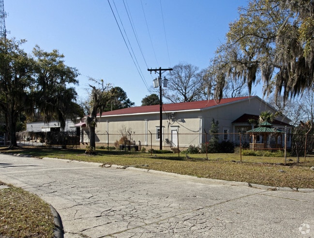
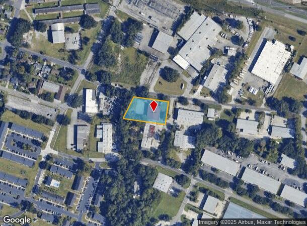
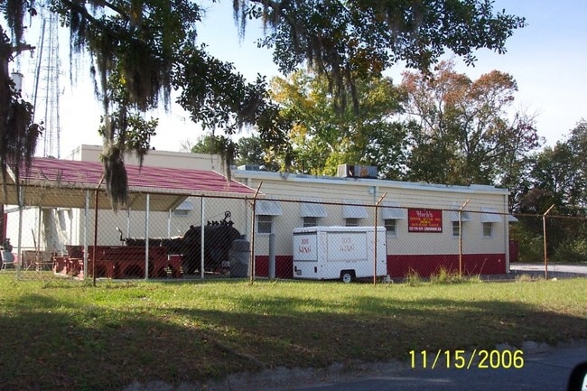
Property Record
2605 Causton Bluff Rd, Savannah, GA 31404

NEARBY LISTINGS FOR SALE OR LEASE
Property Detail
2605 Causton Bluff Rd
2000704001
Butler Ward
Manufacturinglight
PORTION DEPTFORD INDUS PK BUTLE R WD
X
Chatham
45053C0550D
Georgia
2024
0.79 AC
2025
Greater Savannah
003601
Savannah
7,695 SF
Savannah, GA
DEMOGRAPHICS near 2605 Causton Bluff Rd
1 Mile
3 Mile
5 Mile
2024 Total Population
6,762
49,366
105,487
2029 Population
7,023
51,503
110,155
Pop Growth 2024-2029
+ 3.86%
+ 4.33%
+ 4.43%
Average Age
37
40
39
2024 Total Households
2,772
22,244
43,374
HH Growth 2024-2029
+ 4.18%
+ 4.69%
+ 4.74%
Median Household Inc
$45,253
$56,513
$54,241
Avg Household Size
2.40
2.10
2.20
2024 Avg HH Vehicles
2.00
1.00
2.00
Median Home Value
$150,000
$264,965
$255,399
Median Year Built
1981
1956
1959
Nearby Places
Map Layers
Map Styles
 Street
 Aerial
- Restaurants
- Banks
- Shops
- Fitness
- Groceries
PUBLIC TRANSPORTATION
COMMUTER RAIL
DRIVE
WALK
Distance
15 min
7.4 mi
AIRPORT
Savannah/Hilton Head International
DRIVE
WALK
Distance
Savannah/Hilton Head International
24 min
13.0 mi
Hilton Head
DRIVE
WALK
Distance
Hilton Head
65 min
40.5 mi
Freight Ports
Georgia Ports - Savannah
DRIVE
WALK
Distance
Georgia Ports - Savannah
18 min
9.4 mi
Nearby Properties
Address
Land Use
TOTAL SIZE
Lot Size
Zoning
Address
Land Use
TOTAL SIZE
Lot Size
Zoning
22.34 AC
PUDBW
Address
Land Use
TOTAL SIZE
Lot Size
Zoning
453,984 SF
10.42 AC
Address
Land Use
TOTAL SIZE
Lot Size
Zoning
86,336 SF
1.08 AC
BB
Address
Land Use
TOTAL SIZE
Lot Size
Zoning
354,322 SF
6.30 AC
IH
Address
Land Use
TOTAL SIZE
Lot Size
Zoning
421 SF
6.82 AC
PUDBW
Address
Land Use
TOTAL SIZE
Lot Size
Zoning
26,388 SF
27.95 AC
PUD
Address
Land Use
TOTAL SIZE
Lot Size
Zoning
108,273 SF
18.20 AC
PUDBC
Address
Land Use
TOTAL SIZE
Lot Size
Zoning
33,000 SF
1.92 AC
I-L
Address
Land Use
TOTAL SIZE
Lot Size
Zoning
116,928 SF
1.10 AC
BB
Address
Land Use
TOTAL SIZE
Lot Size
Zoning
84,560 SF
0.31 AC
BC1
Address
Land Use
TOTAL SIZE
Lot Size
Zoning
77,610 SF
0.33 AC
BC1
Address
Land Use
TOTAL SIZE
Lot Size
Zoning
245,610 SF
1.10 AC
RIPC
Address
Land Use
TOTAL SIZE
Lot Size
Zoning
92,132 SF
4.92 AC
PUDBW
Address
Land Use
TOTAL SIZE
Lot Size
Zoning
9,303 SF
9.84 AC
PUDM
Address
Land Use
TOTAL SIZE
Lot Size
Zoning
120,084 SF
0.48 AC
BC1
Address
Land Use
TOTAL SIZE
Lot Size
Zoning
8,112 SF
17.89 AC
R1
Address
Land Use
TOTAL SIZE
Lot Size
Zoning
116,000 SF
0.53 AC
BB
Address
Land Use
TOTAL SIZE
Lot Size
Zoning
0.49 AC
BC1
Address
Land Use
TOTAL SIZE
Lot Size
Zoning
9 AC
RMF-2-35
Address
Land Use
TOTAL SIZE
Lot Size
Zoning
7,900 SF
1.98 AC
RIPB1
Address
Land Use
TOTAL SIZE
Lot Size
Zoning
60,911 SF
0.17 AC
BB
Address
Land Use
TOTAL SIZE
Lot Size
Zoning
70,124 SF
0.38 AC
BC1
Address
Land Use
TOTAL SIZE
Lot Size
Zoning
15,474 SF
50.30 AC
RM25
Address
Land Use
TOTAL SIZE
Lot Size
Zoning
108,996 SF
0.38 AC
BG
Address
Land Use
TOTAL SIZE
Lot Size
Zoning
77,320 SF
0.27 AC
BC1
Address
Land Use
TOTAL SIZE
Lot Size
Zoning
121,760 SF
0.58 AC
BB
Address
Land Use
TOTAL SIZE
Lot Size
Zoning
70,840 SF
0.39 AC
BC1
Address
Land Use
TOTAL SIZE
Lot Size
Zoning
88,080 SF
0.51 AC
BC1
Address
Land Use
TOTAL SIZE
Lot Size
Zoning
87,405 SF
1.14 AC
RBC
Address
Land Use
TOTAL SIZE
Lot Size
Zoning
388,944 SF
7 AC
BC1
The World's #1 Commercial Real Estate Marketplace
Connect with us
© 2025 CoStar Group
The information above has been obtained from sources believed reliable. While we do not doubt its accuracy we have not verified it and make no guarantee, warranty or representation about it. It is your responsibility to independently confirm its accuracy and completeness. Any projections, opinions, assumptions, or estimates used are for example only and do not represent the current or future performance of the property. The value of this transaction to you depends on tax and other factors which should be evaluated by your tax, financial, and legal advisors. You and your advisors should conduct a careful, independent investigation of the property to determine to your satisfaction the suitability of the property for your needs.