Property Record
2605 E 3300 S, Salt Lake City, UT 84109


NEARBY LISTINGS FOR SALE OR LEASE
Property Detail
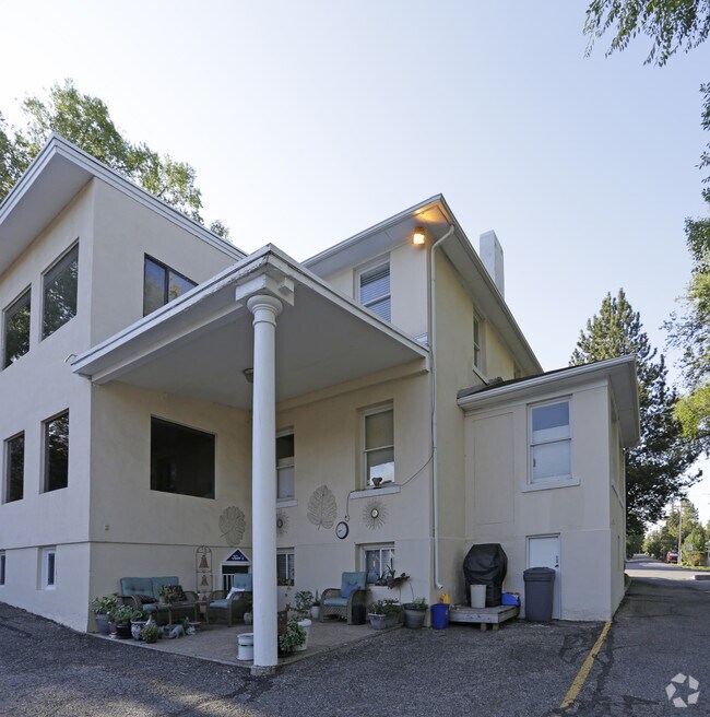
2605 E 3300 S
16-27-432-015-0000
Holladay Highlands Subdivision No 3
Officebuilding
BEG 1171.46 FT N & 635.25 FT W FR SE COR OF SEC 27, T1S, R1E, SLM; N 148.3 FT M OR L; E 125 FT; S 158.3 FT M OR L; W 106.46 FT M OR L; N 61^2929 W 21.1 FT TO BEG.
X
Salt Lake
49035C0304H
Utah
2024
0.49 AC
2025
Foothill Corridor
110200
Salt Lake City
3,846 SF
Salt Lake City, UT
DEMOGRAPHICS near 2605 E 3300 S
1 Mile
3 Mile
5 Mile
2024 Total Population
14,898
107,059
240,088
2029 Population
14,947
108,042
242,354
Pop Growth 2024-2029
+ 0.33%
+ 0.92%
+ 0.94%
Average Age
39
39
38
2024 Total Households
5,220
41,744
98,424
HH Growth 2024-2029
+ 0.21%
+ 0.96%
+ 0.95%
Median Household Inc
$110,708
$95,385
$75,009
Avg Household Size
2.70
2.50
2.30
2024 Avg HH Vehicles
2.00
2.00
2.00
Median Home Value
$659,400
$645,249
$585,642
Median Year Built
1958
1963
1968
Nearby Places
Map Layers
Map Styles
 Street
 Aerial
- Restaurants
- Banks
- Shops
- Fitness
- Groceries
PUBLIC TRANSPORTATION
AIRPORT
Salt Lake City International
DRIVE
WALK
Distance
Salt Lake City International
20 min
14.1 mi
Provo Municipal
DRIVE
WALK
Distance
Provo Municipal
61 min
47.7 mi
SALE & LEASE HISTORY
LISTING DATE
SALE/LEASE

Aug 21, 2017
For Lease
Nearby Properties
Address
Land Use
TOTAL SIZE
Lot Size
Zoning
Address
Land Use
TOTAL SIZE
Lot Size
Zoning
298,628 SF
27.30 AC
I
Address
Land Use
TOTAL SIZE
Lot Size
Zoning
207,140 SF
23.06 AC
P
Address
Land Use
TOTAL SIZE
Lot Size
Zoning
257,003 SF
25.87 AC
1108
Address
Land Use
TOTAL SIZE
Lot Size
Zoning
691,463 SF
17.80 AC
RM
Address
Land Use
TOTAL SIZE
Lot Size
Zoning
183,600 SF
10.70 AC
RMF-35
Address
Land Use
TOTAL SIZE
Lot Size
Zoning
297,476 SF
1.62 AC
CSHBD2
Address
Land Use
TOTAL SIZE
Lot Size
Zoning
369,717 SF
2.50 AC
RO
Address
Land Use
TOTAL SIZE
Lot Size
Zoning
412,006 SF
1.70 AC
C3
Address
Land Use
TOTAL SIZE
Lot Size
Zoning
369,377 SF
1.65 AC
Address
Land Use
TOTAL SIZE
Lot Size
Zoning
426,600 SF
1.61 AC
CSHBD1
Address
Land Use
TOTAL SIZE
Lot Size
Zoning
903,167 SF
1.90 AC
CSHBD1
Address
Land Use
TOTAL SIZE
Lot Size
Zoning
125,518 SF
11.03 AC
RMZC
Address
Land Use
TOTAL SIZE
Lot Size
Zoning
107,416 SF
5.46 AC
CSHBD2
Address
Land Use
TOTAL SIZE
Lot Size
Zoning
303,240 SF
29.21 AC
1205
Address
Land Use
TOTAL SIZE
Lot Size
Zoning
299,673 SF
2.16 AC
C3
Address
Land Use
TOTAL SIZE
Lot Size
Zoning
266,380 SF
2.09 AC
CSHBD1
Address
Land Use
TOTAL SIZE
Lot Size
Zoning
295,307 SF
2.46 AC
C-B
Address
Land Use
TOTAL SIZE
Lot Size
Zoning
386,512 SF
9.66 AC
C-SHDB
Address
Land Use
TOTAL SIZE
Lot Size
Zoning
621,969 SF
10.17 AC
CS
Address
Land Use
TOTAL SIZE
Lot Size
Zoning
256,179 SF
0.87 AC
CSHBD2
Address
Land Use
TOTAL SIZE
Lot Size
Zoning
147,742 SF
1.52 AC
CSH BD
Address
Land Use
TOTAL SIZE
Lot Size
Zoning
433,385 SF
3.64 AC
R/M-U
Address
Land Use
TOTAL SIZE
Lot Size
Zoning
132,942 SF
18 AC
1108
Address
Land Use
TOTAL SIZE
Lot Size
Zoning
517,619 SF
4.20 AC
CSHBD1
Address
Land Use
TOTAL SIZE
Lot Size
Zoning
130,948 SF
18.95 AC
1107
Address
Land Use
TOTAL SIZE
Lot Size
Zoning
106,467 SF
4.41 AC
2000
Address
Land Use
TOTAL SIZE
Lot Size
Zoning
345,554 SF
3.21 AC
RO
Address
Land Use
TOTAL SIZE
Lot Size
Zoning
40,414 SF
3.81 AC
C-2
Address
Land Use
TOTAL SIZE
Lot Size
Zoning
83,406 SF
8.02 AC
RM
Address
Land Use
TOTAL SIZE
Lot Size
Zoning
479,027 SF
1.98 AC
C3
The World's #1 Commercial Real Estate Marketplace
Connect with us
© 2026 CoStar Group
The information above has been obtained from sources believed reliable. While we do not doubt its accuracy we have not verified it and make no guarantee, warranty or representation about it. It is your responsibility to independently confirm its accuracy and completeness. Any projections, opinions, assumptions, or estimates used are for example only and do not represent the current or future performance of the property. The value of this transaction to you depends on tax and other factors which should be evaluated by your tax, financial, and legal advisors. You and your advisors should conduct a careful, independent investigation of the property to determine to your satisfaction the suitability of the property for your needs.