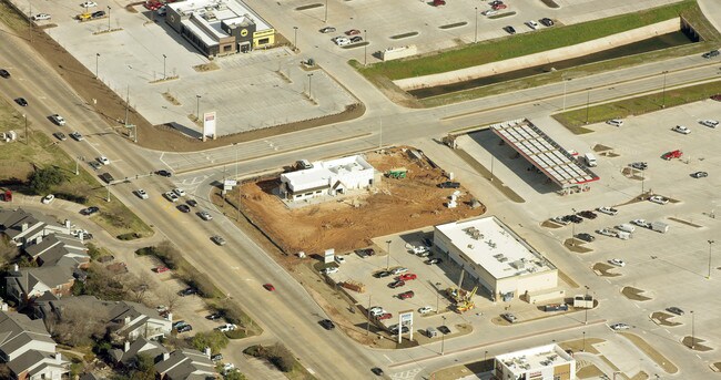
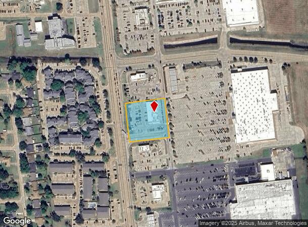
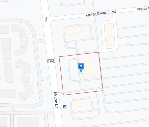
Property Record
2610 Airline Dr, Benton, LA 71006
NEARBY LISTINGS FOR SALE OR LEASE
Property Detail
2610 Airline Dr
Shreveport-Bossier City, LA
Red Bend Crossing
178146
LOT 6 BLK 1 RED BEND CROSSING
Storebuilding
Bossier
AE
Louisiana
22015C0412D
6
2024
9.14 AC
2024
Bossier Parish
011116
Shreveport/Bossier City
9,450 SF
DEMOGRAPHICS near 2610 Airline Dr
1 Mile
3 Mile
5 Mile
2024 Total Population
5,087
35,957
81,896
2029 Population
5,120
36,086
81,719
Pop Growth 2024-2029
+ 0.65%
+ 0.36%
(0.22%)
Average Age
41
38
38
2024 Total Households
2,116
14,916
33,818
HH Growth 2024-2029
+ 0.57%
+ 0.38%
(0.24%)
Median Household Inc
$49,768
$41,469
$41,723
Avg Household Size
2.30
2.30
2.30
2024 Avg HH Vehicles
2.00
2.00
2.00
Median Home Value
$194,653
$180,110
$179,348
Median Year Built
1973
1977
1977
Nearby Places
Map Layers
Map Styles
 Street
 Aerial
- Restaurants
- Banks
- Shops
- Fitness
- Groceries
PUBLIC TRANSPORTATION
AIRPORT
Shreveport Regional
DRIVE
WALK
Distance
Shreveport Regional
26 min
13.4 mi
Freight Ports
Port of Shreveport
DRIVE
WALK
Distance
Port of Shreveport
30 min
17.8 mi
Nearby Properties
Address
Land Use
TOTAL SIZE
Lot Size
Zoning
Address
Land Use
TOTAL SIZE
Lot Size
Zoning
66,239 SF
111 AC
Address
Land Use
TOTAL SIZE
Lot Size
Zoning
239,598 SF
4.10 AC
Address
Land Use
TOTAL SIZE
Lot Size
Zoning
166,418 SF
32 AC
Address
Land Use
TOTAL SIZE
Lot Size
Zoning
1,700 SF
28 AC
Address
Land Use
TOTAL SIZE
Lot Size
Zoning
66,828 SF
74.46 AC
Address
Land Use
TOTAL SIZE
Lot Size
Zoning
348,362 SF
22 AC
Address
Land Use
TOTAL SIZE
Lot Size
Zoning
128,389 SF
7.77 AC
Address
Land Use
TOTAL SIZE
Lot Size
Zoning
222,616 SF
0.28 AC
Address
Land Use
TOTAL SIZE
Lot Size
Zoning
192,369 SF
7 AC
Address
Land Use
TOTAL SIZE
Lot Size
Zoning
99.09 AC
Address
Land Use
TOTAL SIZE
Lot Size
Zoning
6,494 SF
74.46 AC
Address
Land Use
TOTAL SIZE
Lot Size
Zoning
107,841 SF
2 AC
Address
Land Use
TOTAL SIZE
Lot Size
Zoning
9 AC
Address
Land Use
TOTAL SIZE
Lot Size
Zoning
110,252 SF
18.86 AC
Address
Land Use
TOTAL SIZE
Lot Size
Zoning
205,616 SF
0.63 AC
Address
Land Use
TOTAL SIZE
Lot Size
Zoning
25,413 SF
8 AC
Address
Land Use
TOTAL SIZE
Lot Size
Zoning
5,262 SF
16 AC
Address
Land Use
TOTAL SIZE
Lot Size
Zoning
57,400 SF
2.29 AC
Address
Land Use
TOTAL SIZE
Lot Size
Zoning
10,080 SF
12 AC
Address
Land Use
TOTAL SIZE
Lot Size
Zoning
255 SF
10 AC
Address
Land Use
TOTAL SIZE
Lot Size
Zoning
76,700 SF
15.47 AC
Address
Land Use
TOTAL SIZE
Lot Size
Zoning
74,372 SF
1 AC
Address
Land Use
TOTAL SIZE
Lot Size
Zoning
135,238 SF
14.54 AC
Address
Land Use
TOTAL SIZE
Lot Size
Zoning
39,992 SF
5 AC
Address
Land Use
TOTAL SIZE
Lot Size
Zoning
100,000 SF
1.21 AC
Address
Land Use
TOTAL SIZE
Lot Size
Zoning
82,547 SF
17 AC
Address
Land Use
TOTAL SIZE
Lot Size
Zoning
133,742 SF
16.62 AC
Address
Land Use
TOTAL SIZE
Lot Size
Zoning
72,696 SF
15 AC
Address
Land Use
TOTAL SIZE
Lot Size
Zoning
88,773 SF
2.31 AC
Address
Land Use
TOTAL SIZE
Lot Size
Zoning
3,200 SF
13.70 AC
The World's #1 Commercial Real Estate Marketplace
Connect with us
© 2026 CoStar Group
The information above has been obtained from sources believed reliable. While we do not doubt its accuracy we have not verified it and make no guarantee, warranty or representation about it. It is your responsibility to independently confirm its accuracy and completeness. Any projections, opinions, assumptions, or estimates used are for example only and do not represent the current or future performance of the property. The value of this transaction to you depends on tax and other factors which should be evaluated by your tax, financial, and legal advisors. You and your advisors should conduct a careful, independent investigation of the property to determine to your satisfaction the suitability of the property for your needs.