Property Record
26245 Palomar Rd, Menifee, CA 92585


NEARBY LISTINGS FOR SALE OR LEASE
Property Detail
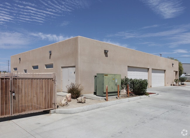
26245 Palomar Rd
Riverside-San Bernardino-Ontario, CA
Parcel Map 15183
331-190-045
.89 ACRES M/L IN PAR 3 PM 086/096 PM 15183
Heavyindustrial
Riverside
A
California
06065C2060H
3
2024
0.89 AC
2025
South Riverside
042728
Inland Empire (California)
8,440 SF
DEMOGRAPHICS near 26245 Palomar Rd
1 Mile
3 Mile
5 Mile
2024 Total Population
3,948
42,278
126,417
2029 Population
4,170
44,724
134,131
Pop Growth 2024-2029
+ 5.62%
+ 5.79%
+ 6.10%
Average Age
36
41
38
2024 Total Households
1,068
14,478
39,944
HH Growth 2024-2029
+ 5.52%
+ 5.38%
+ 5.63%
Median Household Inc
$77,372
$72,351
$75,039
Avg Household Size
3.50
2.80
3.10
2024 Avg HH Vehicles
3.00
2.00
2.00
Median Home Value
$369,854
$382,143
$400,345
Median Year Built
1990
1991
1995
Nearby Places
Map Layers
Map Styles
 Street
 Aerial
- Restaurants
- Banks
- Shops
- Fitness
- Groceries
PUBLIC TRANSPORTATION
COMMUTER RAIL
South Perris (Metrolink 91-Perris Valley Line - Metrolink Trains)
DRIVE
WALK
Distance
South Perris (Metrolink 91-Perris Valley Line - Metrolink Trains)
6 min
3.2 mi
Perris Downtown (Metrolink 91-Perris Valley Line - Metrolink Trains)
DRIVE
WALK
Distance
Perris Downtown (Metrolink 91-Perris Valley Line - Metrolink Trains)
9 min
5.9 mi
Freight Ports
Port of Long Beach
DRIVE
WALK
Distance
Port of Long Beach
99 min
73.9 mi
Nearby Properties
Address
Land Use
TOTAL SIZE
Lot Size
Zoning
Address
Land Use
TOTAL SIZE
Lot Size
Zoning
40,349 SF
9.89 AC
R3
Address
Land Use
TOTAL SIZE
Lot Size
Zoning
61,487 SF
5.73 AC
Address
Land Use
TOTAL SIZE
Lot Size
Zoning
104,208 SF
10.96 AC
Address
Land Use
TOTAL SIZE
Lot Size
Zoning
13.95 AC
Address
Land Use
TOTAL SIZE
Lot Size
Zoning
83,814 SF
8.87 AC
CPS
Address
Land Use
TOTAL SIZE
Lot Size
Zoning
97,942 SF
11 AC
Address
Land Use
TOTAL SIZE
Lot Size
Zoning
86,590 SF
10.97 AC
MM
Address
Land Use
TOTAL SIZE
Lot Size
Zoning
27,252 SF
5.42 AC
R6
Address
Land Use
TOTAL SIZE
Lot Size
Zoning
41,840 SF
8.92 AC
Address
Land Use
TOTAL SIZE
Lot Size
Zoning
24,889 SF
42.36 AC
Address
Land Use
TOTAL SIZE
Lot Size
Zoning
86,403 SF
6.17 AC
R2
Address
Land Use
TOTAL SIZE
Lot Size
Zoning
70,680 SF
4.59 AC
M-M
Address
Land Use
TOTAL SIZE
Lot Size
Zoning
68,986 SF
7.21 AC
CPS
Address
Land Use
TOTAL SIZE
Lot Size
Zoning
28,428 SF
1.97 AC
CICP
Address
Land Use
TOTAL SIZE
Lot Size
Zoning
13,808 SF
2.82 AC
R2
Address
Land Use
TOTAL SIZE
Lot Size
Zoning
11,200 SF
11.05 AC
MM
Address
Land Use
TOTAL SIZE
Lot Size
Zoning
54,282 SF
3.87 AC
MSC
Address
Land Use
TOTAL SIZE
Lot Size
Zoning
3,275 SF
7.79 AC
Address
Land Use
TOTAL SIZE
Lot Size
Zoning
1,936 SF
4.06 AC
Address
Land Use
TOTAL SIZE
Lot Size
Zoning
4.43 AC
SPZONE
Address
Land Use
TOTAL SIZE
Lot Size
Zoning
45,640 SF
10.01 AC
MM
Address
Land Use
TOTAL SIZE
Lot Size
Zoning
12,928 SF
0.97 AC
CPS
Address
Land Use
TOTAL SIZE
Lot Size
Zoning
940 SF
0.89 AC
CPS
The World's #1 Commercial Real Estate Marketplace
Connect with us
© 2026 CoStar Group
The information above has been obtained from sources believed reliable. While we do not doubt its accuracy we have not verified it and make no guarantee, warranty or representation about it. It is your responsibility to independently confirm its accuracy and completeness. Any projections, opinions, assumptions, or estimates used are for example only and do not represent the current or future performance of the property. The value of this transaction to you depends on tax and other factors which should be evaluated by your tax, financial, and legal advisors. You and your advisors should conduct a careful, independent investigation of the property to determine to your satisfaction the suitability of the property for your needs.