Property Record
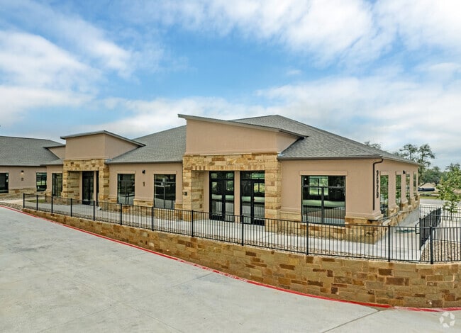
2629 Palmera Ridge Blvd, Leander, TX 78641


Property Detail
2629 Palmera Ridge Blvd
Austin-Round Rock-San Marcos, TX
S12264 - PALMERA RIDGE SEC 10, BLOCK L, LOT 1, ACRES 3.09
R594477
WILLIAMSON
Commercialnec
Texas
B and X Area of moderate flood hazard, usually the area between the limits of the 100-year and 500-year floods.
1
2024
3.09 AC
2025
Georgetown
020340
Austin
16,744 SF
NEARBY LISTINGS FOR SALE OR LEASE
DEMOGRAPHICS near 2629 Palmera Ridge Blvd
1 mile
3 mile
5 mile
2025 Total Population
2,900
39,740
130,049
2030 Population
3,523
47,209
152,535
Pop Growth 2025-2030
+ 21.48%
+ 18.79%
+ 17.29%
Average Age
37
36
37
2025 Total Households
1,035
13,984
44,747
HH Growth 2025-2030
+ 21.93%
+ 19.19%
+ 17.76%
Median Household Inc
$174,218
$143,761
$134,064
Avg Household Size
2.80
2.80
2.90
2025 Avg HH Vehicles
2.00
2.00
2.00
Median Home Value
$676,630
$537,548
$484,370
Median Year Built
2011
2011
2010
Nearby Places
Map Layers
Map Styles
 Street
 Aerial
Layers
 Traffic
 Biking
Places
Listings with unknown addresses are not visible on the map
- Restaurants
- Banks
- Shops
- Fitness
- Groceries
PUBLIC TRANSPORTATION
AIRPORT
Austin-Bergstrom International
Drive
Walk
Distance
Austin-Bergstrom International
53 min
38.3 mi
Robert Gray AAF
Drive
Walk
Distance
Robert Gray AAF
63 min
40.3 mi
Killeen Municipal
Drive
Walk
Distance
Killeen Municipal
61 min
46.4 mi
SALE & LEASE HISTORY
LISTING DATE
SALE/LEASE

Apr 19, 2023
For Sale
Nearby Properties
Address
Land Use
TOTAL SIZE
Lot Size
Zoning
Address
Land Use
TOTAL SIZE
Lot Size
Zoning
106,000 SF
72.51 AC
Address
Land Use
TOTAL SIZE
Lot Size
Zoning
341,700 SF
17.71 AC
Address
Land Use
TOTAL SIZE
Lot Size
Zoning
1 SF
138.94 AC
Address
Land Use
TOTAL SIZE
Lot Size
Zoning
287,118 SF
9.26 AC
Address
Land Use
TOTAL SIZE
Lot Size
Zoning
310,297 SF
15.01 AC
Address
Land Use
TOTAL SIZE
Lot Size
Zoning
285,365 SF
12.24 AC
Address
Land Use
TOTAL SIZE
Lot Size
Zoning
246,060 SF
9.30 AC
Address
Land Use
TOTAL SIZE
Lot Size
Zoning
249,826 SF
37.40 AC
Address
Land Use
TOTAL SIZE
Lot Size
Zoning
117,076 SF
15.51 AC
Address
Land Use
TOTAL SIZE
Lot Size
Zoning
195,426 SF
12.11 AC
Address
Land Use
TOTAL SIZE
Lot Size
Zoning
249,862 SF
16.14 AC
Address
Land Use
TOTAL SIZE
Lot Size
Zoning
232,172 SF
10.43 AC
Address
Land Use
TOTAL SIZE
Lot Size
Zoning
341,700 SF
9.90 AC
Address
Land Use
TOTAL SIZE
Lot Size
Zoning
286,888 SF
20.68 AC
Address
Land Use
TOTAL SIZE
Lot Size
Zoning
316,408 SF
15 AC
Address
Land Use
TOTAL SIZE
Lot Size
Zoning
247,584 SF
18.45 AC
Address
Land Use
TOTAL SIZE
Lot Size
Zoning
193,011 SF
8.91 AC
Address
Land Use
TOTAL SIZE
Lot Size
Zoning
109,663 SF
19.54 AC
Address
Land Use
TOTAL SIZE
Lot Size
Zoning
11.98 AC
Address
Land Use
TOTAL SIZE
Lot Size
Zoning
194,695 SF
5.09 AC
Address
Land Use
TOTAL SIZE
Lot Size
Zoning
35,223 SF
9.75 AC
Address
Land Use
TOTAL SIZE
Lot Size
Zoning
37,809 SF
6.26 AC
Address
Land Use
TOTAL SIZE
Lot Size
Zoning
163.59 AC
Address
Land Use
TOTAL SIZE
Lot Size
Zoning
185,652 SF
10 AC
Address
Land Use
TOTAL SIZE
Lot Size
Zoning
39,180 SF
9.28 AC
Address
Land Use
TOTAL SIZE
Lot Size
Zoning
58,524 SF
16.13 AC
Address
Land Use
TOTAL SIZE
Lot Size
Zoning
60,305 SF
0.87 AC
Address
Land Use
TOTAL SIZE
Lot Size
Zoning
159,400 SF
8.26 AC
Address
Land Use
TOTAL SIZE
Lot Size
Zoning
91,200 SF
3.53 AC
Address
Land Use
TOTAL SIZE
Lot Size
Zoning
1,412 SF
20.17 AC
The World's #1 Commercial Real Estate Marketplace
Connect with us
© 2026 CoStar Group
The information above has been obtained from sources believed reliable. While we do not doubt its accuracy we have not verified it and make no guarantee, warranty or representation about it. It is your responsibility to independently confirm its accuracy and completeness. Any projections, opinions, assumptions, or estimates used are for example only and do not represent the current or future performance of the property. The value of this transaction to you depends on tax and other factors which should be evaluated by your tax, financial, and legal advisors. You and your advisors should conduct a careful, independent investigation of the property to determine to your satisfaction the suitability of the property for your needs.