Property Record
2630 Highway 138 Sw, Conyers, GA 30094
NEARBY LISTINGS FOR SALE OR LEASE
Property Detail
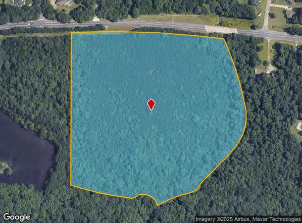
2630 Highway 138 Sw
Atlanta-Sandy Springs-Roswell, GA
Rural
029-0-01-0012
S/SIDE HWY 138
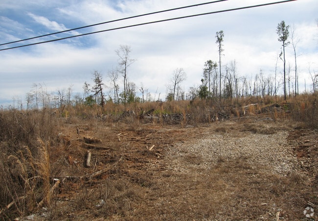
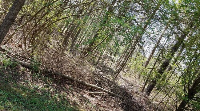
Agriculturalland
Rockdale
AE
Georgia
13247C0152D
205
2024
25.57 AC
2024
I-20 East/Conyers
060411
Atlanta
DEMOGRAPHICS near 2630 Highway 138 Sw
1 Mile
3 Mile
5 Mile
2024 Total Population
2,082
19,345
67,142
2029 Population
2,147
19,894
69,002
Pop Growth 2024-2029
+ 3.12%
+ 2.84%
+ 2.77%
Average Age
43
41
40
2024 Total Households
716
6,726
24,321
HH Growth 2024-2029
+ 3.07%
+ 2.87%
+ 2.73%
Median Household Inc
$102,285
$72,684
$72,649
Avg Household Size
2.80
2.80
2.70
2024 Avg HH Vehicles
3.00
2.00
2.00
Median Home Value
$291,959
$223,367
$235,656
Median Year Built
1996
1990
1990
Nearby Places
Map Layers
Map Styles
 Street
 Aerial
- Restaurants
- Banks
- Shops
- Fitness
- Groceries
PUBLIC TRANSPORTATION
AIRPORT
Hartsfield - Jackson Atlanta International
DRIVE
WALK
Distance
Hartsfield - Jackson Atlanta International
42 min
28.1 mi
Freight Ports
Georgia Ports - Savannah
DRIVE
WALK
Distance
Georgia Ports - Savannah
270 min
237.4 mi
SALE & LEASE HISTORY
LISTING DATE
SALE/LEASE

Sep 01, 2021
For Sale
May 01, 2017
For Sale
Aug 12, 2022
For Sale
Nearby Properties
Address
Land Use
TOTAL SIZE
Lot Size
Zoning
Address
Land Use
TOTAL SIZE
Lot Size
Zoning
88,314 SF
107.40 AC
AR
Address
Land Use
TOTAL SIZE
Lot Size
Zoning
216,855 SF
42.21 AC
AR
Address
Land Use
TOTAL SIZE
Lot Size
Zoning
69,417 SF
13.85 AC
C1/C
Address
Land Use
TOTAL SIZE
Lot Size
Zoning
29.26 AC
R1
Address
Land Use
TOTAL SIZE
Lot Size
Zoning
113,548 SF
15 AC
AR
Address
Land Use
TOTAL SIZE
Lot Size
Zoning
82,000 SF
23.58 AC
AR
Address
Land Use
TOTAL SIZE
Lot Size
Zoning
2,910 SF
51.75 AC
AR
Address
Land Use
TOTAL SIZE
Lot Size
Zoning
81,201 SF
17.48 AC
R1
Address
Land Use
TOTAL SIZE
Lot Size
Zoning
3,432 SF
7 AC
AR
Address
Land Use
TOTAL SIZE
Lot Size
Zoning
21,249 SF
33.78 AC
AR
Address
Land Use
TOTAL SIZE
Lot Size
Zoning
9,372 SF
2.90 AC
C1
Address
Land Use
TOTAL SIZE
Lot Size
Zoning
24,750 SF
6 AC
R1
Address
Land Use
TOTAL SIZE
Lot Size
Zoning
113.51 AC
AR/R1/C
Address
Land Use
TOTAL SIZE
Lot Size
Zoning
2,978 SF
1.03 AC
C1
Address
Land Use
TOTAL SIZE
Lot Size
Zoning
14,412 SF
36.40 AC
AR/R1
Address
Land Use
TOTAL SIZE
Lot Size
Zoning
3,621 SF
1.25 AC
C1
Address
Land Use
TOTAL SIZE
Lot Size
Zoning
38,110 SF
16.02 AC
R1
Address
Land Use
TOTAL SIZE
Lot Size
Zoning
3,956 SF
0.91 AC
C1
Address
Land Use
TOTAL SIZE
Lot Size
Zoning
11,876 SF
115.43 AC
R1
Address
Land Use
TOTAL SIZE
Lot Size
Zoning
2,128 SF
10 AC
AR
Address
Land Use
TOTAL SIZE
Lot Size
Zoning
5,880 SF
7.70 AC
R2
Address
Land Use
TOTAL SIZE
Lot Size
Zoning
100.69 AC
X
Address
Land Use
TOTAL SIZE
Lot Size
Zoning
5,670 SF
2.49 AC
OI/COND
Address
Land Use
TOTAL SIZE
Lot Size
Zoning
9,600 SF
0.65 AC
OI
Address
Land Use
TOTAL SIZE
Lot Size
Zoning
13,960 SF
3.04 AC
OI/C
Address
Land Use
TOTAL SIZE
Lot Size
Zoning
4,116 SF
1.39 AC
C1
Address
Land Use
TOTAL SIZE
Lot Size
Zoning
392.41 AC
R85
Address
Land Use
TOTAL SIZE
Lot Size
Zoning
4,140 SF
2.04 AC
C1
Address
Land Use
TOTAL SIZE
Lot Size
Zoning
175.80 AC
AR
Address
Land Use
TOTAL SIZE
Lot Size
Zoning
275 AC
AR
The World's #1 Commercial Real Estate Marketplace
Connect with us
© 2025 CoStar Group
The information above has been obtained from sources believed reliable. While we do not doubt its accuracy we have not verified it and make no guarantee, warranty or representation about it. It is your responsibility to independently confirm its accuracy and completeness. Any projections, opinions, assumptions, or estimates used are for example only and do not represent the current or future performance of the property. The value of this transaction to you depends on tax and other factors which should be evaluated by your tax, financial, and legal advisors. You and your advisors should conduct a careful, independent investigation of the property to determine to your satisfaction the suitability of the property for your needs.