Property Record
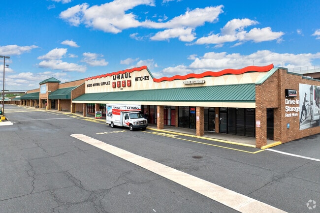
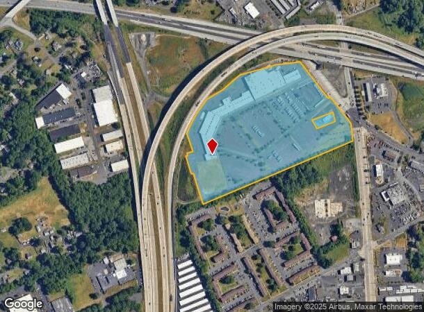
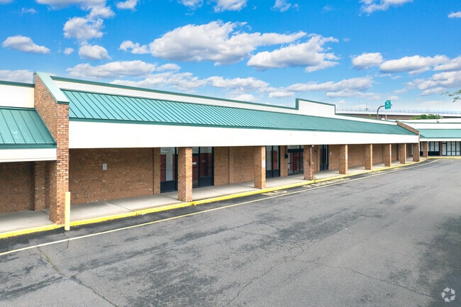
2631 Durham Rd, Bristol, PA 19007
Property Detail
2631 Durham Rd
05-020-003
30.3488 AC SW COR SR413 & DURHAM RD 230 ON SR413
Regionalshoppingcenterormallwithanchorstore
BUCKS
C
Pennsylvania
B and X Area of moderate flood hazard, usually the area between the limits of the 100-year and 500-year floods.
30.35 AC
2024
Lower Bucks County
2025
Philadelphia
100303
Philadelphia-Camden-Wilmington, PA-NJ-DE-MD
146,556 SF
NEARBY LISTINGS FOR SALE OR LEASE
DEMOGRAPHICS near 2631 Durham Rd
1 mile
3 mile
5 mile
2025 Total Population
9,293
102,245
228,093
2030 Population
9,293
102,367
229,546
Pop Growth 2025-2030
0.00%
+ 0.12%
+ 0.64%
Average Age
40
42
42
2025 Total Households
3,885
38,062
86,355
HH Growth 2025-2030
(0.10%)
+ 0.08%
+ 0.62%
Median Household Inc
$57,877
$87,661
$88,655
Avg Household Size
2.30
2.60
2.60
2025 Avg HH Vehicles
2.00
2.00
2.00
Median Home Value
$309,219
$337,111
$343,671
Median Year Built
1966
1960
1963
Nearby Places
Map Layers
Map Styles
 Street
 Aerial
Layers
 Traffic
 Biking
Places
Listings with unknown addresses are not visible on the map
- Restaurants
- Banks
- Shops
- Fitness
- Groceries
PUBLIC TRANSPORTATION
COMMUTER RAIL
Bristol (R7 - Southeastern Pennsylvania Transportation Authority Regional Rail (SEPTA Regional Rail))
Drive
Walk
Distance
Bristol (R7 - Southeastern Pennsylvania Transportation Authority Regional Rail (SEPTA Regional Rail))
8 min
3.1 mi
Croydon (R7 - Southeastern Pennsylvania Transportation Authority Regional Rail (SEPTA Regional Rail))
Drive
Walk
Distance
Croydon (R7 - Southeastern Pennsylvania Transportation Authority Regional Rail (SEPTA Regional Rail))
8 min
3.4 mi
AIRPORT
Trenton Mercer
Drive
Walk
Distance
Trenton Mercer
23 min
13.9 mi
Philadelphia International
Drive
Walk
Distance
Philadelphia International
47 min
30.8 mi
Freight Ports
Port of Philadelphia
Drive
Walk
Distance
Port of Philadelphia
27 min
17.1 mi
SALE & LEASE HISTORY
LISTING DATE
SALE/LEASE

Sep 25, 2016
For Lease
Nearby Properties
Address
Land Use
TOTAL SIZE
Lot Size
Zoning
Address
Land Use
TOTAL SIZE
Lot Size
Zoning
32,912 SF
42.06 AC
AO
Address
Land Use
TOTAL SIZE
Lot Size
Zoning
11,280 SF
26.16 AC
R3
Address
Land Use
TOTAL SIZE
Lot Size
Zoning
150,000 SF
21.46 AC
R3
Address
Land Use
TOTAL SIZE
Lot Size
Zoning
10,025 SF
19.11 AC
CD
Address
Land Use
TOTAL SIZE
Lot Size
Zoning
19.95 AC
CD
Address
Land Use
TOTAL SIZE
Lot Size
Zoning
202,400 SF
20.98 AC
C
Address
Land Use
TOTAL SIZE
Lot Size
Zoning
242,550 SF
24.32 AC
PI
Address
Land Use
TOTAL SIZE
Lot Size
Zoning
72,540 SF
14.02 AC
CD
Address
Land Use
TOTAL SIZE
Lot Size
Zoning
10,779 SF
19.07 AC
CD
Address
Land Use
TOTAL SIZE
Lot Size
Zoning
242,550 SF
24.18 AC
PI
Address
Land Use
TOTAL SIZE
Lot Size
Zoning
125,307 SF
31.79 AC
VC
Address
Land Use
TOTAL SIZE
Lot Size
Zoning
171,918 SF
17.70 AC
AO
Address
Land Use
TOTAL SIZE
Lot Size
Zoning
60,000 SF
19.99 AC
I
Address
Land Use
TOTAL SIZE
Lot Size
Zoning
10,812 SF
16.87 AC
R3
Address
Land Use
TOTAL SIZE
Lot Size
Zoning
281,600 SF
26.57 AC
PI
Address
Land Use
TOTAL SIZE
Lot Size
Zoning
9.54 AC
M2
Address
Land Use
TOTAL SIZE
Lot Size
Zoning
37,146 SF
11.50 AC
M2
Address
Land Use
TOTAL SIZE
Lot Size
Zoning
4,722 SF
14.30 AC
CD
Address
Land Use
TOTAL SIZE
Lot Size
Zoning
8,878 SF
15.04 AC
R2
Address
Land Use
TOTAL SIZE
Lot Size
Zoning
93,562 SF
12.60 AC
AO
Address
Land Use
TOTAL SIZE
Lot Size
Zoning
84,490 SF
0.57 AC
Address
Land Use
TOTAL SIZE
Lot Size
Zoning
17,570 SF
21.14 AC
AO
Address
Land Use
TOTAL SIZE
Lot Size
Zoning
384,080 SF
25.38 AC
M2
Address
Land Use
TOTAL SIZE
Lot Size
Zoning
28.45 AC
R3
Address
Land Use
TOTAL SIZE
Lot Size
Zoning
403,130 SF
23.32 AC
I
Address
Land Use
TOTAL SIZE
Lot Size
Zoning
33,528 SF
5.38 AC
P
Address
Land Use
TOTAL SIZE
Lot Size
Zoning
24,900 SF
10.82 AC
R3
Address
Land Use
TOTAL SIZE
Lot Size
Zoning
200,000 SF
12.07 AC
M1
Address
Land Use
TOTAL SIZE
Lot Size
Zoning
64,548 SF
11.59 AC
R1
The World's #1 Commercial Real Estate Marketplace
Connect with us
© 2026 CoStar Group
The information above has been obtained from sources believed reliable. While we do not doubt its accuracy we have not verified it and make no guarantee, warranty or representation about it. It is your responsibility to independently confirm its accuracy and completeness. Any projections, opinions, assumptions, or estimates used are for example only and do not represent the current or future performance of the property. The value of this transaction to you depends on tax and other factors which should be evaluated by your tax, financial, and legal advisors. You and your advisors should conduct a careful, independent investigation of the property to determine to your satisfaction the suitability of the property for your needs.