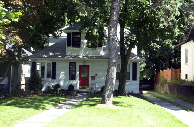
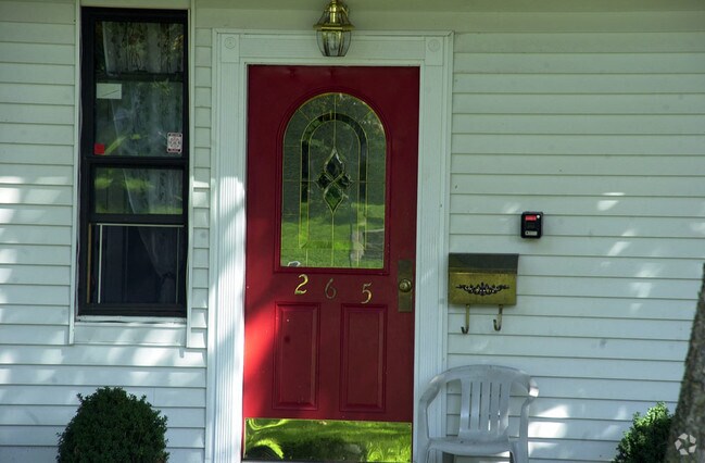
Property Record
265 Speedwell Ave, Morristown, NJ 07960

NEARBY LISTINGS FOR SALE OR LEASE
Property Detail
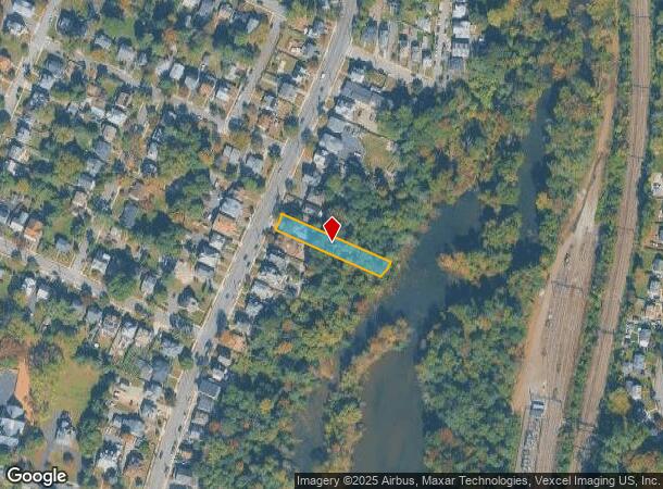
265 Speedwell Ave
Newark, NJ-PA
Morris
24-02604-0000-00011
New Jersey
Commercialnec
11
2024
0.38 AC
2025
Morristown Region
043401
Northern New Jersey
2,328 SF
DEMOGRAPHICS near 265 Speedwell Ave
1 Mile
3 Mile
5 Mile
2024 Total Population
16,758
61,619
124,722
2029 Population
16,721
61,798
124,721
Pop Growth 2024-2029
(0.22%)
+ 0.29%
0.00%
Average Age
37
41
41
2024 Total Households
6,580
24,312
46,510
HH Growth 2024-2029
(0.03%)
+ 0.43%
+ 0.09%
Median Household Inc
$108,846
$139,066
$143,240
Avg Household Size
2.40
2.40
2.50
2024 Avg HH Vehicles
2.00
2.00
2.00
Median Home Value
$471,545
$637,365
$639,830
Median Year Built
1964
1969
1970
Nearby Places
Map Layers
Map Styles
 Street
 Aerial
- Restaurants
- Banks
- Shops
- Fitness
- Groceries
PUBLIC TRANSPORTATION
COMMUTER RAIL
Morristown (Morris & Essex Morristown Line - NJ Transit Commuter Rail (NJ Transit))
DRIVE
WALK
Distance
Morristown (Morris & Essex Morristown Line - NJ Transit Commuter Rail (NJ Transit))
2 min
1.2 mi
Morris Plains (Morris & Essex Morristown Line - NJ Transit Commuter Rail (NJ Transit))
DRIVE
WALK
Distance
Morris Plains (Morris & Essex Morristown Line - NJ Transit Commuter Rail (NJ Transit))
2 min
1.4 mi
AIRPORT
Newark Liberty International
DRIVE
WALK
Distance
Newark Liberty International
29 min
22.5 mi
Freight Ports
Maher Terminal
DRIVE
WALK
Distance
Maher Terminal
32 min
23.0 mi
Nearby Properties
Address
Land Use
TOTAL SIZE
Lot Size
Zoning
Address
Land Use
TOTAL SIZE
Lot Size
Zoning
2,023 SF
136.41 AC
R-R
Address
Land Use
TOTAL SIZE
Lot Size
Zoning
596 SF
64.81 AC
OBRL
Address
Land Use
TOTAL SIZE
Lot Size
Zoning
23.01 AC
R-2
Address
Land Use
TOTAL SIZE
Lot Size
Zoning
1.55 AC
Address
Land Use
TOTAL SIZE
Lot Size
Zoning
2.82 AC
Address
Land Use
TOTAL SIZE
Lot Size
Zoning
13,428 SF
108.84 AC
OSGU
Address
Land Use
TOTAL SIZE
Lot Size
Zoning
396,029 SF
40.08 AC
OL40
Address
Land Use
TOTAL SIZE
Lot Size
Zoning
8.64 AC
RG
Address
Land Use
TOTAL SIZE
Lot Size
Zoning
Address
Land Use
TOTAL SIZE
Lot Size
Zoning
18.42 AC
RM
Address
Land Use
TOTAL SIZE
Lot Size
Zoning
475,100 SF
38 AC
OL40
Address
Land Use
TOTAL SIZE
Lot Size
Zoning
0.36 AC
UR
Address
Land Use
TOTAL SIZE
Lot Size
Zoning
10.42 AC
Address
Land Use
TOTAL SIZE
Lot Size
Zoning
34.13 AC
OB
Address
Land Use
TOTAL SIZE
Lot Size
Zoning
3.13 AC
CBD
Address
Land Use
TOTAL SIZE
Lot Size
Zoning
14.50 AC
RG
Address
Land Use
TOTAL SIZE
Lot Size
Zoning
38.86 AC
L
Address
Land Use
TOTAL SIZE
Lot Size
Zoning
32 AC
R-1M
Address
Land Use
TOTAL SIZE
Lot Size
Zoning
0.57 AC
CBD
Address
Land Use
TOTAL SIZE
Lot Size
Zoning
88,345 SF
15.67 AC
R-7
Address
Land Use
TOTAL SIZE
Lot Size
Zoning
0.41 AC
UR
Address
Land Use
TOTAL SIZE
Lot Size
Zoning
0.35 AC
UR
Address
Land Use
TOTAL SIZE
Lot Size
Zoning
1.71 AC
Address
Land Use
TOTAL SIZE
Lot Size
Zoning
377,114 SF
40.64 AC
SD10
Address
Land Use
TOTAL SIZE
Lot Size
Zoning
203,590 SF
24.98 AC
SD10
Address
Land Use
TOTAL SIZE
Lot Size
Zoning
13.45 AC
IP
Address
Land Use
TOTAL SIZE
Lot Size
Zoning
322,575 SF
32.28 AC
OL40
Address
Land Use
TOTAL SIZE
Lot Size
Zoning
6.56 AC
OB
Address
Land Use
TOTAL SIZE
Lot Size
Zoning
25.14 AC
I-B3
Address
Land Use
TOTAL SIZE
Lot Size
Zoning
2,380 SF
1.32 AC
RC
The World's #1 Commercial Real Estate Marketplace
Connect with us
© 2025 CoStar Group
The information above has been obtained from sources believed reliable. While we do not doubt its accuracy we have not verified it and make no guarantee, warranty or representation about it. It is your responsibility to independently confirm its accuracy and completeness. Any projections, opinions, assumptions, or estimates used are for example only and do not represent the current or future performance of the property. The value of this transaction to you depends on tax and other factors which should be evaluated by your tax, financial, and legal advisors. You and your advisors should conduct a careful, independent investigation of the property to determine to your satisfaction the suitability of the property for your needs.