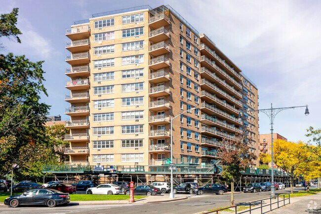
Property Record
2650 Ocean Pkwy, Brooklyn, NY 11235

NEARBY LISTINGS FOR SALE OR LEASE
Property Detail
2650 Ocean Pkwy
07238-01158C
Kings
Cooperative
New York
X
115
3604970354F
0.85 AC
0
Gravesend
2025
Long Island (New York)
037401
New York-Jersey City-White Plains, NY-NJ
186,630 SF
DEMOGRAPHICS near 2650 Ocean Pkwy
1 mile
3 mile
5 mile
2024 Total Population
116,370
545,908
1,213,591
2029 Population
109,394
508,892
1,127,026
Pop Growth 2024-2029
(5.99%)
(6.78%)
(7.13%)
Average Age
45
42
40
2024 Total Households
47,077
193,994
420,280
HH Growth 2024-2029
(6.19%)
(7.15%)
(7.41%)
Median Household Inc
$54,465
$60,154
$65,337
Avg Household Size
2.40
2.70
2.80
2024 Avg HH Vehicles
1.00
1.00
1.00
Median Home Value
$646,244
$777,029
$781,144
Median Year Built
1958
1948
1948
Nearby Places
Map Layers
Map Styles
 Street
 Aerial
Transit
 Traffic
 Biking
Places
Listings with unknown addresses are not visible on the map
- Restaurants
- Banks
- Shops
- Fitness
- Groceries
PUBLIC TRANSPORTATION
TRANSIT/SUBWAY
Neptune Avenue (F - New York MTA Subway (The Subway))
Drive
Walk
Distance
Neptune Avenue (F - New York MTA Subway (The Subway))
3 min
11 min
0.6 mi
Ocean Parkway (Q - New York MTA Subway (The Subway))
Drive
Walk
Distance
Ocean Parkway (Q - New York MTA Subway (The Subway))
2 min
13 min
0.6 mi
Avenue X (F - New York MTA Subway (The Subway))
Drive
Walk
Distance
Avenue X (F - New York MTA Subway (The Subway))
2 min
14 min
0.7 mi
Sheepshead Bay (B - New York MTA Subway (The Subway), Q - New York MTA Subway (The Subway))
Drive
Walk
Distance
Sheepshead Bay (B - New York MTA Subway (The Subway), Q - New York MTA Subway (The Subway))
4 min
15 min
0.8 mi
Brighton Beach (B - New York MTA Subway (The Subway), Q - New York MTA Subway (The Subway))
Drive
Walk
Distance
Brighton Beach (B - New York MTA Subway (The Subway), Q - New York MTA Subway (The Subway))
4 min
16 min
0.8 mi
COMMUTER RAIL
Grasmere (Staten Island Railway - New York MTA Subway (The Subway))
Drive
Walk
Distance
Grasmere (Staten Island Railway - New York MTA Subway (The Subway))
16 min
8.4 mi
Nostrand Avenue Station (Far Rockaway Branch - Long Island Rail Road, Hempstead Branch - Long Island Rail Road, Long Beach Branch - Long Island Rail Road, West Hempstead Branch - Long Island Rail Road)
Drive
Walk
Distance
Nostrand Avenue Station (Far Rockaway Branch - Long Island Rail Road, Hempstead Branch - Long Island Rail Road, Long Beach Branch - Long Island Rail Road, West Hempstead Branch - Long Island Rail Road)
20 min
8.4 mi
AIRPORT
John F Kennedy International
Drive
Walk
Distance
John F Kennedy International
26 min
15.1 mi
LaGuardia
Drive
Walk
Distance
LaGuardia
35 min
19.4 mi
Newark Liberty International
Drive
Walk
Distance
Newark Liberty International
37 min
23.5 mi
Freight Ports
NY - Red Hook Container Terminal
Drive
Walk
Distance
NY - Red Hook Container Terminal
15 min
8.3 mi
SALE & LEASE HISTORY
LISTING DATE
SALE/LEASE

Sep 13, 2023
For Sale
Mar 28, 2023
For Sale
Mar 01, 2022
For Sale
Nearby Properties
Address
Land Use
TOTAL SIZE
Lot Size
Zoning
Address
Land Use
TOTAL SIZE
Lot Size
Zoning
200 SF
281.30 AC
R4
Address
Land Use
TOTAL SIZE
Lot Size
Zoning
200 SF
281.30 AC
R4
Address
Land Use
TOTAL SIZE
Lot Size
Zoning
200 SF
281.30 AC
R4
Address
Land Use
TOTAL SIZE
Lot Size
Zoning
200 SF
281.30 AC
R4
Address
Land Use
TOTAL SIZE
Lot Size
Zoning
200 SF
281.30 AC
R4
Address
Land Use
TOTAL SIZE
Lot Size
Zoning
200 SF
281.30 AC
R4
Address
Land Use
TOTAL SIZE
Lot Size
Zoning
200 SF
281.30 AC
R4
Address
Land Use
TOTAL SIZE
Lot Size
Zoning
200 SF
281.30 AC
R4
Address
Land Use
TOTAL SIZE
Lot Size
Zoning
200 SF
281.30 AC
R4
Address
Land Use
TOTAL SIZE
Lot Size
Zoning
200 SF
281.30 AC
R4
Address
Land Use
TOTAL SIZE
Lot Size
Zoning
200 SF
281.30 AC
R4
Address
Land Use
TOTAL SIZE
Lot Size
Zoning
200 SF
281.30 AC
R4
Address
Land Use
TOTAL SIZE
Lot Size
Zoning
200 SF
281.30 AC
R4
Address
Land Use
TOTAL SIZE
Lot Size
Zoning
200 SF
281.30 AC
R4
Address
Land Use
TOTAL SIZE
Lot Size
Zoning
200 SF
281.30 AC
R4
Address
Land Use
TOTAL SIZE
Lot Size
Zoning
200 SF
281.30 AC
R4
Address
Land Use
TOTAL SIZE
Lot Size
Zoning
200 SF
281.30 AC
R4
Address
Land Use
TOTAL SIZE
Lot Size
Zoning
200 SF
281.30 AC
R4
Address
Land Use
TOTAL SIZE
Lot Size
Zoning
200 SF
281.30 AC
R4
Address
Land Use
TOTAL SIZE
Lot Size
Zoning
200 SF
281.30 AC
R4
Address
Land Use
TOTAL SIZE
Lot Size
Zoning
200 SF
281.30 AC
R4
Address
Land Use
TOTAL SIZE
Lot Size
Zoning
200 SF
281.30 AC
R4
Address
Land Use
TOTAL SIZE
Lot Size
Zoning
200 SF
281.30 AC
R4
Address
Land Use
TOTAL SIZE
Lot Size
Zoning
200 SF
281.30 AC
R4
Address
Land Use
TOTAL SIZE
Lot Size
Zoning
200 SF
281.30 AC
R4
Address
Land Use
TOTAL SIZE
Lot Size
Zoning
200 SF
281.30 AC
R4
Address
Land Use
TOTAL SIZE
Lot Size
Zoning
200 SF
281.30 AC
R4
Address
Land Use
TOTAL SIZE
Lot Size
Zoning
200 SF
281.30 AC
R4
Address
Land Use
TOTAL SIZE
Lot Size
Zoning
200 SF
281.30 AC
R4
Address
Land Use
TOTAL SIZE
Lot Size
Zoning
200 SF
281.30 AC
R4
The World's #1 Commercial Real Estate Marketplace
Connect with us
© 2026 CoStar Group
The information above has been obtained from sources believed reliable. While we do not doubt its accuracy we have not verified it and make no guarantee, warranty or representation about it. It is your responsibility to independently confirm its accuracy and completeness. Any projections, opinions, assumptions, or estimates used are for example only and do not represent the current or future performance of the property. The value of this transaction to you depends on tax and other factors which should be evaluated by your tax, financial, and legal advisors. You and your advisors should conduct a careful, independent investigation of the property to determine to your satisfaction the suitability of the property for your needs.