Property Record
2660 W Quail Ave, Phoenix, AZ 85027


NEARBY LISTINGS FOR SALE OR LEASE
Property Detail
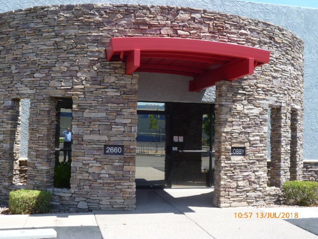
2660 W Quail Ave
Phoenix-Mesa-Scottsdale, AZ
Phoenix International Science Center
209-20-001
PHOENIX INTERNATIONAL SCIENCE CENTER MCR 100-42
Industrialgeneral
Maricopa
X
Arizona
04013C1290M
1
2025
0.95 AC
2025
Deer Vly/Pinnacle Pk
614602
Phoenix
23,810 SF
DEMOGRAPHICS near 2660 W Quail Ave
1 Mile
3 Mile
5 Mile
2024 Total Population
14,159
90,421
248,750
2029 Population
15,395
97,678
268,752
Pop Growth 2024-2029
+ 8.73%
+ 8.03%
+ 8.04%
Average Age
36
38
38
2024 Total Households
6,184
35,956
97,452
HH Growth 2024-2029
+ 8.94%
+ 8.23%
+ 8.20%
Median Household Inc
$59,852
$71,658
$76,886
Avg Household Size
2.20
2.40
2.50
2024 Avg HH Vehicles
2.00
2.00
2.00
Median Home Value
$309,219
$291,403
$350,896
Median Year Built
1991
1987
1988
Nearby Places
Map Layers
Map Styles
 Street
 Aerial
- Restaurants
- Banks
- Shops
- Fitness
- Groceries
PUBLIC TRANSPORTATION
AIRPORT
Phoenix Sky Harbor International
DRIVE
WALK
Distance
Phoenix Sky Harbor International
33 min
23.5 mi
Freight Ports
Port of San Diego
DRIVE
WALK
Distance
Port of San Diego
407 min
365.4 mi
SALE & LEASE HISTORY
LISTING DATE
SALE/LEASE

Sep 10, 2018
For Lease
Oct 19, 2023
For Sale
Jun 11, 2019
For Sale
Nearby Properties
Address
Land Use
TOTAL SIZE
Lot Size
Zoning
Address
Land Use
TOTAL SIZE
Lot Size
Zoning
159,642 SF
11.85 AC
C-C
Address
Land Use
TOTAL SIZE
Lot Size
Zoning
132,348 SF
9.16 AC
I-P
Address
Land Use
TOTAL SIZE
Lot Size
Zoning
2,354,235 SF
83.18 AC
CPGCP
Address
Land Use
TOTAL SIZE
Lot Size
Zoning
Address
Land Use
TOTAL SIZE
Lot Size
Zoning
526,912 SF
55.64 AC
Address
Land Use
TOTAL SIZE
Lot Size
Zoning
53,813 SF
1,286.11 AC
Address
Land Use
TOTAL SIZE
Lot Size
Zoning
704,521 SF
15.12 AC
C-C
Address
Land Use
TOTAL SIZE
Lot Size
Zoning
625,318 SF
15.79 AC
Address
Land Use
TOTAL SIZE
Lot Size
Zoning
16.84 AC
Address
Land Use
TOTAL SIZE
Lot Size
Zoning
434,799 SF
69.70 AC
R-8
Address
Land Use
TOTAL SIZE
Lot Size
Zoning
302,786 SF
220.27 AC
S-1
Address
Land Use
TOTAL SIZE
Lot Size
Zoning
355,901 SF
40.61 AC
Address
Land Use
TOTAL SIZE
Lot Size
Zoning
471,671 SF
18.04 AC
I-1
Address
Land Use
TOTAL SIZE
Lot Size
Zoning
17,365 SF
1.50 AC
C-G
Address
Land Use
TOTAL SIZE
Lot Size
Zoning
389,967 SF
245.48 AC
I-1
Address
Land Use
TOTAL SIZE
Lot Size
Zoning
264,909 SF
219.16 AC
I-1
Address
Land Use
TOTAL SIZE
Lot Size
Zoning
968,899 SF
76.37 AC
I-1
Address
Land Use
TOTAL SIZE
Lot Size
Zoning
425,279 SF
11.64 AC
S1
Address
Land Use
TOTAL SIZE
Lot Size
Zoning
361,228 SF
24.60 AC
I-P
Address
Land Use
TOTAL SIZE
Lot Size
Zoning
296,753 SF
9.53 AC
CPBP
Address
Land Use
TOTAL SIZE
Lot Size
Zoning
307,891 SF
15.89 AC
Address
Land Use
TOTAL SIZE
Lot Size
Zoning
28.71 AC
Address
Land Use
TOTAL SIZE
Lot Size
Zoning
312,070 SF
20.04 AC
A1
Address
Land Use
TOTAL SIZE
Lot Size
Zoning
291,059 SF
16.54 AC
I-1
Address
Land Use
TOTAL SIZE
Lot Size
Zoning
240.86 AC
IND.PK.
Address
Land Use
TOTAL SIZE
Lot Size
Zoning
228,085 SF
7.84 AC
I-P
Address
Land Use
TOTAL SIZE
Lot Size
Zoning
149,165 SF
12.33 AC
C2
Address
Land Use
TOTAL SIZE
Lot Size
Zoning
244,787 SF
5.83 AC
Address
Land Use
TOTAL SIZE
Lot Size
Zoning
15,000 SF
359.72 AC
R-43
Address
Land Use
TOTAL SIZE
Lot Size
Zoning
189,524 SF
13.80 AC
I-P
The World's #1 Commercial Real Estate Marketplace
Connect with us
© 2026 CoStar Group
The information above has been obtained from sources believed reliable. While we do not doubt its accuracy we have not verified it and make no guarantee, warranty or representation about it. It is your responsibility to independently confirm its accuracy and completeness. Any projections, opinions, assumptions, or estimates used are for example only and do not represent the current or future performance of the property. The value of this transaction to you depends on tax and other factors which should be evaluated by your tax, financial, and legal advisors. You and your advisors should conduct a careful, independent investigation of the property to determine to your satisfaction the suitability of the property for your needs.