Property Record
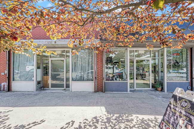
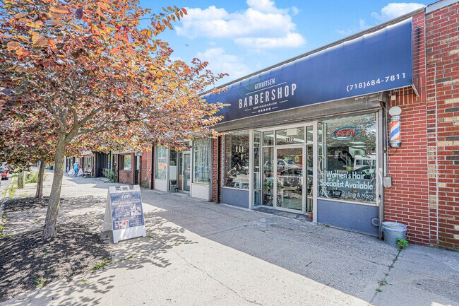
2672 Gerritsen Ave, Brooklyn, NY 11229

Property Detail
2672 Gerritsen Ave
08932-0514
KINGS
Storebuilding
New York
R4
514
C and X Area of minimal flood hazard, usually depicted on FIRMs as above the 500-year flood level.
0.05 AC
2025
South Brooklyn
2026
Long Island (New York)
062800
New York-Jersey City-White Plains, NY-NJ
1,880 SF
NEARBY LISTINGS FOR SALE OR LEASE
DEMOGRAPHICS near 2672 Gerritsen Ave
1 mile
3 mile
5 mile
2025 Total Population
37,929
447,695
1,275,181
2030 Population
37,423
439,545
1,252,002
Pop Growth 2025-2030
(1.33%)
(1.82%)
(1.82%)
Average Age
45
43
41
2025 Total Households
14,720
161,421
442,568
HH Growth 2025-2030
(1.61%)
(2.03%)
(2.04%)
Median Household Inc
$69,726
$72,089
$68,859
Avg Household Size
2.40
2.70
2.70
2025 Avg HH Vehicles
1.00
1.00
1.00
Median Home Value
$626,766
$766,566
$812,291
Median Year Built
1953
1951
1949
Nearby Places
Map Layers
Map Styles
 Street
 Aerial
Layers
 Traffic
 Biking
Places
Listings with unknown addresses are not visible on the map
- Restaurants
- Banks
- Shops
- Fitness
- Groceries
PUBLIC TRANSPORTATION
COMMUTER RAIL
East New York Station (Far Rockaway Branch - Long Island Rail Road, Long Beach Branch - Long Island Rail Road, West Hempstead Branch - Long Island Rail Road)
Drive
Walk
Distance
East New York Station (Far Rockaway Branch - Long Island Rail Road, Long Beach Branch - Long Island Rail Road, West Hempstead Branch - Long Island Rail Road)
13 min
7.1 mi
Drive
Walk
Distance
18 min
7.1 mi
AIRPORT
John F Kennedy International
Drive
Walk
Distance
John F Kennedy International
25 min
14.0 mi
LaGuardia
Drive
Walk
Distance
LaGuardia
33 min
17.9 mi
Newark Liberty International
Drive
Walk
Distance
Newark Liberty International
42 min
23.7 mi
Freight Ports
NY - Red Hook Container Terminal
Drive
Walk
Distance
NY - Red Hook Container Terminal
18 min
9.1 mi
Nearby Properties
Address
Land Use
TOTAL SIZE
Lot Size
Zoning
Address
Land Use
TOTAL SIZE
Lot Size
Zoning
530.51 AC
C3
Address
Land Use
TOTAL SIZE
Lot Size
Zoning
100 SF
1,207.35 AC
M1-1
Address
Land Use
TOTAL SIZE
Lot Size
Zoning
1,281,577 SF
20.78 AC
M3-1
Address
Land Use
TOTAL SIZE
Lot Size
Zoning
1,078,317 SF
10.45 AC
R4
Address
Land Use
TOTAL SIZE
Lot Size
Zoning
10,250 SF
773.50 AC
PARK
Address
Land Use
TOTAL SIZE
Lot Size
Zoning
1,073,920 SF
16.53 AC
R6
Address
Land Use
TOTAL SIZE
Lot Size
Zoning
785,450 SF
14.22 AC
R6
Address
Land Use
TOTAL SIZE
Lot Size
Zoning
353,600 SF
55.79 AC
R3-1
Address
Land Use
TOTAL SIZE
Lot Size
Zoning
61.60 AC
PARK
Address
Land Use
TOTAL SIZE
Lot Size
Zoning
6,000 SF
110.42 AC
PARK
Address
Land Use
TOTAL SIZE
Lot Size
Zoning
2,000 SF
253.68 AC
R4
Address
Land Use
TOTAL SIZE
Lot Size
Zoning
12,252,000 SF
190 AC
PARK
Address
Land Use
TOTAL SIZE
Lot Size
Zoning
241,735 SF
1.99 AC
C8-4
Address
Land Use
TOTAL SIZE
Lot Size
Zoning
275,163 SF
9.69 AC
R3-1
Address
Land Use
TOTAL SIZE
Lot Size
Zoning
59,063 SF
21.56 AC
PARK
Address
Land Use
TOTAL SIZE
Lot Size
Zoning
846,056 SF
20.71 AC
R5
Address
Land Use
TOTAL SIZE
Lot Size
Zoning
22.96 AC
PARK
Address
Land Use
TOTAL SIZE
Lot Size
Zoning
137,500 SF
2.13 AC
M1-1
Address
Land Use
TOTAL SIZE
Lot Size
Zoning
351,762 SF
1.65 AC
R7A
Address
Land Use
TOTAL SIZE
Lot Size
Zoning
987,444 SF
21.01 AC
R3-2
Address
Land Use
TOTAL SIZE
Lot Size
Zoning
387,706 SF
8 AC
C4-2
Address
Land Use
TOTAL SIZE
Lot Size
Zoning
822,192 SF
14.15 AC
R6
Address
Land Use
TOTAL SIZE
Lot Size
Zoning
221,704 SF
0.83 AC
R5B
Address
Land Use
TOTAL SIZE
Lot Size
Zoning
521,976 SF
13.59 AC
R5
Address
Land Use
TOTAL SIZE
Lot Size
Zoning
470,000 SF
3.40 AC
R6
Address
Land Use
TOTAL SIZE
Lot Size
Zoning
2,000 SF
73.29 AC
PARK
Address
Land Use
TOTAL SIZE
Lot Size
Zoning
60,288 SF
0.76 AC
R5
Address
Land Use
TOTAL SIZE
Lot Size
Zoning
305,046 SF
8.76 AC
R6
Address
Land Use
TOTAL SIZE
Lot Size
Zoning
211,552 SF
7.39 AC
R3-2
Address
Land Use
TOTAL SIZE
Lot Size
Zoning
181,387 SF
0.78 AC
C8-2
The World's #1 Commercial Real Estate Marketplace
Connect with us
© 2026 CoStar Group
The information above has been obtained from sources believed reliable. While we do not doubt its accuracy we have not verified it and make no guarantee, warranty or representation about it. It is your responsibility to independently confirm its accuracy and completeness. Any projections, opinions, assumptions, or estimates used are for example only and do not represent the current or future performance of the property. The value of this transaction to you depends on tax and other factors which should be evaluated by your tax, financial, and legal advisors. You and your advisors should conduct a careful, independent investigation of the property to determine to your satisfaction the suitability of the property for your needs.