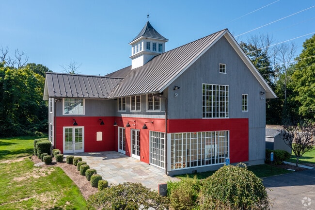
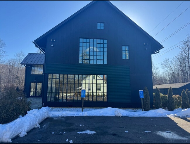
Property Record
27 Cannon Rd, Wilton, CT 06897

Property Detail
27 Cannon Rd
Commercialnec
Western Ct
DRB
Connecticut
AE The base floodplain where base flood elevations are provided. AE Zones are now used on new format FIRMs instead of A1-A30 Zones.
3.09 AC
2024
Wilton
2025
Westchester/So Connecticut
045102
Bridgeport-Stamford-Danbury, CT
6,035 SF
WILT-000034-000001
NEARBY LISTINGS FOR SALE OR LEASE
DEMOGRAPHICS near 27 Cannon Rd
1 mile
3 mile
5 mile
2025 Total Population
1,876
18,312
54,637
2030 Population
1,936
18,857
56,253
Pop Growth 2025-2030
+ 3.20%
+ 2.98%
+ 2.96%
Average Age
43
42
42
2025 Total Households
603
6,175
19,295
HH Growth 2025-2030
+ 3.15%
+ 3.00%
+ 3.01%
Median Household Inc
$197,916
$214,423
$206,731
Avg Household Size
2.90
2.90
2.80
2025 Avg HH Vehicles
2.00
2.00
2.00
Median Home Value
$973,255
$912,232
$903,756
Median Year Built
1976
1971
1971
Nearby Places
Map Layers
Map Styles
 Street
 Aerial
Layers
 Traffic
 Biking
Places
Listings with unknown addresses are not visible on the map
- Restaurants
- Banks
- Shops
- Fitness
- Groceries
PUBLIC TRANSPORTATION
TRANSIT/SUBWAY
Cannondale Station (New Haven Line - Metro-North Commuter Railroad Company (Metro-North))
Drive
Walk
Distance
Cannondale Station (New Haven Line - Metro-North Commuter Railroad Company (Metro-North))
1 min
1 min
0.1 mi
COMMUTER RAIL
Cannondale Station (New Haven Line - Metro-North Commuter Railroad Company (Metro-North))
Drive
Walk
Distance
Cannondale Station (New Haven Line - Metro-North Commuter Railroad Company (Metro-North))
1 min
1 min
0.1 mi
Wilton Station (New Haven Line - Metro-North Commuter Railroad Company (Metro-North))
Drive
Walk
Distance
Wilton Station (New Haven Line - Metro-North Commuter Railroad Company (Metro-North))
3 min
1.9 mi
AIRPORT
Westchester County
Drive
Walk
Distance
Westchester County
39 min
27.0 mi
Tweed/New Haven
Drive
Walk
Distance
Tweed/New Haven
59 min
38.6 mi
Freight Ports
Port of New Haven
Drive
Walk
Distance
Port of New Haven
54 min
35.7 mi
SALE & LEASE HISTORY
LISTING DATE
SALE/LEASE

Jul 01, 2021
For Sale
Feb 11, 2025
For Lease
Feb 11, 2025
For Sale
Aug 04, 2022
For Sale
Nearby Properties
Address
Land Use
TOTAL SIZE
Lot Size
Zoning
Address
Land Use
TOTAL SIZE
Lot Size
Zoning
82.14 AC
R-2
Address
Land Use
TOTAL SIZE
Lot Size
Zoning
109.27 AC
R-2
Address
Land Use
TOTAL SIZE
Lot Size
Zoning
196,084 SF
4.34 AC
DE-5
Address
Land Use
TOTAL SIZE
Lot Size
Zoning
260,868 SF
C
Address
Land Use
TOTAL SIZE
Lot Size
Zoning
24.67 AC
DE-10
Address
Land Use
TOTAL SIZE
Lot Size
Zoning
111,713 SF
C
Address
Land Use
TOTAL SIZE
Lot Size
Zoning
12.32 AC
CRA-1
Address
Land Use
TOTAL SIZE
Lot Size
Zoning
160,264 SF
C
Address
Land Use
TOTAL SIZE
Lot Size
Zoning
10.64 AC
HODD
Address
Land Use
TOTAL SIZE
Lot Size
Zoning
32.55 AC
DE-10
Address
Land Use
TOTAL SIZE
Lot Size
Zoning
33.70 AC
R-2
Address
Land Use
TOTAL SIZE
Lot Size
Zoning
7.61 AC
WC
Address
Land Use
TOTAL SIZE
Lot Size
Zoning
8.92 AC
R-2
Address
Land Use
TOTAL SIZE
Lot Size
Zoning
75,656 SF
3.81 AC
R-1
Address
Land Use
TOTAL SIZE
Lot Size
Zoning
131,476 SF
12.73 AC
DE-5
Address
Land Use
TOTAL SIZE
Lot Size
Zoning
117,972 SF
6.76 AC
WC
Address
Land Use
TOTAL SIZE
Lot Size
Zoning
11.17 AC
R-2
Address
Land Use
TOTAL SIZE
Lot Size
Zoning
127,706 SF
17.68 AC
DE-5
Address
Land Use
TOTAL SIZE
Lot Size
Zoning
130.09 AC
C
Address
Land Use
TOTAL SIZE
Lot Size
Zoning
5.44 AC
Address
Land Use
TOTAL SIZE
Lot Size
Zoning
157.25 AC
R-2
Address
Land Use
TOTAL SIZE
Lot Size
Zoning
81,699 SF
4.28 AC
DE-5
Address
Land Use
TOTAL SIZE
Lot Size
Zoning
130.09 AC
C
Address
Land Use
TOTAL SIZE
Lot Size
Zoning
80,980 SF
5.95 AC
GB
Address
Land Use
TOTAL SIZE
Lot Size
Zoning
335 AC
C
Address
Land Use
TOTAL SIZE
Lot Size
Zoning
31,680 SF
4.65 AC
DRB
Address
Land Use
TOTAL SIZE
Lot Size
Zoning
13.45 AC
R-1
Address
Land Use
TOTAL SIZE
Lot Size
Zoning
46,863 SF
1.81 AC
WC
Address
Land Use
TOTAL SIZE
Lot Size
Zoning
83,055 SF
88.73 AC
CRA-1
Address
Land Use
TOTAL SIZE
Lot Size
Zoning
1,200 SF
75.12 AC
R-2
The World's #1 Commercial Real Estate Marketplace
Connect with us
© 2026 CoStar Group
The information above has been obtained from sources believed reliable. While we do not doubt its accuracy we have not verified it and make no guarantee, warranty or representation about it. It is your responsibility to independently confirm its accuracy and completeness. Any projections, opinions, assumptions, or estimates used are for example only and do not represent the current or future performance of the property. The value of this transaction to you depends on tax and other factors which should be evaluated by your tax, financial, and legal advisors. You and your advisors should conduct a careful, independent investigation of the property to determine to your satisfaction the suitability of the property for your needs.